
Benjamin Chew was a fifth-generation American, a Quaker-born legal scholar, a prominent and successful Philadelphia lawyer, head of the Pennsylvania Judiciary System under both Colony and Commonwealth, and Chief Justice of the Supreme Court of the Province of Pennsylvania. Chew was well known for his precision and brevity in making legal arguments as well as his excellent memory, judgment, and knowledge of statutory law. His primary allegiance was to the supremacy of law and constitution.

Chew Magna is a village and civil parish within the Chew Valley in the unitary authority of Bath and North East Somerset, in the ceremonial county of Somerset, England. The parish has a population of 1,149.

New Bridge was a prosperous mill hamlet, centered upon a bridge strategically placed at the narrows of the Hackensack River. In the American Revolution, New Bridge Landing was the site of a strategic bridge crossing the Hackensack River, where General George Washington led his troops in retreat from British forces November 20, 1776. Eleven engagements took place here throughout the war. The current Draw Bridge at New Bridge was installed in 1889 and added to the National Register of Historic Places on July 5, 1989. The area is now a New Jersey historic site in portions of New Milford, River Edge, Hackensack and Teaneck in Bergen County, New Jersey, United States.

Raritan Landing is a historical unincorporated community located within Piscataway Township in Middlesex County, New Jersey, United States, which was once an inland port, the farthest upstream point ocean-going ships could reach along the Raritan River, across from New Brunswick. Begun in the early 18th century it remained vital until the mid 19th century, when most of the port was abandoned.
America's 11 Most Endangered Places or America's 11 Most Endangered Historic Places is a list of places in the United States that the National Trust for Historic Preservation considers the most endangered. It aims to inspire Americans to preserve examples of architectural and cultural heritage that could be "relegated to the dustbins of history" without intervention.

Brick Church is a New Jersey Transit station in East Orange, Essex County, New Jersey, United States, along the Morris and Essex Line. Service is available from this station east to Hoboken Terminal, New York Penn Station and west to Dover and Hackettstown.

Lake Hopatcong is a commuter railroad station for New Jersey Transit. The station, located in the community of Landing in Roxbury Township, Morris County, New Jersey, United States, serves trains for the Montclair-Boonton Line and Morristown Line at peak hours and on holiday weekends. Service from Lake Hopatcong provides to/from Hackettstown to New York Penn Station and Hoboken Terminal. The stop is located on the tracks below Landing Road next to the eponymous Lake Hopatcong. The station consists of one active and one abandoned side platform, along with a shelter on the active platform. There is no accessibility for handicapped persons under the Americans with Disabilities Act of 1990.

The Campbell-Christie House is a historic home that has been relocated to New Bridge Landing in River Edge, Bergen County, New Jersey, United States.

Heislerville is an unincorporated community located in Maurice River Township of Cumberland County, New Jersey. It was named after the Heisler family, prominent members of the Methodist Episcopal Church established here in 1828.

The Black Horse Pike is a designation used for a number of different roadways that had been part of a historic route connecting the Camden area to the area of Atlantic City, New Jersey. Roadways now bearing the Black Horse Pike designation include portions of Route 168, Route 42, U.S. Route 322 (US 322) and US 40.

Church of the Ascension was a historic church building at 1601 Pacific Avenue in Atlantic City, Atlantic County, New Jersey, United States. The church was built in 1893 and demolished in July 2017.

Mays Landing Presbyterian Church is a historic church at Main Street and Cape May Avenue in the Mays Landing section of Hamilton Township, Atlantic County, New Jersey, United States

Capt. John Jeffries Burial Marker is an historic burial monument in the cemetery at Scullville Bible Church in Egg Harbor Township, New Jersey, along County Route 559 near Somers Point. It was built in 1887 and added to both the New Jersey Register of Historic Places and the National Register of Historic Places in 1984.
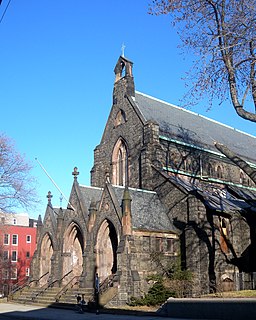
Saint John's Episcopal Church in Jersey City, New Jersey is a disused church of the Episcopal Diocese of Newark. Located on Summit Avenue in Bergen Hill, it is considered a masterwork of 19th-century ecclesiastical architecture. The building, which was named a municipal landmark in 2013, has not housed a congregation since 1994, and has fallen into disrepair.
Amsterdam is an unincorporated community located within Holland Township in Hunterdon County, New Jersey. Located on the southern flank of the Musconetcong Mountain, the area was settled in the first half of the 18th century. It was later named after Amsterdam, Netherlands. The Amsterdam Historic District, encompassing the community, was listed on the state and national registers of historic places in 1995.

Cloverhill is an unincorporated community located at the intersection of the boundaries of East Amwell and Raritan townships in Hunterdon County and Hillsborough Township in Somerset County, in New Jersey, United States. The Clover Hill Historic District was listed on the state and national registers of historic places in 1980.

Reaville is an unincorporated community located along the border of East Amwell and Raritan townships in Hunterdon County, New Jersey. By the 1830s, it was known as Greenville. It was later renamed after Runkle Rea, the first postmaster in 1850.

Middletown Village is an unincorporated community located in the central part of Middletown Township, Monmouth County, New Jersey. It was the first settlement in the township and one of the oldest in New Jersey. The Middletown Village Historic District, encompassing the community, was listed on the state and national registers of historic places in 1974.

Old Bridge, also known as the Historic Village of Old Bridge, is an unincorporated community located within East Brunswick in Middlesex County, New Jersey. It is on the South River, a tributary of the Raritan River. The community is named after the first bridge built here to cross the river, the South River Bridge. After other bridges were built crossing the river, it became known as the Old Bridge. The Old Bridge Historic District, encompassing much of the village, is listed on the state and national registers of historic places.

The Turner–Chew–Carhart Farm, also known as the Jockey Hollow Farm, is a historic 57-acre (23 ha) farm located off Van Syckles Road in Union Township, Hunterdon County, New Jersey and near Clinton. It was added to the National Register of Historic Places on August 11, 1977, for its significance in agriculture, architecture, industry, and politics/government. The farmstead includes seven contributing buildings.


