Barclay Farm, New Jersey | |
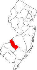
---|---|
Coordinates: 39°54′04″N75°00′03″W / 39.901243°N 75.000829°W | |
Country | United States |
State | New Jersey |
County | Camden |
Township | Cherry Hill |
Area | |
• Total | 1.66 sq mi (4.30 km2) |
• Land | 1.66 sq mi (4.30 km2) |
• Water | 0.00 sq mi (0.00 km2) 0.00% |
Elevation | 43 ft (13 m) |
Population | |
• Total | 4,656 |
• Density | 2,806.51/sq mi (1,083.66/km2) |
Time zone | UTC−05:00 (Eastern (EST)) |
• Summer (DST) | UTC−04:00 (EDT) |
Area code | 856 |
FIPS code | 34-02880 [4] [5] [6] |
GNIS feature ID | 02389172 [4] [7] |
Barclay Farm (or simply Barclay) is an unincorporated community and census-designated place (CDP) [8] located within Cherry Hill, in Camden County, in the U.S. state of New Jersey, that had been part of the Barclay-Kingston CDP until 2000, which was split to form the CDPs of Barclay and Kingston Estates as of the 2010 Census. [9] Until the 2000 census, Barclay was included as part of the Barclay-Kingston CDP. As of the 2010 United States Census, the CDP's population was 4,428. [10]
Located on a 32-acre (13 ha) site, the Barclay Farm House is a historic farmhouse constructed in 1816. The property is listed on the National Register of Historic Places and is operated by the township to provide visitors with insight into Cherry Hill and its past as an agricultural center. [11]
According to the United States Census Bureau, Barclay Farm had a total area of 1.659 square miles (4.297 km2), all of which was land. [4] [12]
Census | Pop. | Note | %± |
---|---|---|---|
2010 | 4,428 | — | |
2020 | 4,656 | 5.1% | |
source: 2010 [10] 2020 [3] |
The 2010 United States census counted 4,428 people, 1,621 households, and 1,334 families in the CDP. The population density was 2,669.2 per square mile (1,030.6/km2). There were 1,651 housing units at an average density of 995.2 per square mile (384.2/km2). The racial makeup was 94.60% (4,189) White, 1.08% (48) Black or African American, 0.07% (3) Native American, 2.62% (116) Asian, 0.00% (0) Pacific Islander, 0.50% (22) from other races, and 1.13% (50) from two or more races. Hispanic or Latino of any race were 2.57% (114) of the population. [10]
Of the 1,621 households, 33.2% had children under the age of 18; 73.3% were married couples living together; 7.0% had a female householder with no husband present and 17.7% were non-families. Of all households, 15.1% were made up of individuals and 8.3% had someone living alone who was 65 years of age or older. The average household size was 2.73 and the average family size was 3.04. [10]
23.7% of the population were under the age of 18, 6.2% from 18 to 24, 19.3% from 25 to 44, 33.9% from 45 to 64, and 16.9% who were 65 years of age or older. The median age was 45.5 years. For every 100 females, the population had 96.8 males. For every 100 females ages 18 and older there were 93.6 males. [10]
Ashland is an unincorporated community and census-designated place (CDP) located within Cherry Hill, in Camden County, in the U.S. state of New Jersey. As of the 2010 United States Census, the CDP's population was 8,302.
Barclay-Kingston is an unincorporated community and former census-designated place (CDP) located within Cherry Hill Township, in Camden County, New Jersey, United States. As of the 2000 United States Census, the section population was 10,728. In the 2010 United States Census, the Barclay-Kingston CDP was split into two new CDPs, Barclay and Kingston Estates.
Cherry Hill Mall is a unincorporated community and growing census-designated place (CDP) located in Cherry Hill, in Camden County, in the U.S. state of New Jersey. As of the 2020 United States census, the CDP’s population was 14,805, its highest decennial count ever and an increase of 634 (+4.5%) from the 14,171 residents recorded at the 2010 census count, which in turn reflected an increase of 933 (+7.0%) from the 13,238 counted in the 2000 census. The CDP is home to the namesake Cherry Hill Mall shopping complex.
Golden Triangle is an unincorporated community and census-designated place (CDP) located within Cherry Hill Township, in Camden County, in the U.S. state of New Jersey. As of the 2010 United States Census, the CDP's population was 4,145.
Greentree is an unincorporated community and census-designated place (CDP) located within Cherry Hill Township, in Camden County, in the U.S. state of New Jersey. As of the 2010 United States Census, the CDP's population was 11,367.
Springdale is an unincorporated community and census-designated place (CDP) located within Cherry Hill Township, in Camden County, in the U.S. state of New Jersey. As of the 2010 United States Census, the section population was 14,518.
Princeton Junction is an unincorporated community and census-designated place (CDP) located within West Windsor, in Mercer County, in the U.S. state of New Jersey. As of the 2010 United States Census, the CDP's population was 2,465.
Cranbury is an unincorporated community and census-designated place (CDP) located within Cranbury Township, in Middlesex County, in the U.S. state of New Jersey. As of the 2010 United States Census, the CDP's population was 2,181. Despite the similarity in the name of Cranbury Township and the CDP, the two are not one and the same, as had been the case for most paired Township / CDP combinations prior to the 2010 Census, in which the CDP was coextensive with a township of the same name.
Kingston is an unincorporated community and census designated place (CDP) along the border of South Brunswick Township in Middlesex County and Franklin Township in Somerset County, and also located relatively near Princeton in Mercer County in the U.S. state of New Jersey. The historic settlement is in the Raritan Valley region, located along the course of the Millstone River. As of the 2010 United States Census, the CDP's population was 1,493, of which 1,222 were in South Brunswick Township and 271 in Franklin Township.
Plainsboro Center is an unincorporated community and census-designated place (CDP) located within Plainsboro Township, in Middlesex County, in the U.S. state of New Jersey. As of the 2010 United States Census, the CDP's population was 2,712.
Society Hill is an unincorporated community and census-designated place (CDP) located within Piscataway Township, in Middlesex County, in the U.S. state of New Jersey. As of the 2010 United States Census, the CDP's population was 3,829.
Shark River Hills is an unincorporated community and census-designated place (CDP) within Neptune Township, in Monmouth County, in the U.S. state of New Jersey. As of the 2010 United States Census, the CDP's population was 3,697.
West Freehold is an unincorporated community and census-designated place (CDP) within Freehold Township, in Monmouth County, New Jersey, United States. As of the 2010 United States Census, the CDP's population was 13,613. Due to the community's close proximity to the Battle of Monmouth, West Freehold is home to several important historical structures, which have been preserved in the 'West Freehold Village Historic District'. The historically preserved Monmouth Battlefield, along with the historic villages of Clarksburg, Englishtown, Smithburg and Tennent are a short distance away.
Toms River is an unincorporated community and census-designated place (CDP) located within and constituting the mainland portion of Toms River Township, in Ocean County, in the U.S. state of New Jersey. As of the 2020 United States census, the CDP's population was 92,830, its highest decennial count ever and an increase of 4,039 (+4.5%) from the 88,791 recorded at the 2010 census, which in turn reflected an increase of 2,464 (+2.9%) from the 86,327 counted in the 2000 census. The Toms River CDP is the county seat of Ocean County. The area is named for Toms River, whose estuary flows through the community and empties into Barnegat Bay.
Robbinsville is a census-designated place (CDP) located within Robbinsville Township in Mercer County, in the U.S. state of New Jersey. The area is served as United States Postal Service ZIP Code 08691. As of the 2010 United States Census, the population for the CDP was 3,041.
Juliustown is an unincorporated community and census-designated place (CDP) located within Springfield Township, in Burlington County, in the U.S. state of New Jersey, that was established as part of the 2010 United States census. As of the 2010 Census, the CDP's population was 429.
Cherry Hill is a township within Camden County, in the U.S. state of New Jersey. As of the 2020 United States census, the township's population was 74,553, an increase of 3,508 (+4.9%) from the 2010 census count of 71,045, which in turn reflected an increase of 1,080 (+1.5%) from the 69,965 counted in the 2000 census. As of 2020, the township was the state's 12th most populous municipality, and the largest in Camden County, after having been the state's 14th most-populous municipality and the county's second largest in the 2010 Census, having surpassed both Brick Township, as well as nearby Camden, within the previous decade, and was ranked 13th in 2000.
Ellisburg is an unincorporated community and census-designated place (CDP) located within Cherry Hill Township, in Camden County, in the U.S. state of New Jersey. As of the 2010 United States Census, the CDP's population was 8,168. The area had been part of the combined Erlton-Ellisburg CDP, which was discontinued after the 2000 census.
East Rocky Hill is an unincorporated community and census-designated place (CDP) located in Franklin Township, in Somerset County, in the U.S. state of New Jersey. As of the 2010 United States Census, the CDP's population was 469.
Kingston Estates is an unincorporated community and census-designated place (CDP) located within Cherry Hill, in Camden County, in the U.S. state of New Jersey, that had been part of the Barclay-Kingston CDP until the 2000 census, which was split to form the CDPs of Barclay and Kingston Estates as of the 2010 Census. As of the 2010 United States Census, the CDP's population was 5,685.