Kingston Estates, New Jersey | |
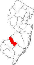
---|---|
Location in Camden County Location in New Jersey | |
Coordinates: 39°55′05″N74°59′25″W / 39.918085°N 74.990185°W | |
Country | United States |
State | New Jersey |
County | Camden |
Township | Cherry Hill |
Area | |
• Total | 1.16 sq mi (3.00 km2) |
• Land | 1.16 sq mi (3.00 km2) |
• Water | 0.00 sq mi (0.00 km2) 0.13% |
Elevation | 43 ft (13 m) |
Population | |
• Total | 6,322 |
• Density | 5,459.4/sq mi (2,107.9/km2) |
Time zone | UTC−05:00 (Eastern (EST)) |
• Summer (DST) | UTC−04:00 (EDT) |
Area code | 856 |
FIPS code | 34-36960 [4] [5] [6] |
GNIS feature ID | 02389172 [4] [7] |
Kingston Estates is an unincorporated community and census-designated place (CDP) [8] located within Cherry Hill, in Camden County, in the U.S. state of New Jersey, that had been part of the Barclay-Kingston CDP until the 2000 census, which was split to form the CDPs of Barclay and Kingston Estates as of the 2010 Census. [9] As of the 2010 United States Census, the CDP's population was 5,685. [10]
According to the United States Census Bureau, the CDP had a total area of 1.164 square miles (3.013 km2), including 1.162 square miles (3.009 km2) of land and 0.002 square miles (0.004 km2) of water (0.13%). [4] [11]
Census | Pop. | Note | %± |
---|---|---|---|
2010 | 5,685 | — | |
2020 | 6,322 | 11.2% | |
source: 2010 [10] 2020 [3] |
The 2010 United States census counted 5,685 people, 2,191 households, and 1,510 families in the CDP. The population density was 4,893.3 per square mile (1,889.3/km2). There were 2,553 housing units at an average density of 2,197.5 per square mile (848.5/km2). The racial makeup was 76.66% (4,358) White, 6.95% (395) Black or African American, 0.19% (11) Native American, 12.52% (712) Asian, 0.02% (1) Pacific Islander, 1.27% (72) from other races, and 2.39% (136) from two or more races. Hispanic or Latino of any race were 5.19% (295) of the population. [10]
Of the 2,191 households, 28.3% had children under the age of 18; 55.4% were married couples living together; 10.1% had a female householder with no husband present and 31.1% were non-families. Of all households, 27.5% were made up of individuals and 14.3% had someone living alone who was 65 years of age or older. The average household size was 2.55 and the average family size was 3.16. [10]
21.7% of the population were under the age of 18, 7.2% from 18 to 24, 23.0% from 25 to 44, 28.2% from 45 to 64, and 19.9% who were 65 years of age or older. The median age was 43.5 years. For every 100 females, the population had 91.5 males. For every 100 females ages 18 and older there were 85.2 males. [10]
Country Lake Estates is an unincorporated community and census-designated place (CDP) located within Pemberton Township, in Burlington County, in the U.S. state of New Jersey. As of the 2010 United States Census, the CDP's population was 3,943.
Presidential Lakes Estates is an unincorporated community and census-designated place (CDP) located within Pemberton Township, in Burlington County, in the U.S. state of New Jersey. As of the 2010 United States Census, the CDP's population was 2,365.
Ramblewood is an unincorporated community and census-designated place (CDP) located within Mount Laurel Township in Burlington County, in the U.S. state of New Jersey. As of the 2010 United States Census, the CDP's population was 5,907.
Barclay-Kingston is an unincorporated community and former census-designated place (CDP) located within Cherry Hill Township, in Camden County, New Jersey, United States. As of the 2000 United States Census, the section population was 10,728. In the 2010 United States Census, the Barclay-Kingston CDP was split into two new CDPs, Barclay and Kingston Estates.
Echelon is an unincorporated community and census-designated place (CDP) located within Voorhees Township in Camden County, in the U.S. state of New Jersey. As of the 2010 United States Census, the CDP's population was 10,743.
Port Norris is an unincorporated community and census-designated place (CDP) located within Commercial Township, in Cumberland County, in the U.S. state of New Jersey. It is part of the Vineland-Millville- Bridgeton Primary Metropolitan Statistical Area for statistical purposes. As of the 2000 United States Census, the CDP's population was 1,377. Legislation was passed in 1911 allowing voters to choose to incorporate Port Norris as a borough, independent from Commercial Township, but it was defeated in a referendum.
Fords is an unincorporated community and census-designated place (CDP) located within Woodbridge Township, in Middlesex County, in the U.S. state of New Jersey. As of the 2010 United States Census, the CDP's population was 15,187.
Kingston is an unincorporated community and census designated place (CDP) along the border of South Brunswick Township in Middlesex County and Franklin Township in Somerset County, and also located relatively near Princeton in Mercer County in the U.S. state of New Jersey. The historic settlement is in the Raritan Valley region, located along the course of the Millstone River. As of the 2010 United States Census, the CDP's population was 1,493, of which 1,222 were in South Brunswick Township and 271 in Franklin Township.
Plainsboro Center is an unincorporated community and census-designated place (CDP) located within Plainsboro Township, in Middlesex County, in the U.S. state of New Jersey. As of the 2010 United States Census, the CDP's population was 2,712.
Sewaren is an unincorporated community and census-designated place (CDP) within Woodbridge Township, in Middlesex County, in the U.S. state of New Jersey. As of the 2010 United States Census, the CDP's population was 2,756.
East Freehold is an unincorporated community and census-designated place (CDP) located within Freehold Township, in Monmouth County, in the U.S. state of New Jersey. As of the 2010 United States Census, the CDP's population was 4,894.
West Belmar is an unincorporated community and census-designated place (CDP) within Wall Township, in Monmouth County, in the U.S. state of New Jersey. At the 2010 census, the CDP's population was 2,493.
White Meadow Lake is an unincorporated community and census-designated place (CDP) located within Rockaway Township, in Morris County, in the U.S. state of New Jersey. As of the 2010 United States Census, the CDP's population was 8,836.
Leisure Knoll is an unincorporated community and census-designated place (CDP) located within Manchester Township, in Ocean County, in the U.S. state of New Jersey. As of the 2010 United States Census, the CDP's population was 2,490.
Waretown is an unincorporated community and census-designated place (CDP) located within Ocean Township, in Ocean County, in the U.S. state of New Jersey. As of the 2010 United States Census, the CDP's population was 1,569. Waretown is home to Albert Music Hall.
Beattystown is an unincorporated community and census-designated place (CDP) located within Mansfield Township, in Warren County, in the U.S. state of New Jersey. As of the 2010 United States Census, the CDP's population was 4,554.
Pine Lake Park is an unincorporated community and census-designated place (CDP) located within Manchester Township, in Ocean County, in the U.S. state of New Jersey. Until the 2000 census, the CDP had been part of the Leisure Village West-Pine Lake Park CDP, which was split for the 2010 enumeration into separate CDPs for Leisure Village West and Pine Lake Park. As of the 2010 United States Census, the CDP's population was 8,707.
Barclay Farm is an unincorporated community and census-designated place (CDP) located within Cherry Hill, in Camden County, in the U.S. state of New Jersey, that had been part of the Barclay-Kingston CDP until 2000, which was split to form the CDPs of Barclay and Kingston Estates as of the 2010 Census. Until the 2000 census, Barclay was included as part of the Barclay-Kingston CDP. As of the 2010 United States Census, the CDP's population was 4,428.
Florence is an unincorporated community and census-designated place (CDP) located within Florence Township, in Burlington County, in the U.S. state of New Jersey, that was established as part of the 2010 United States Census. As of the 2000 United States Census, the CDP was combined as Florence-Roebling, which had a total population of 8,200. As of the 2010 Census, the Florence-Roebling CDP was split into its components, Roebling and Florence. As of the 2010 Census, the population of the Florence CDP was 4,426.
Upper Pohatcong is an unincorporated community and census-designated place (CDP) located within Pohatcong Township in Warren County, in the U.S. state of New Jersey, that was defined as part of the 2010 United States Census. As of the 2010 Census, the CDP's population was 1,781.