
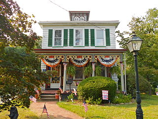
Lawrenceville is an unincorporated community and census-designated place (CDP) within Lawrence Township in Mercer County, in the U.S. state of New Jersey. The community is situated roughly halfway between Princeton and Trenton. Lawrenceville is part of the Trenton–Princeton metropolitan area within the New York combined statistical area; however, the CDP actually is located approximately 15 miles closer to Philadelphia than to New York City, and as with the remainder of Mercer County, lies within the Federal Communications Commission's Philadelphia Designated Market Area. As of the 2020 census, the CDP's population was 3,751, a decrease of 136 (−3.5%) from the 3,887 recorded at the 2010 census, which in turn had reflected a decrease of 194 (−4.8%) from the 4,081 counted in the 2000 census.

Camden County is a county located in the U.S. state of New Jersey. Its county seat is Camden. As of the 2020 census, the county was the state's ninth-most populous county, with a population of 523,485, its highest decennial count ever and an increase of 9,828 (+1.9%) from the 2010 census count of 513,657, which in turn reflected an increase of 4,725 (0.9%) from the 508,932 counted in the 2000 census. The county is part of the South Jersey region of the state.
Berlin is a borough in Camden County, in the U.S. state of New Jersey. As of the 2020 United States census, the borough's population was 7,489, a decrease of 99 (−1.3%) from the 2010 census count of 7,588, which in turn reflected an increase of 1,439 (+23.4%) from the 6,149 counted in the 2000 census.

Berlin Township is a township in Camden County, in the U.S. state of New Jersey. As of the 2020 United States census, the township's population was 5,867, an increase of 510 (+9.5%) from the 2010 census count of 5,357, which in turn reflected an increase of 67 (+1.3%) from the 5,290 counted in the 2000 census.

Haddon Township is a township in Camden County, in the U.S. state of New Jersey. As of the 2020 United States census, the township's population was 15,407, an increase of 700 (+4.8%) from the 2010 census count of 14,707, which in turn reflected an increase of 56 (+0.4%) from the 14,651 counted in the 2000 census.

Tavistock is a borough in Camden County, in the U.S. state of New Jersey. As of the 2020 United States census, the borough's population was 9, an increase of 4 (+80.0%) from the 2010 census count of 5, which in turn reflected a decline of 19 (−79.2%) from the 24 counted in the 2000 census. As of the 2010 Census it was the smallest municipality by population in New Jersey, with seven fewer residents than nearby Pine Valley, which had 12, while the 2020 census placed Tavistock as second-smallest by population, two more than Walpack Township, New Jersey, which had a population of 7.

Voorhees Township is a township in Camden County, in the U.S. state of New Jersey. The township is a suburb in the Delaware Valley / Greater Philadelphia Metropolitan Area. As of the 2020 United States census, the township's population was 31,069, an increase of 1,938 (+6.7%) from the 2010 census count of 29,131, which in turn reflected an increase of 1,005 (+3.6%) from the 28,126 counted in the 2000 census.

Waterford Township is a township in Camden County, in the U.S. state of New Jersey. As of the 2020 United States census, the township's population was 10,421, a decrease of 228 (−2.1%) from the 2010 census count of 10,649, which in turn reflected an increase of 155 (+1.5%) from the 10,494 counted in the 2000 census.

Winslow Township is a township in Camden County, in the U.S. state of New Jersey. As of the 2020 United States census, the township's population was 39,907, an increase of 408 (+1.0%) from the 2010 census count of 39,499, which in turn reflected an increase of 4,888 (+14.1%) from the 34,611 counted in the 2000 census.

Monroe Township is a township in Gloucester County, in the U.S. state of New Jersey. As of the 2020 United States census, the township's population was 37,117, its highest decennial count ever and an increase of 988 (+2.7%) from the 36,129 recorded at the 2010 census, which in turn reflected an increase of 7,162 (+24.7%) from the 28,967 counted in the 2000 census. The township is part of the South Jersey region of the state and a suburb of Philadelphia, within the Delaware Valley.

Bethlehem Township is a township in Hunterdon County, in the U.S. state of New Jersey. It is part of the New York metropolitan area. As of the 2020 United States census, the township's population was 3,745, a decrease of 234 (−5.9%) from the 2010 census count of 3,979, which in turn reflected an increase of 159 (+4.2%) from the 3,820 counted in the 2000 census.
Califon is a borough in Hunterdon County, in the U.S. state of New Jersey. As of the 2020 United States census, the borough's population was 1,005, a decrease of 71 (−6.6%) from the 2010 census count of 1,076, which in turn reflected an increase of 21 (+2.0%) from the 1,055 counted in the 2000 census.

Franklin Township is a township in central Hunterdon County, in the U.S. state of New Jersey. As of the 2020 United States census, the township's population was 3,267, an increase of 72 (+2.3%) from the 2010 census count of 3,195, which in turn reflected an increase of 205 (+6.9%) from the 2,990 counted in the 2000 census. Most of the township lies on the Hunterdon Plateau with only the eastern section along the South Branch Raritan River being on the lower part of the Newark Basin.

High Bridge is a borough in Hunterdon County, in the U.S. state of New Jersey. As of the 2020 United States census, the borough's population was 3,546, a decrease of 102 (−2.8%) from the 2010 census count of 3,648, which in turn reflected a decline of 128 (−3.4%) from the 3,776 counted in the 2000 census.
Lebanon Township is the northernmost township in Hunterdon County, in the U.S. state of New Jersey. As of the 2020 United States census, the township's population was 6,195, a decrease of 393 (−6.0%) from the 2010 census count of 6,588, which in turn reflected an increase of 772 (+13.3%) from the 5,816 counted in the 2000 census.

Tewksbury Township is a township located in Hunterdon County, in the U.S. state of New Jersey and is located within the New York Metropolitan Area. As of the 2020 United States census, the township's population was 5,870, a decrease of 123 (−2.1%) from the 2010 census count of 5,993, which in turn reflected an increase of 452 (+8.2%) from the 5,541 counted in the 2000 census.

Union Township is a township in Hunterdon County, in the U.S. state of New Jersey. The southwest half of the township lies on what is known as the Hunterdon Plateau, the northwest corner consists of the Musconetcong Ridge and the northeast section is part of the lower-lying Newark Basin around Spruce Run Reservoir. As of the 2020 United States census, the township's population was 6,507, its highest ever decennial count and an increase of 599 (+10.1%) from the 2010 census count of 5,908, which in turn reflected a decline of 252 (−4.1%) from the 6,160 counted in the 2000 census.
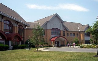
The Voorhees Township Public Schools is a comprehensive community public school district serving students in pre-kindergarten through eighth grade from Voorhees Township, in Camden County, in the U.S. state of New Jersey.
Cherry Hill is a township within Camden County, in the U.S. state of New Jersey. As a suburb of Philadelphia the township is part of South Jersey and the Delaware Valley region. Cherry Hill Township grew during the mid-20th century suburbanization, becoming one of the Delaware Valley's main commercial centers, including the Cherry Hill Mall. As of the 2020 United States census, the township's population was 74,553.
Osage is an unincorporated community located within the Echelon section of Voorhees Township in Camden County, in the U.S. state of New Jersey. The name Osage derives from a small group of Indians of the Sioux tribe from the Midwestern United States that settled in the area.


