Ellisburg, New Jersey | |
|---|---|
 Map of the former Erlton-Ellisburg CDP in Camden County. Inset: Location of Camden County in New Jersey. | |
 Ellisburg Location in Camden County  Ellisburg Location in New Jersey  Ellisburg Location in the United States | |
| Coordinates: 39°55′12″N75°00′34″W / 39.919889°N 75.009336°W | |
| Country | |
| State | |
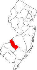
| County | Camden |
| Township | Cherry Hill |
| Area | |
• Total | 0.90 sq mi (2.34 km2) |
| • Land | 0.90 sq mi (2.34 km2) |
| • Water | 0 sq mi (0.00 km2) 0.00% |
| Elevation | 89 ft (27 m) |
| Population | |
• Total | 4,601 |
| • Density | 5,085/sq mi (1,963.2/km2) |
| Time zone | UTC−05:00 (Eastern (EST)) |
| • Summer (DST) | UTC−04:00 (EDT) |
| ZIP Code | 08002 - Cherry Hill [4] |
| Area code | 856 |
| FIPS code | 34-21120 [5] [6] [7] |
| GNIS feature ID | 02583987 [5] [8] |
Ellisburg is an unincorporated community and census-designated place (CDP) [9] located within Cherry Hill Township, in Camden County, in the U.S. state of New Jersey. [10] As of the 2010 United States census, the CDP's population was 8,168. [11] The area had been part of the combined Erlton-Ellisburg CDP, which was discontinued after the 2000 census. [10]