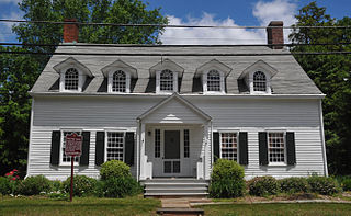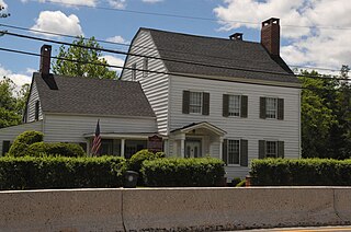
Morris County is a county located in the U.S. state of New Jersey, about 30 mi (48 km) west of New York City. According to the 2020 census, the county was the state's tenth-most populous county, with a population of 509,285, its highest decennial count ever and an increase of 17,009 (+3.5%) from the 2010 census count of 492,276, which in turn reflected an increase of 22,064 (+11.6%) from the 470,212 counted in the 2000 census, Morris County is part of the New York metropolitan area and is divided into 39 municipalities, with many commuter towns but no large cities. Its county seat is Morristown, in the southeast. The most populous place was Parsippany-Troy Hills Township, with 56,162 residents at the time of the 2020 census, while Rockaway Township covered 45.55 square miles (118.0 km2), the largest total area of any municipality. The county is part of the North Jersey region of the state.

Route 10 is a 23.5 mi (37.82 km) state highway in the northern part of the U.S. state of New Jersey. It runs from an intersection of US 46 in Roxbury, Morris County, east to Prospect Avenue / Mt Pleasant Avenue in West Orange, Essex County. Route 10 is a major route through northern New Jersey that runs through Ledgewood, East Hanover, and Livingston. It is a four-lane highway for most of its length with the exception of the easternmost part of the route. Route 10 features intersections and interchanges with many major roads including Route 53 and US 202 in Morris Plains and I-287 in Hanover.

East Hanover Township is a township in Morris County, in the U.S. state of New Jersey. As of the 2020 United States census, the township's population was 11,105, a decrease of 52 (−0.5%) from the 2010 census count of 11,157, which in turn reflected a decline of 236 (−2.1%) from the 11,393 counted in the 2000 census.

Florham Park is a borough in Morris County, in the U.S. state of New Jersey. As of the 2020 United States census, the borough's population was 12,585, its highest decennial count ever and an increase of 889 (+7.6%) from the 11,696 recorded at the 2010 census, which in turn reflected an increase of 2,839 (+32.1%) from the 8,857 counted in the 2000 census.

Hanover Township is a township in Morris County, in the U.S. state of New Jersey. As of the 2020 United States census, the township's population was 14,677, its highest decennial count ever and an increase of 965 (+7.0%) from the 13,712 recorded at the 2010 census, which in turn reflected an increase of 814 (+6.3%) from the 12,898 counted in the 2000 census. The township comprises the unincorporated communities of Whippany and Cedar Knolls.

Morristown is a town in and the county seat of Morris County, in the U.S. state of New Jersey. Morristown has been called "the military capital of the American Revolution" because of its strategic role in the war for independence from Great Britain. Morristown's history is visible in a variety of locations that collectively make up Morristown National Historical Park, the country's first National Historical Park.

The Whippany River is a tributary of the Rockaway River, approximately 20 mi (30 km) long, in northern New Jersey in the United States.

Cedar Knolls is an unincorporated community located within Hanover Township in Morris County, in the U.S. state of New Jersey. It is part of Hanover Township along with Whippany.
The Hanover Park Regional High School District is a comprehensive regional public school district that serves students in ninth through twelfth grades from three communities in Morris County, in the U.S. state of New Jersey. Students come from East Hanover Township, Florham Park and Hanover Township.
Daniel Frischman is an American actor, comedian, writer, director, playwright and magician. He is best known for his roles as Chris Potter on the Nickelodeon sitcom Kenan & Kel and Arvid Engen on the ABC sitcom Head of the Class. He is noted for playing socially inept "geeks" and "nerds". Frischman is a member of The Magic Castle, who belongs to the Academy of Magic Arts in Hollywood.
The Hanover Township Public Schools is a comprehensive community public school district that serves students in kindergarten through eighth grade from Hanover Township, in Morris County, in the U.S. state of New Jersey.
The Florham Park School District is a comprehensive community public school district that serves students in kindergarten through eighth grade from Florham Park, in Morris County, in the U.S. state of New Jersey.
The East Hanover School District is a community public school district that serves students in pre-kindergarten through eighth grade from East Hanover, in Morris County, in the U.S. state of New Jersey.

Hanover Park High School is a four-year comprehensive public high school that serves students in ninth through twelfth grades from East Hanover Township and Florham Park, in Morris County, in the U.S. state of New Jersey, operating as one of the two secondary schools of the Hanover Park Regional High School District. Hanover Park's sister school is Whippany Park High School, which serves students from Hanover Township, where the school is located. The school opened in 1956.
Whippany Park High School is a four-year comprehensive public high school that serves students in ninth through twelfth grade from Hanover Township in Morris County, in the U.S. state of New Jersey, operating as one of the two secondary schools of the Hanover Park Regional High School District. The other school in the district, Hanover Park High School, serves students from East Hanover and Florham Park. | us_nces_school_id = 340666004246

Brookside is a historic unincorporated community and census-designated place (CDP) located within Mendham Township in Morris County, in the U.S. state of New Jersey. It is located approximately 6 mi (9.7 km) west of Morristown, the county seat.
Troy Hills is a census-designated place (CDP) in the township of Parsippany–Troy Hills, Morris County, New Jersey, United States. As of the 2020 census, it had a population of 5,081.

The Whippany River Watershed Action Committee (WRWAC) is a member-based, nonprofit 501(c)(3) organization, which identifies and implements projects to preserve and protect water and the surrounding natural areas. The Whippany River Watershed is an area of 69.3 square miles within Morris County in north central New Jersey. The 16-mile long Whippany River serves the only significant unconsolidated aquifer in northern New Jersey and is a source of drinking water for more than 1 million people.

Washington Valley is an unincorporated community in the Whippany River valley within Morris Township in Morris County, in the U.S. state of New Jersey.
Parsippany is a census-designated place (CDP) and the central community in the township of Parsippany–Troy Hills, Morris County, in the U.S. state of New Jersey. As of the 2020 United States census, the population was 22,778, out of 56,162 in the entire township. It includes development around Lake Parsippany, as well as neighborhoods in the eastern part of the township, between Troy Hills to the south and Lake Hiawatha to the northeast. The southern end of Boonton Reservoir is also in the CDP. In common usage, "Parsippany" usually applies to the entire township.


