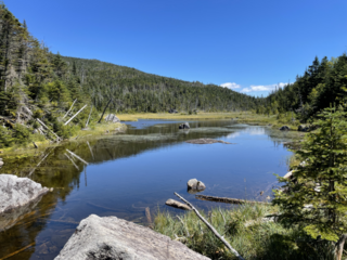
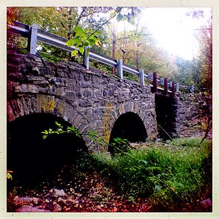
Ridgeway is an unincorporated community located within Manchester Township, in Ocean County, in the U.S. state of New Jersey.

Lake Tear of the Clouds is a small tarn located in the town of Keene, in Essex County, New York, United States, on the southwest slope of Mount Marcy, the state's highest point, in the Adirondack Mountains. It is the highest pond in the state at 4,293 feet (1,309 m). It is often cited as the highest source of the Hudson River, via Feldspar Brook, the Opalescent River and Calamity Brook.

Blue Mountain, Blue Mountain Ridge, or the Blue Mountains of Pennsylvania is a ridge of the Appalachian Mountains in eastern Pennsylvania. Forming the southern and eastern edge of the Ridge-and-Valley Appalachians physiographic province in Pennsylvania, Blue Mountain extends 150 miles (240 km) from the Delaware Water Gap on the New Jersey border in the east to Big Gap in Franklin County in south-central Pennsylvania at its southwestern end.

The South Branch Raritan River is a 50-mile-long (80 km) tributary of the Raritan River in New Jersey.

Papakating Creek is a 20.1-mile-long (32.3 km) tributary of the Wallkill River located in Frankford and Wantage townships in Sussex County, New Jersey in the United States. The creek rises in a small swamp located beneath the eastern face of Kittatinny Mountain in Frankford and its waters join the Wallkill to the east of Sussex borough.
The Stroudwater River is a 15.2-mile-long (24.5 km) river located mostly in Cumberland County, Maine. The river begins as a small stream at Duck Pond in Buxton and grows as it flows through Buxton, Gorham, Westbrook, and finally Portland before emptying into the Fore River at Stroudwater falls in Portland's Stroudwater neighborhood. Several smaller streams flow into the river in Buxton and Gorham, including Deering Brook, Gully Brook, Fogg Brook and Silver Brook.
Pleasant Run was a hamlet in Readington Township, Hunterdon County, in the U.S. state of New Jersey. Located along Campbell's Brook, the hamlet consisted of farms, a schoolhouse and a general store. The brook was named after John Campbell, who purchased the land around it in 1685.

Millhurst is an unincorporated community located within Manalapan Township in Monmouth County, in the U.S. state of New Jersey. Route 33 and County Route 527 pass through the center of Millhurst. Much of the area consists of businesses along the aforementioned arterial roads with the Millhurst Mill at the CR 527 crossing of Manalapan Brook. The mill is a former grist mill built in the 1700s, rebuilt in the 1800s as a more efficient mill, and turned into a family business by Bernard Hochberg in 1925.

Henderson Lake is located in the Adirondack Mountains in the town of Newcomb, Essex County, New York in the United States. It was named in 1826 after David Henderson, one of the founders of the Elba Iron Works near Lake Placid, New York, and of the Upper Works at Tahawus, New York. The lake is mainly cited by cartographers as the place where the Hudson River as named officially begins, flowing out of the eastern end and outlet of the lake. Unofficially, the source of the river is traced up Indian Pass Brook and other watercourses to Lake Tear of the Clouds.

Burrs Mill is an unincorporated community located within Southampton Township in Burlington County, in the U.S. state of New Jersey. Found in a rural portion of the township near Route 70, it is located along its eponymous brook in a forested area within the Pine Barrens. A low density of houses surround nearby roads including Burrs Mill Road and Route 70's fire roads.
Quarryville is an unincorporated community located within Wantage Township in Sussex County, in the U.S. state of New Jersey.

Jericho is a community located within Stow Creek Township, in Cumberland County, in the U.S. state of New Jersey.

Zion is an unincorporated community along the border of Hillsborough Township and Montgomery Township in Somerset County, in the U.S. state of New Jersey. It is located on Rock Brook, approximately 3 mi (4.8 km) north of Hopewell.

Hoffman is an unincorporated community located within Monroe Township in Middlesex County, in the U.S. state of New Jersey. The settlement is located at the site of a former railroad station on the Freehold and Jamesburg Agricultural Railroad. Today, most of the area is made up of homes and housing developments along Hoffman Station Road and Gravel Hill-Spotswood Road. Forestland and the Manalapan Brook valley make up the remainder of the area.

Sand Brook is an unincorporated community located along County Route 523, Sand Brook-Headquarters & Britton Roads in Delaware Township in Hunterdon County, in the U.S. state of New Jersey.

Little Rocky Hill is an unincorporated community located within South Brunswick in Middlesex County and Franklin Township, Somerset County, in the U.S. state of New Jersey. The community is located atop a small hill east of the borough of Rocky Hill. The Middlesex–Somerset county line runs through the community along Old Road though elsewhere it follows Route 27. Carters Brook runs through the area flowing south.

Charleston Springs is an unincorporated community located within Millstone Township in Monmouth County, in the U.S. state of New Jersey. Stage Coach Road, also designated County Route 524, is the main road that runs through the settlement, with Ely Harmony Road as the intersecting road defining the locality. The Manalapan Brook runs to the west of the center of Charleston Springs and CR 537 runs to the south of the area. The Monmouth County-owned Charleston Springs Golf Course is located one mile (1.6 km) northeast of the center of Charleston Springs on CR 527.

Millbrook, also known as Millbrook Village, is an unincorporated community located along Old Mine Road within Hardwick Township, formerly Pahaquarry Township, in Warren County, in the U.S. state of New Jersey. It is named after the Mill Brook, now known as Van Campens Mill Brook, a tributary of the Delaware River. The area is now part of the Delaware Water Gap National Recreation Area.

Trout Brook is a stream in Ramsey County, in the U.S. state of Minnesota. It source is at McCarrons Lake.

Millville is an unincorporated community located along River Road and Shimers Brook in Montague Township of Sussex County, New Jersey. The Montague Grange and other parts of the community are in the Delaware Water Gap National Recreation Area.


