Parsippany–Troy Hills, commonly known as Parsippany, is a township in Morris County, in the U.S. state of New Jersey. As of the 2020 United States census, the township's population was 56,162, an increase of 2,924 (+5.5%) from the 2010 census count of 53,238, which in turn reflected an increase of 2,589 (+5.1%) from the 50,649 counted in the 2000 census.

Pompton Plains is a census-designated place (CDP) and unincorporated community constituting the majority of Pequannock Township, Morris County, in the U.S. state of New Jersey. As of the 2020 United States census, the CDP’s population was 11,144. The community was first listed as a CDP in advance of the 2020 census.

Lake Hopatcong is a census-designated place (CDP) located in Jefferson Township, Morris County, in the U.S. state of New Jersey. It includes communities on the northeast side of Lake Hopatcong, the largest freshwater body in the state.

Stewartsville is an unincorporated community and census-designated place (CDP) located within Greenwich Township in Warren County, in the U.S. state of New Jersey, that was created as part of the 2010 United States Census. As of the 2010 Census, the CDP's population was 349.

Juliustown is an unincorporated community and census-designated place (CDP) located within Springfield Township, in Burlington County, in the U.S. state of New Jersey, that was established as part of the 2010 United States census. As of the 2010 Census, the CDP's population was 429.
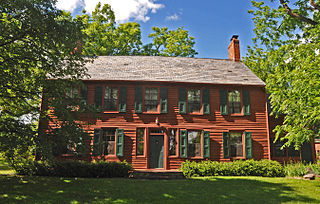
Troy Hills is a census-designated place (CDP) in the township of Parsippany-Troy Hills, Morris County, in the U.S. state of New Jersey. It is in the southeast part of the township, bordered to the north and west by the Parsippany CDP, to the south by Whippany in Hanover Township, and to the east by Troy Meadows, the largest freshwater marsh in New Jersey.

Leisure Village West is an unincorporated community and census-designated place (CDP) located within Manchester Township, in Ocean County, in the U.S. state of New Jersey. Until the 2000 census, the CDP had been part of the Leisure Village West-Pine Lake Park CDP, which was split for the 2010 enumeration into separate CDPs for Leisure Village West and Pine Lake Park. As of the 2010 United States Census, the CDP's population was 3,493. Leisure Village West is one of several active adult communities bearing similar names. Leisure Village and Leisure Village East are the other two communities nearby.

Oxford is an unincorporated community and census-designated place (CDP) located within Oxford Township in Warren County, New Jersey, United States, that was created as part of the 2010 United States Census. As of the 2010 Census, the CDP's population was 1,090.

Barclay Farm is an unincorporated community and census-designated place (CDP) located within Cherry Hill, in Camden County, in the U.S. state of New Jersey, that had been part of the Barclay-Kingston CDP until 2000, which was split to form the CDPs of Barclay and Kingston Estates as of the 2010 Census. Until the 2000 census, Barclay was included as part of the Barclay-Kingston CDP. As of the 2010 United States Census, the CDP's population was 4,428.

Anderson is an unincorporated community and census-designated place (CDP) located within Mansfield Township, in Warren County, in the U.S. state of New Jersey, that was created as part of the 2010 United States census. As of the 2020 United States census, the CDP's population was 306, a decrease of 36 (-10.5%) from the 342 enumerated at the 2010 census.
Greenwich is an unincorporated community and census-designated place (CDP) located within Greenwich Township in Warren County, in the U.S. state of New Jersey, that was defined as part of the 2010 United States Census. As of the 2010 Census, the CDP's population was 2,755.
Absecon Highlands is an unincorporated community and census-designated place (CDP) in Atlantic County, in the U.S. state of New Jersey. It is in the eastern part of the county, in southern Galloway Township. It is bordered to the south by the city of Absecon and to the east by Reeds Bay, a tidal water body the connects to the Atlantic Ocean through Broad Creek and Absecon Inlet. The CDP includes the neighborhoods of Absecon Highlands, Seaview Estates, Seaview Park, Conovertown, and Holly Brook.
Arrowhead Lake is an unincorporated community and census-designated place (CDP) in Cumberland County, in the U.S. state of New Jersey. It is in the northwestern part of the county, in the northern part of Stow Creek Township. A small artificial lake is in the northwestern part of the CDP, with a residential neighborhood on its southern shore.
Carlls Corner is a census-designated place (CDP) located in Upper Deerfield Township in Cumberland County, in the U.S. state of New Jersey. It is bordered at its southwest corner by the city of Bridgeton, the county seat.
Laurel Heights is a census-designated place (CDP) in Cumberland County, in the U.S. state of New Jersey. It is in the northern part of the county, in the southwestern part of Upper Deerfield Township, 2 miles (3 km) north of Bridgeton, the county seat. It is bordered to the west by the community of Sunset Lake.

Lower Berkshire Valley is a census-designated place (CDP) located in Roxbury and Jefferson townships, Morris County, in the U.S. state of New Jersey. It is primarily in the northeast part of Roxbury, along Berkshire Valley Road. Interstate 80 passes through the southern part of the CDP, but with no direct access. The community is 2 miles (3 km) northwest of Wharton and 4 miles (6 km) northwest of Dover.
Rainbow Lakes is a census-designated place (CDP) in Parsippany-Troy Hills, Morris County, in the U.S. state of New Jersey. It is in the western part of the township and consists of housing built around Rainbow Lake, plus a zone of commercial buildings to the east of the lakes. It is bordered to the east by Parsippany proper, to the north by the borough of Mountain Lakes, and to the west by Denville Township. The northern edge of the CDP is formed by U.S. Route 46 and the NJ Transit Montclair-Boonton Line, and Interstate 80 forms the southern edge. It is 21 miles (34 km) northwest of Newark and 30 miles (48 km) west of the George Washington Bridge over the Hudson River.
Bedminster is an unincorporated community and census-designated place (CDP) comprising the primary community in Bedminster Township, Somerset County, in the U.S. state of New Jersey. It was first listed as a CDP prior to the 2020 census.
The Hills is a planned community and census-designated place (CDP) in Bedminster and Bernards townships, Somerset County, in the U.S. state of New Jersey. It was first listed as a CDP prior to the 2020 census.
Bridgewater Center is a census-designated place (CDP) located in the west-central part of Bridgewater Township, Somerset County, in the U.S. state of New Jersey. It was first listed as a CDP prior to the 2020 census with a population of 4,616.


