Lake Hopatcong, New Jersey

Last updated

Lake Hopatcong, New Jersey
The Isles Bridge, Lake Hopatcong, New Jersey, circa 1911.png
The Isles Bridge, Lake Hopatcong, New Jersey
Location map of Morris County, New Jersey.svg
Red pog.svg
Lake Hopatcong
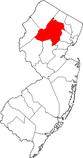
Location in Morris County
USA New Jersey relief location map.svg
Red pog.svg
Lake Hopatcong
Location in New Jersey
Usa edcp relief location map.png
Red pog.svg
Lake Hopatcong
Location in the United States
Coordinates: 40°57′39″N74°36′46″W / 40.96083°N 74.61278°W / 40.96083; -74.61278
CountryFlag of the United States.svg  United States
StateFlag of New Jersey.svg  New Jersey
County Morris
Township Jefferson
Area
[1]
  Total9.39 sq mi (24.32 km2)
  Land7.39 sq mi (19.13 km2)
  Water2.00 sq mi (5.19 km2)
Elevation
930 ft (280 m)
Population
 (2020) [2]
  Total10,232
  Density1,385.32/sq mi (534.90/km2)
Time zone UTC−05:00 (Eastern (EST))
  Summer (DST) UTC−04:00 (EDT)
ZIP Code
07849
Area code(s) 973/862
FIPS code 34-37710 [3]
GNIS feature ID2806109 [4]

Lake Hopatcong is a census-designated place (CDP) in Jefferson Township, Morris County, in the U.S. state of New Jersey. It includes communities on the northeast side of Lake Hopatcong, the largest freshwater body in the state.

Contents

Lakefront communities in the CDP include Espanong, Prospect Point, Raccoon Island, and Woodport, and inland communities include Hurdtown, Tierneys Corner, and Berkshire Valley. The CDP is bordered to the west, across the lake, by the borough of Hopatcong in Sussex County, and to the south it is bordered by Mount Arlington in Roxbury Township and by the Lower Berkshire Valley CDP. Lake Shawnee is in the northeast part of the CDP.

New Jersey Route 15 passes through the eastern side of the Lake Hopatcong CDP, leading south 4 miles (6 km) to Interstate 80 in Wharton and north 6 miles (10 km) to Sparta.

The community was first listed as a CDP prior to the 2020 census. [4]

Demographics

Historical population
CensusPop.Note
2020 10,232
U.S. Decennial Census [5] [2]

Notable people

People who were born in, residents of, or otherwise closely associated with Lake Hopatcong include:

Related Research Articles

<span class="mw-page-title-main">Byram Township, New Jersey</span> Township in Sussex County, New Jersey, United States

Byram Township is a township in Sussex County, in the U.S. state of New Jersey. As of the 2020 United States census, the township's population was 8,028, a decrease of 322 (−3.9%) from the 2010 census count of 8,350, which in turn reflected an increase of 96 (+1.2%) from the 8,254 counted in the 2000 census.

<span class="mw-page-title-main">Hopatcong, New Jersey</span> Borough in Sussex County, New Jersey, United States

Hopatcong is a borough in Sussex County, in the U.S. state of New Jersey. As of the 2020 United States census, the borough's population was 14,362, a decrease of 785 (−5.2%) from the 2010 census count of 15,147, which in turn reflected a decline of 741 (−4.7%) from the 15,888 counted in the 2000 census.

<span class="mw-page-title-main">Jefferson Township, New Jersey</span> Township in Morris County, New Jersey, United States

Jefferson Township is the northernmost township in Morris County, in the U.S. state of New Jersey. As of the 2020 United States census, the township's population was 20,538, a decrease of 776 (−3.6%) from the 2010 census count of 21,314, which in turn reflected an increase of 1,597 (+8.1%) from the 19,717 counted in the 2000 census.

<span class="mw-page-title-main">Newfoundland, New Jersey</span> Populated place in Morris and Passaic counties, New Jersey, US

Newfoundland is an unincorporated community and census-designated place (CDP), geographically spanning both West Milford Township in Passaic County, and Jefferson Township in Morris County, in the U.S. state of New Jersey. It is located along Route 23 and is the mailing address of Green Pond, a private lake in Rockaway Township. As of the 2020 United States census, the CDP's population was 1,145.

<span class="mw-page-title-main">Highland Lakes, New Jersey</span> Populated place in Sussex County, New Jersey, US

Highland Lakes is an unincorporated community and census-designated place (CDP) located within Vernon Township, in Sussex County, in the U.S. state of New Jersey. As of the 2010 United States Census, the CDP's population was 4,933. Highland Lakes has its own Post Office with the ZIP Code 07422.

<span class="mw-page-title-main">Pompton Plains, New Jersey</span> Populated place in Morris County, New Jersey, US

Pompton Plains is a census-designated place (CDP) and unincorporated community constituting the majority of Pequannock Township, Morris County, in the U.S. state of New Jersey. As of the 2020 United States census, the CDP’s population was 11,144. The community was first listed as a CDP in advance of the 2020 census.

Auburn is an unincorporated community and census-designated place (CDP) in Salem County, in the U.S. state of New Jersey. It includes the Auburn section of Oldmans Township and extends southeast to include rural and semi-suburban land in Pilesgrove Township.

Landing is an unincorporated community and census-designated place (CDP) located within Roxbury Township, in Morris County, New Jersey, United States. The community is located on the south shore of Lake Hopatcong near Hopatcong State Park. The area is served as United States Postal Service ZIP Code 07850.

<span class="mw-page-title-main">Juliustown, New Jersey</span> School district in Burlington County, New Jersey, US

Juliustown is an unincorporated community and census-designated place (CDP) located within Springfield Township, in Burlington County, in the U.S. state of New Jersey, that was established as part of the 2010 United States census. As of the 2010 Census, the CDP's population was 429.

Troy Hills is a census-designated place (CDP) in the township of Parsippany-Troy Hills, Morris County, New Jersey, United States. It is in the southeast part of the township, bordered to the north and west by the Parsippany CDP, to the south by Whippany in Hanover Township, and to the east by Troy Meadows, the largest freshwater marsh in New Jersey.

New Village is an unincorporated community and census-designated place (CDP) located within Franklin Township in Warren County, New Jersey, United States, that was created as part of the 2010 United States Census. As of the 2010 Census, the CDP's population was 421.

<span class="mw-page-title-main">Finesville, New Jersey</span> Populated place in Warren County, New Jersey, US

Finesville is an unincorporated community and census-designated place (CDP) located within Pohatcong Township in Warren County, New Jersey, United States, that was defined as part of the 2010 United States Census. As of the 2010 Census, the CDP's population was 175.

<span class="mw-page-title-main">Gouldtown, New Jersey</span> Populated placein Cumberland County, New Jersey, US

Gouldtown is an unincorporated community and census-designated place (CDP) in Cumberland County, in the U.S. state of New Jersey. It is in the northwestern part of the county, in the northeast part of Fairfield Township, and it is bordered to the west by the city of Bridgeton, the county seat. New Jersey Route 49 runs through the community, leading east 8 miles (13 km) to Millville and west through Bridgeton 19 miles (31 km) to Salem.

Ampere North is a unincorporated community and census-designated place (CDP) in Bloomfield Township, Essex County, in the U.S. state of New Jersey. It is in the southern corner of the township, bordered to the north by the Watsessing CDP, to the northeast by Silver Lake, to the southwest by East Orange, and to the southeast by Newark. Ampere Parkway runs through the center of the CDP, from Bloomfield Avenue at the northeast border of the community, south into the Ampere neighborhood in East Orange.

Watsessing is a neighborhood and census-designated place (CDP) in Bloomfield Township, Essex County, in the U.S. state of New Jersey. It is in the southwest corner of the township, bordered to the northwest by Glen Ridge, to the southwest by East Orange, to the southeast by the Ampere North part of Bloomfield, and to the northeast by the rest of Bloomfield. Watsessing Park is in the center of the community, in the valley of the Second River or Watsessing River, part of the Passaic River watershed.

Encore at Monroe is a gated community and census-designated place (CDP) in Monroe Township, Middlesex County, in the U.S. state of New Jersey. It is in the western part of the township, bordered to the south by Clearbrook. It is 3 miles (5 km) southwest of Jamesburg, 15 miles (24 km) south of New Brunswick, 6 miles (10 km) northeast of Hightstown, and 18 miles (29 km) northeast of Trenton.

Forsgate is a golf course community and census-designated place (CDP) in Monroe Township, Middlesex County, in the U.S. state of New Jersey. It consists of Forsgate Country Club and its associated housing developments. It is in the northwestern part of the township, bordered to the south across Forsgate Drive by Rossmoor, to the east by the Hightstown Industrial Track rail line, to the north by a branch rail line connecting Jamesburg and Monmouth Junction, and to the west by the New Jersey Turnpike at Exit 8A. It is 13 miles (21 km) south of New Brunswick and 19 miles (31 km) northeast of Trenton.

Stonebridge is a gated community and census-designated place (CDP) in Monroe Township, Middlesex County, New Jersey, United States. It is in the southwestern part of the township, bordered to the north, across Union Valley Road, by Clearbrook, to the west by Applegarth Road, and to the south by Federal Road. It is 5 miles (8 km) south of Jamesburg and 4 miles (6 km) northeast of Hightstown.

<span class="mw-page-title-main">Lower Berkshire Valley, New Jersey</span> Populated place in Morris County, New Jersey, US

Lower Berkshire Valley is a census-designated place (CDP) in Roxbury and Jefferson townships, Morris County, in the U.S. state of New Jersey. It is primarily in the northeast part of Roxbury, along Berkshire Valley Road. Interstate 80 passes through the southern part of the CDP, but with no direct access. The community is 2 miles (3 km) northwest of Wharton and 4 miles (6 km) northwest of Dover.

Bedminster is an unincorporated community and census-designated place (CDP) comprising the primary community in Bedminster Township, Somerset County, in the U.S. state of New Jersey. It was first listed as a CDP prior to the 2020 census.

References

  1. "ArcGIS REST Services Directory". United States Census Bureau. Retrieved October 11, 2022.
  2. 1 2 "Census Population API". United States Census Bureau. Retrieved October 11, 2022.
  3. Geographic Codes Lookup for New Jersey, Missouri Census Data Center. Accessed June 9, 2023.
  4. 1 2 "Lake Hopatcong Census Designated Place". Geographic Names Information System . United States Geological Survey, United States Department of the Interior.
  5. "Census of Population and Housing". Census.gov. Retrieved June 4, 2016.
  6. Lestinsky, Marc. "Jefferson Student Hits Basketball Big Time; Breakout 2010-11 season has netted Jefferson resident national attention.", Jefferson, NJ Patch, August 9, 2011. Accessed October 13, 2021. "Jefferson native and bona fide basketball star-in-the-making Jaren Sina admitted to being something of an unknown to most outsiders entering his freshman year at Gill St. Bernard's School (Gladstone) in 2009.... The 17-year-old kid from little-known Lake Hopatcong can play."