Mount Hope, New Jersey

Last updated

Mount Hope, New Jersey
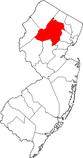
Location map of Morris County, New Jersey.svg
Red pog.svg
Mount Hope
Location in Morris County
USA New Jersey relief location map.svg
Red pog.svg
Mount Hope
Location in New Jersey
Usa edcp relief location map.png
Red pog.svg
Mount Hope
Location in the United States
Coordinates: 40°55′34″N74°32′34″W / 40.92611°N 74.54278°W / 40.92611; -74.54278 [1]
Country Flag of the United States.svg  United States
State Flag of New Jersey.svg  New Jersey
County Morris
Township Rockaway
Area
[2]
  Total2.31 sq mi (5.97 km2)
  Land2.20 sq mi (5.69 km2)
  Water0.11 sq mi (0.28 km2)
Elevation
[1]
823 ft (251 m)
Population
 (2020) [3]
  Total2,930
  Density1,332.42/sq mi (514.49/km2)
FIPS code 34-48930 [4]
GNIS feature ID878546 [1]

Mount Hope is an unincorporated community and census-designated place [5] (CDP) that is a part of Rockaway Township, in Morris County in the U.S. state of New Jersey. [1] [6]

Contents

It was formerly an unincorporated iron mining village associated with the American Revolutionary War. Mining operations were said to have begun around 1710 and operated continuously through the 1970s. John Jacob Faesch was the first to develop Mount Hope into an iron plantation with the erection of a stone furnace in 1772 and operated the facility until his death in 1799. Various owners and lessees ran the furnace until 1831 when The Mount Hope Mining Company was incorporated in response to the opening of the Morris Canal and its transportation opportunities. Operations ceased from 1893 to 1899 due to financial panics, the opening of the Mesabi Range and cheaper imported iron ore from South America. Empire Steel & Iron Company bought the mine and reopened it in 1900. Additional companies and partnerships continued until its final closure in 1979.

The Mount Hope Miners' Church was added to the National Register of Historic Places in 2012 for its significance in architecture, social history, and religion. [7]

Demographics

As of the 2020 United States census, the population was 2,930. [3]

Historical population
CensusPop.Note
2020 2,930
U.S. Decennial Census [8]

Related Research Articles

<span class="mw-page-title-main">Lake Telemark, New Jersey</span> Populated place in Morris County, New Jersey, US

Lake Telemark is an unincorporated community and census-designated place (CDP) located within Rockaway Township, in Morris County, in the U.S. state of New Jersey. As of the 2010 United States Census, the CDP's population was 1,255.

<span class="mw-page-title-main">Rockaway Township, New Jersey</span> Township in Morris County, New Jersey, United States

Rockaway Township is a township in Morris County, in the U.S. state of New Jersey. As of the 2020 United States census, the township's population was 25,341, an increase of 1,185 (+4.9%) from the 2010 census count of 24,156, which in turn reflected an increase of 1,226 (+5.3%) from the 22,930 counted in the 2000 census.

<span class="mw-page-title-main">Wharton, New Jersey</span> Borough in Morris County, New Jersey, United States

Wharton is a borough in Morris County, in the U.S. state of New Jersey. As of the 2020 United States census, the borough's population was 7,241, an increase of 719 (+11.0%) from the 2010 census count of 6,522, which in turn reflected an increase of 224 (+3.6%) from the 6,298 counted in the 2000 census.

<span class="mw-page-title-main">White Meadow Lake, New Jersey</span> Populated place in Morris County, New Jersey, US

White Meadow Lake is an unincorporated community and census-designated place (CDP) located within Rockaway Township, in Morris County, in the U.S. state of New Jersey. As of the 2010 United States Census, the CDP's population was 8,836.

<span class="mw-page-title-main">Newfoundland, New Jersey</span> Populated place in Morris and Passaic counties, New Jersey, US

Newfoundland is an unincorporated community and census-designated place (CDP) coveringportions of both West Milford in Passaic County, and Jefferson Township in Morris County, in the U.S. state of New Jersey. It is located along Route 23 and is the mailing address of Green Pond, a private lake in Rockaway Township. As of the 2020 United States census, the CDP's population was 1,145.

<span class="mw-page-title-main">Cedar Knolls, New Jersey</span> Census-designated place in New Jersey, United States

Cedar Knolls is an unincorporated community located within Hanover Township in Morris County, in the U.S. state of New Jersey. It is part of Hanover Township along with Whippany.

<span class="mw-page-title-main">Kenvil, New Jersey</span> Populated place in Morris County, New Jersey, US

Kenvil is an unincorporated community and census-designated place (CDP) located within Roxbury Township, in Morris County, in the U.S. state of New Jersey, that had been part of the Succasunna-Kenvil CDP as part of the 2000 United States Census, at which time the population of the combined was 12,569. For the 2010 census, the area was split into two CDPs, Succasunna and Kenvil.

<span class="mw-page-title-main">Ledgewood, New Jersey</span> Census-designated place in New Jersey, United States

Ledgewood is an unincorporated community and census-designated place (CDP) located within Roxbury Township in Morris County, in the U.S. state of New Jersey. It was historically known as Drakesville after Abraham Drake, originally from Piscataway, New Jersey, who operated a mill and tavern here in the mid 1700s. The community was located on the Morris Canal.

<span class="mw-page-title-main">Hibernia, New Jersey</span> Populated place in Morris County, New Jersey, US

Hibernia is an unincorporated community and census-designated place (CDP) located along County Route 513 in Rockaway Township of Morris County, in the U.S. state of New Jersey. The area is served as United States Postal Service ZIP Code 07842. The community takes its name from Hibernia, the classical name for Ireland.

<span class="mw-page-title-main">Pine Brook, Morris County, New Jersey</span> Populated place in Morris County, New Jersey, US

Pine Brook, sometimes spelled Pinebrook, is a census-designated place (CDP) and unincorporated community located within Montville in Morris County, in the U.S. state of New Jersey. As of the 2020 United States census, the CDP had a population of 5,675.

<span class="mw-page-title-main">Lake Hopatcong, New Jersey</span> Populated place in Morris County, New Jersey, US

Lake Hopatcong is a census-designated place (CDP) located in Jefferson Township, Morris County, in the U.S. state of New Jersey. It includes communities on the northeast side of Lake Hopatcong, the largest freshwater body in the state.

<span class="mw-page-title-main">Pottersville, New Jersey</span> Populated place in Hunterdon and Somerset counties, New Jersey, US

Pottersville is an unincorporated community and census-designated place (CDP) split between Bedminster Township in Somerset County and Tewksbury Township in Hunterdon County, in the U.S. state of New Jersey. The area is served as United States Postal Service ZIP Code 07979. As of the 2010 United States Census, the population for ZIP Code Tabulation Area 07979 was 589. In 1990, most of the village was listed on the National Register of Historic Places as the Pottersville Village Historic District.

<span class="mw-page-title-main">Millington, New Jersey</span> Place in Morris County, New Jersey, United States

Millington is an unincorporated community and census-designated place (CDP) located within Long Hill Township in Morris County, in the U.S. state of New Jersey.

John Jacob Faesch was a Swiss ironmaster who established the Mount Hope Iron Furnace in the Mount Hope village section of Rockaway Township, New Jersey in 1772 which played an important role in providing munitions and tools during the Revolutionary War.

<span class="mw-page-title-main">Stewartsville, New Jersey</span> Populated place in Warren County, New Jersey, US

Stewartsville is an unincorporated community and census-designated place (CDP) located within Greenwich Township in Warren County, in the U.S. state of New Jersey, that was created as part of the 2010 United States Census. As of the 2010 Census, the CDP's population was 349.

<span class="mw-page-title-main">Brookside, New Jersey</span> Place in Morris County, New Jersey, United States

Brookside is a historic unincorporated community and census-designated place (CDP) located within Mendham Township in Morris County, in the U.S. state of New Jersey. It is located approximately 6 mi (9.7 km) west of Morristown. It is close to the Washington Valley Historic District in neighboring Morris Township.

<span class="mw-page-title-main">Port Murray, New Jersey</span> Census-designated place in Warren County, New Jersey, United States

Port Murray is an unincorporated community and census-designated place (CDP) located within Mansfield Township in Warren County, in the U.S. state of New Jersey, that was created as part of the 2010 United States Census. As of the 2010 Census, the CDP's population was 129.

<span class="mw-page-title-main">Port Colden, New Jersey</span> Populated place in Warren County, New Jersey, US

Port Colden is an unincorporated community and census-designated place (CDP) located within Washington Township, in Warren County, in the U.S. state of New Jersey, that was created as part of the 2010 United States Census. As of the 2010 Census, the CDP's population was 122.

Mount Hermon is an unincorporated community and census-designated place (CDP) located within Hope Township in Warren County, in the U.S. state of New Jersey, that was defined as part of the 2010 United States Census. As of the 2010 Census, the CDP's population was 141.

<span class="mw-page-title-main">Finesville, New Jersey</span> Populated place in Warren County, New Jersey, US

Finesville is an unincorporated community and census-designated place (CDP) located within Pohatcong Township in Warren County, in the U.S. state of New Jersey. The CDP was defined as part of the 2010 United States Census. As of the 2010 Census, the CDP's population was 175.

References

  1. 1 2 3 4 "Mount Hope". Geographic Names Information System . United States Geological Survey, United States Department of the Interior.
  2. "ArcGIS REST Services Directory". United States Census Bureau. Retrieved October 11, 2022.
  3. 1 2 Census Data Explorer: Mount Hope CDP, New Jersey, United States Census Bureau. Accessed June 15, 2023.
  4. Geographic Codes Lookup for New Jersey, Missouri Census Data Center. Accessed June 9, 2023.
  5. of New Jersey Census Designated Places - BVP20 - Data as of January 1, 2020, United States Census Bureau. Accessed January 1, 2023.
  6. "Locality Search". State of New Jersey.
  7. "National Register Information System  (#12000530)". National Register of Historic Places . National Park Service. November 2, 2013.
  8. "Census of Population and Housing". Census.gov. Retrieved June 4, 2016.

Sources