Gillette, New Jersey

Last updated

Gillette, New Jersey
Gillette Station with leaving train.jpg
NJ Transit commuter train to Manhattan
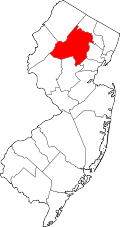
Location map of Morris County, New Jersey.svg
Red pog.svg
Gillette
Location in Morris County
USA New Jersey relief location map.svg
Red pog.svg
Gillette
Location in New Jersey
Usa edcp relief location map.png
Red pog.svg
Gillette
Location in the United States
Coordinates: 40°40′26″N74°27′58″W / 40.67389°N 74.46611°W / 40.67389; -74.46611
CountryFlag of the United States.svg  United States
StateFlag of New Jersey.svg  New Jersey
County Morris
Township Long Hill
Area
[1]
  Total4.47 sq mi (11.56 km2)
  Land4.32 sq mi (11.20 km2)
  Water0.14 sq mi (0.37 km2)
Elevation
230 ft (70 m)
Population
 (2020) [2]
  Total2,956
  Density683.78/sq mi (263.99/km2)
ZIP Code
07933
FIPS code 34-26220 [3]
GNIS feature ID0876612 [4]

Gillette is an unincorporated community and census-designated place (CDP) [5] located within Long Hill Township in Morris County, in the U.S. state of New Jersey. [6] The area is served as United States Postal Service ZIP Code 07933.

Contents

As of the 2000 United States Census, the population for ZIP Code Tabulation Area 07933 was 3,278; [7] In the 2010 census, Gillette had a population of 3,251. [8]

Demographics

As of the 2020 United States census, the area had a population of 2,956. [2]

Historical population
CensusPop.Note
2020 2,956
U.S. Decennial Census [9]

Gillette was first listed as a census designated place in the 2020 U.S. Census.

2020 census

Gillette, New Jersey – Racial and ethnic composition
Note: the US Census treats Hispanic/Latino as an ethnic category. This table excludes Latinos from the racial categories and assigns them to a separate category. Hispanics/Latinos may be of any race.
Race / Ethnicity (NH = Non-Hispanic)Pop 2020 [10] 2020 %
White alone (NH)2,29277.54%
Black or African American alone (NH)160.54%
Native American or Alaska Native alone (NH)20.07%
Asian alone (NH)2458.29%
Pacific Islander alone (NH)10.03%
Some Other Race alone (NH)110.37%
Mixed Race/Multi-Racial (NH)852.88%
Hispanic or Latino (any race)30410.28%
Total2,956100.00%

Park

Gillette's Riverside Park was renamed Matthew G. Kantor Memorial Park in 2013, to honor a Navy SEAL killed in Afghanistan in 2012. [11]

Notable people

People who were born in, residents of, or otherwise closely associated with Gillette include:

See also

Related Research Articles

<span class="mw-page-title-main">Flanders, New Jersey</span> Populated place in Morris County, New Jersey, US

Flanders is an unincorporated community and census-designated place (CDP) located within Mount Olive Township, in southwestern Morris County, in the U.S. state of New Jersey. Flanders is served by the United States Postal Service as ZIP Code 07836.

<span class="mw-page-title-main">Thorofare, New Jersey</span> Populated place in Gloucester County, New Jersey, US

Thorofare is an unincorporated community and census-designated place (CDP) located within West Deptford Township in northwestern Gloucester County, situated in the South Jersey region of the U.S. state of New Jersey. The area is served as United States Postal Service ZIP Code 08086. As of the 2020 United States census, the CDP's population was 2,806. As of the 2000 census, the population of a different geographic entity containing Thorofare, namely ZIP Code Tabulation Area 08086, was 5,424.

<span class="mw-page-title-main">Bridgeport, New Jersey</span> Populated place in Gloucester County, New Jersey, US

Bridgeport is a census-designated place (CDP) and unincorporated community that is part of Logan Township, in Gloucester County, in the U.S. state of New Jersey. At the 2020 United States census, the population of the CDP was 389. in the 2010 census, the population was 504.

<span class="mw-page-title-main">Ledgewood, New Jersey</span> Populated place in Morris County, New Jersey, US

Ledgewood is an unincorporated community and census-designated place (CDP) located within Roxbury Township in Morris County, in the U.S. state of New Jersey. It was historically known as Drakesville after Abraham Drake, originally from Piscataway, New Jersey, who operated a mill and tavern here in the mid 1700s. The community was located on the Morris Canal.

<span class="mw-page-title-main">Delaware, Warren County, New Jersey</span> Census-designated place in Middlesex County, New Jersey, US

Delaware is an unincorporated community and census-designated place (CDP) located along the Delaware River within Knowlton Township in Warren County, New Jersey. It was created as part of the 2010 United States Census. As of the 2010 Census, the CDP's population was 150. The area is served as United States Postal Service ZIP Code 07833.

<span class="mw-page-title-main">Towaco, New Jersey</span> Populated place in Morris County, New Jersey, US

Towaco is an unincorporated community and census-designated place (CDP) located within Montville Township in Morris County, in the U.S. state of New Jersey. The area is served as United States Postal Service ZIP Code 07082. Its name reflects the Native American history in the area, which identified the locale as TaWagh, meaning "hill", a reference to the terrain of Towaco.

Hewitt is an unincorporated community and census-designated place (CDP) located within West Milford Township in Passaic County, in the U.S. state of New Jersey. The area is served as United States Postal Service ZIP Code 07421. It is named for Abram Hewitt.

Landing is an unincorporated community and census-designated place (CDP) located within Roxbury Township, in Morris County, in the U.S. state of New Jersey. The community is located on the south shore of Lake Hopatcong near Hopatcong State Park. The area is served as United States Postal Service ZIP Code 07850.

<span class="mw-page-title-main">Millington, New Jersey</span> Place in Morris County, New Jersey, United States

Millington is an unincorporated community and census-designated place (CDP) located within Long Hill Township in Morris County, in the U.S. state of New Jersey.

New Gretna is an unincorporated community and census-designated place (CDP) located within Bass River Township in Burlington County, in the U.S. state of New Jersey. The area is served as United States Postal Service ZIP Code 08224.

Franklinville is an unincorporated community and census-designated place (CDP) located within Franklin Township in Gloucester County, in the Philadelphia Metropolitan Area in the U.S. state of New Jersey. The area is served as United States Postal Service ZIP Code 08322.

<span class="mw-page-title-main">New Monmouth, New Jersey</span> Populated place in Monmouth County, New Jersey, US

New Monmouth is an unincorporated community located within Middletown Township in Monmouth County, in the U.S. state of New Jersey. The area is served as United States Postal Service ZIP Code 07748.

<span class="mw-page-title-main">Vincentown, New Jersey</span> Place in Burlington County, New Jersey, United States

Vincentown is an unincorporated community and census-designated place (CDP) located on the South Branch Rancocas Creek in Southampton Township of Burlington County, New Jersey. The area is served as United States Postal Service ZIP Code 08088.

<span class="mw-page-title-main">Jobstown, New Jersey</span> Populated place in Burlington County, New Jersey, US

Jobstown is an unincorporated community and census-designated place (CDP) located within Springfield Township in Burlington County, in the U.S. state of New Jersey. The area is served as United States Postal Service ZIP Code 08041.

<span class="mw-page-title-main">Stewartsville, New Jersey</span> Populated place in Warren County, New Jersey, US

Stewartsville is an unincorporated community and census-designated place (CDP) located within Greenwich Township in Warren County, in the U.S. state of New Jersey, that was created as part of the 2010 United States Census. As of the 2010 Census, the CDP's population was 349.

Dorothy is an unincorporated community and census-designated place located in Weymouth Township in Atlantic County, in the U.S. state of New Jersey. The area is served as United States Postal Service ZIP Code 08317.

<span class="mw-page-title-main">Brookside, New Jersey</span> Place in Morris County, New Jersey, United States

Brookside is a historic unincorporated community and census-designated place (CDP) located within Mendham Township in Morris County, in the U.S. state of New Jersey. It is located approximately 6 mi (9.7 km) west of Morristown. It is close to the Washington Valley Historic District in neighboring Morris Township.

<span class="mw-page-title-main">Port Murray, New Jersey</span> Census-designated place in Warren County, New Jersey, United States

Port Murray is an unincorporated community and census-designated place (CDP) located within Mansfield Township in Warren County, in the U.S. state of New Jersey, that was created as part of the 2010 United States Census. As of the 2010 Census, the CDP's population was 129.

<span class="mw-page-title-main">Hainesburg, New Jersey</span> Populated place in Warren County, New Jersey, US

Hainesburg is an unincorporated community and census-designated place (CDP) located within Knowlton Township in Warren County, in the U.S. state of New Jersey. While the community has existed for over a century, the CDP was designated as part of the 2010 United States Census. As of the 2010 Census, the CDP's population was 91.

Allaire is an unincorporated community located within Wall Township in Monmouth County, in the U.S. state of New Jersey. As of the 2010 United States Census, the ZIP Code Tabulation Area for ZIP Code 07727 had a population of 7,050.

References

  1. "ArcGIS REST Services Directory". United States Census Bureau. Retrieved October 11, 2022.
  2. 1 2 Census Data Explorer: Gillette CDP, New Jersey, United States Census Bureau. Accessed June 15, 2023.
  3. Geographic Codes Lookup for New Jersey, Missouri Census Data Center. Accessed June 9, 2023.
  4. "Gillette". Geographic Names Information System . United States Geological Survey, United States Department of the Interior . Retrieved September 24, 2012.
  5. State of New Jersey Census Designated Places - BVP20 - Data as of January 1, 2020, United States Census Bureau. Accessed December 1, 2022.
  6. Locality Search, State of New Jersey. Accessed June 9, 2016.
  7. DP-1 – Profile of General Demographic Characteristics: 2000 from Census 2000 Summary File 1 (SF 1) 100-Percent Data for ZCTA5 07933 Archived February 13, 2020, at archive.today , United States Census Bureau. Accessed December 2, 2019.
  8. DP-1 – Profile of General Population and Housing Characteristics: 2010 from the 2010 Demographic Profile Data for ZCTA5 07933 Archived February 13, 2020, at archive.today , United States Census Bureau. Accessed December 2, 2019.
  9. "Census of Population and Housing". Census.gov. Retrieved June 4, 2016.
  10. "P2 Hispanic or Latino, and Not Hispanic or Latino by Race - 2020: DEC Redistricting Data (PL 94-171) - Gillette CDP, New Jersey". United States Census Bureau .
  11. Matthew G. Kantor Memorial Park, Long Hill Township. Accessed July 30, 2019. "On Veteran's Day 2013 (11/11/13), the park was officially dedicated and renamed Matthew G. Kantor Memorial Park to honor Matthew, a resident of Long Hill and Navy Seal who lost his life while serving in Afghanistan in November 2012."
  12. Bruce, Scott. "Jessie Baylin Leaves Her Mark" Archived June 30, 2015, at the Wayback Machine , movmnt , December 11, 2008. Accessed September 19, 2014. "But success wasn't exactly buzzing around the corner of her hometown, Gillette, New Jersey. Like many an artist, Baylin had to pull herself from the comforts of home and set out on a journey that sent her California bound."