Pompton Plains, New Jersey | |
---|---|
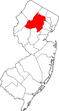
Location in Morris County Location in New Jersey | |
Coordinates: 40°58′5″N74°17′45″W / 40.96806°N 74.29583°W | |
Country | United States |
State | New Jersey |
County | Morris |
Township | Pequannock |
Area | |
• Total | 5.33 sq mi (13.79 km2) |
• Land | 5.18 sq mi (13.41 km2) |
• Water | 0.15 sq mi (0.38 km2) |
Elevation | 201 ft (61 m) |
Population | |
• Total | 11,144 |
• Density | 2,146.4/sq mi (828.7/km2) |
Time zone | UTC−05:00 (Eastern (EST)) |
• Summer (DST) | UTC−04:00 (EDT) |
ZIP Code | 07444 |
Area code(s) | 973/862 |
FIPS code | 34-60120 [3] |
GNIS feature ID | 2806168 [4] |
Pompton Plains is a census-designated place [5] (CDP) and unincorporated community constituting the majority of Pequannock Township, Morris County, in the U.S. state of New Jersey. As of the 2020 United States census, the CDP's population was 11,144. [2] The community was first listed as a CDP in advance of the 2020 census. [4]
Pompton Plains is situated in the valley of the Pompton River, which forms the eastern border of the community, the township, and Morris County. Across the river to the east is Wayne in Passaic County, and across its tributary the Pequannock River to the northeast is the borough of Pompton Lakes. Neighboring communities in Morris County are Riverdale to the north, Kinnelon to the west, Lincoln Park to the southwest, and the remainder of Pequannock Township to the south.
New Jersey Route 23 runs through the east side of the community, leading northwest 22 miles (35 km) to Franklin and south 5 miles (8 km) to Interstate 80 in Wayne. Interstate 287 passes through the northwest part of Pompton Plains, with the closest access from Exit 52 (Route 23) in Riverdale.
According to the U.S. Census Bureau, the Pompton Plains CDP has a total area of 5.33 square miles (13.80 km2), of which 5.18 square miles (13.42 km2) are land and 0.15 square miles (0.39 km2), or 2.76%, are water, [1] comprising the Pompton and Pequannock rivers, as well as Woodland Lake in the southeast corner of the community. Via the Pompton River, the entire CDP is part of the Passaic River watershed.
As of the 2020 United States census, the CDP had a population of 11,144. [2]
Census | Pop. | Note | %± |
---|---|---|---|
2020 | 11,144 | — | |
U.S. Decennial Census [6] 2020 [2] 2020 [2] |
People who were born in, residents of, or otherwise closely associated with Pompton Plains include:
Route 23 is a state highway in the northern part of New Jersey, United States. The route runs 52.63 miles (84.70 km) from Bloomfield Avenue and Prospect Avenue (CR 577) in Verona, Essex County, northwest to the border with New York at Montague Township in Sussex County, where the road continues to Port Jervis, New York, as CR 15. Route 23 heads through Essex and Passaic counties as a two- to four-lane surface road and becomes a six-lane freeway north of a complex interchange with U.S. Route 46 (US 46) and Interstate 80 (I-80) in Wayne. The freeway carries Route 23 north to a concurrency with US 202. Past the freeway portion, the route heads northwest along the border of Morris and Passaic counties as a four- to six-lane arterial road with a wide median at places, winding through mountainous areas and crossing the interchange with I-287 in Riverdale. The route continues northwest through Sussex County as a mostly two-lane surface road that passes through farmland and woodland as well as the communities of Franklin, Hamburg, and Sussex before reaching the New York state line, just south of an interchange with I-84 and US 6 in Port Jervis, in Montague Township near High Point State Park.
Kinnelon is a borough in Morris County, in the U.S. state of New Jersey, located approximately 33 miles (53 km) west of New York City. As of the 2020 United States census, the borough's population was 9,966, a decrease of 282 (−2.8%) from the 2010 census count of 10,248, which in turn reflected an increase of 883 (+9.4%) from the 9,365 counted in the 2000 census. It is a low-density, suburban community, with many parks and trails.
Lincoln Park is a borough in Morris County, in the U.S. state of New Jersey. As of the 2020 United States census, the borough's population was 10,915, an increase of 394 (+3.7%) from the 2010 census count of 10,521, which in turn reflected a decline of 409 (−3.7%) from the 10,930 counted in the 2000 census.
Montville is a township in Morris County, in the U.S. state of New Jersey. As of the 2020 United States census, the township's population was 22,450, an increase of 922 (+4.3%) from the 2010 census count of 21,528, which in turn reflected an increase of 689 (+3.3%) from the 20,839 counted in the 2000 census.
Pequannock Township is a township in Morris County, in the U.S. state of New Jersey. As of the 2020 United States census, the township's population was 15,571, an increase of 31 (+0.2%) from the 2010 census count of 15,540, which in turn reflected an increase of 1,652 (+11.9%) from the 13,888 counted in the 2000 census. The primary community in the township is the census-designated place of Pompton Plains.
Riverdale is a borough in Morris County, in the U.S. state of New Jersey. As of the 2020 United States census, the borough's population was 4,107, an increase of 548 (+15.4%) from the 2010 census count of 3,559, which in turn reflected an increase of 1,061 (+42.5%) from the 2,498 counted in the 2000 census.
Pompton Lakes is a borough in Passaic County, in the U.S. state of New Jersey. As of the 2020 United States census, the borough's population was 11,127, an increase of 30 (+0.3%) from the 2010 census count of 11,097, which in turn reflected an increase of 457 (+4.3%) from the 10,640 counted in the 2000 census.
The Pompton River is a tributary of the Passaic River, approximately 8 miles (13 km) long, in Passaic County in northern New Jersey in the United States.
The Pequannock River is a tributary of the Pompton River, approximately 20 miles (32 km) long, located in northern New Jersey in the United States.
The Newark-Pompton Turnpike, is a roadway in northern New Jersey that was originally a tolled turnpike. The roadway was first laid out in the mid-18th century and given its name in 1806. As originally designed, it connected Newark with the area north and west of the Pompton River in what is now Riverdale. Its south end is Broadway in Newark; its north end is the Paterson-Hamburg Turnpike. As such, it was part of an alternate route between Newark and Paterson.
Mount Hope is an unincorporated community and census-designated place (CDP) that is a part of Rockaway Township in Morris County, New Jersey, United States. As of the 2020 United States census, the population was 2,930.
Lake Hiawatha is an unincorporated community and census-designated place (CDP) located within Parsippany–Troy Hills Township in Morris County, in the U.S. state of New Jersey. The U.S. Postal Service serves the community as ZIP Code 07034. As of the 2020 census, the population was 10,194.
Pine Brook, sometimes spelled Pinebrook, is a census-designated place (CDP) and unincorporated community in Montville Township, Morris County, New Jersey, United States. As of the 2020 United States census, the CDP had a population of 5,675.
Singac is an unincorporated community and census-designated place (CDP) located within Little Falls, in Passaic County, in the U.S. state of New Jersey. As of the 2010 United States Census, the CDP's population was 3,618.
Oak Ridge is an unincorporated community and census-designated place (CDP) located in West Milford Township in Passaic County and Jefferson Township in Morris County, in the U.S. state of New Jersey. The area is served as United States Postal Service ZIP Code 07438.
Susan Misner is an American actress and dancer. She has appeared in a number of TV series as a guest star, as well as several recurring roles.
Brookside is a historic unincorporated community and census-designated place (CDP) located within Mendham Township in Morris County, in the U.S. state of New Jersey. It is located approximately 6 mi (9.7 km) west of Morristown, the county seat.
The Martin Berry House is located in Pompton Plains in Pequannock Township, Morris County, New Jersey, United States. The house was built in 1720 and documented by the Historic American Buildings Survey (HABS) in 1939. It was added to the National Register of Historic Places on June 19, 1973, for its significance in architecture and settlement. Built by the son of one of the first settlers to the Pompton River region, the pre-Revolutionary War building has been little altered since its construction.
New Jersey's 26th legislative district is one of 40 in the New Jersey Legislature. The district includes the Morris County municipalities of Boonton, Denville, East Hanover, Florham Park, Hanover, Lincoln Park, Montville, Morris Plains, Mountain Lakes, Pequannock, Parsippany-Troy Hills, and Riverdale; and the Passaic County municipalities of Bloomingdale, Pompton Lakes, Ringwood, and Wanaque.
Pompton Aquatic Park is a riverside park that spans the border of Wayne and Pompton Lakes in Passaic County, and the Pompton Plains section of Pequannock Township in Morris County, New Jersey, United States. A total of 29 acres (12 ha) are situated within Passaic County, and divided evenly between Wayne and Pompton Lakes. The remaining 10.4 acres is situated in Pompton Plains. The park is located along the Pompton River and the historic Morris Canal Greenway, and adjacent to the Passaic County Farm, which is a preserved farm of approximately 15 acres.