Lower Berkshire Valley, New Jersey

Last updated

Lower Berkshire Valley, New Jersey
79 Mill Road, Roxbury Township, NJ.jpg
Lafayette School, listed on the NRHP
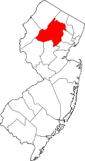
Location map of Morris County, New Jersey.svg
Red pog.svg
Lower Berkshire Valley
Location in Morris County
USA New Jersey relief location map.svg
Red pog.svg
Lower Berkshire Valley
Location in New Jersey
Usa edcp relief location map.png
Red pog.svg
Lower Berkshire Valley
Location in the United States
Coordinates: 40°54′49″N74°36′35″W / 40.91361°N 74.60972°W / 40.91361; -74.60972
CountryFlag of the United States.svg  United States
StateFlag of New Jersey.svg  New Jersey
County Morris
Townships Roxbury
Jefferson
Area
[1]
  Total1.03 sq mi (2.67 km2)
  Land1.01 sq mi (2.61 km2)
  Water0.02 sq mi (0.06 km2)
Elevation
702 ft (214 m)
Population
 (2020) [2]
  Total617
  Density611.50/sq mi (236.15/km2)
Time zone UTC−05:00 (Eastern (EST))
  Summer (DST) UTC−04:00 (EDT)
ZIP Code
07885 (Wharton)
Area code(s) 973/862
FIPS code 34-41700 [3]
GNIS feature ID2813401 [4]

Lower Berkshire Valley is a census-designated place (CDP) [5] located in Roxbury and Jefferson townships, Morris County, in the U.S. state of New Jersey. It is primarily in the northeast part of Roxbury, along Berkshire Valley Road. Interstate 80 passes through the southern part of the CDP, but with no direct access. The community is 2 miles (3 km) northwest of Wharton and 4 miles (6 km) northwest of Dover.

The community was first listed as a CDP during the 2020 census. [4]

Demographics

As of the 2020 United States census, the population was 617. [2]

Historical population
CensusPop.Note
2020 617
U.S. Decennial Census [6] 2020 [2]

Related Research Articles

<span class="mw-page-title-main">Kenvil, New Jersey</span> Populated place in Morris County, New Jersey, US

Kenvil is an unincorporated community and census-designated place (CDP) located within Roxbury Township, in Morris County, in the U.S. state of New Jersey, that had been part of the Succasunna-Kenvil CDP as part of the 2000 United States Census, at which time the population of the combined was 12,569. For the 2010 census, the area was split into two CDPs, Succasunna and Kenvil.

Columbia is an unincorporated community and census-designated place (CDP) located within Knowlton Township in Warren County, in the U.S. state of New Jersey. While the community has existed for over a century, the CDP was created as part of the 2010 United States Census. As of the 2010 Census, the CDP's population was 229. The area is served as United States Postal Service ZIP Code 07832.

<span class="mw-page-title-main">Lake Hopatcong, New Jersey</span> Populated place in Morris County, New Jersey, US

Lake Hopatcong is a census-designated place (CDP) located in Jefferson Township, Morris County, in the U.S. state of New Jersey. It includes communities on the northeast side of Lake Hopatcong, the largest freshwater body in the state.

Troy Hills is a census-designated place (CDP) in the township of Parsippany-Troy Hills, Morris County, in the U.S. state of New Jersey. It is in the southeast part of the township, bordered to the north and west by the Parsippany CDP, to the south by Whippany in Hanover Township, and to the east by Troy Meadows, the largest freshwater marsh in New Jersey.

<span class="mw-page-title-main">Marksboro, New Jersey</span> Census-designated place in Warren County, New Jersey, United States

Marksboro is an unincorporated community and census-designated place (CDP) located within Frelinghuysen Township in Warren County, in the U.S. state of New Jersey, that was created as part of the 2010 United States Census, though settlement and naming of the community date back to before 1760. As of the 2010 Census, the CDP's population was 82.

<span class="mw-page-title-main">Allamuchy (CDP), New Jersey</span> Populated place in Warren County, New Jersey, US

Allamuchy is an unincorporated community and census-designated place (CDP) located within Allamuchy Township, in Warren County, in the U.S. state of New Jersey. As of the 2020 United States census, its population was 208, an increase from the 74 counted in the 2010 census.

Broadway is an unincorporated community and census-designated place (CDP) located within Franklin Township, in Warren County, in the U.S. state of New Jersey, that was created as part of the 2010 United States Census. As of the 2010 Census, the CDP's population was 244.

Greenwich is an unincorporated community and census-designated place (CDP) located within Greenwich Township in Warren County, in the U.S. state of New Jersey, that was defined as part of the 2010 United States Census. As of the 2010 Census, the CDP's population was 2,755.

Harmony is an unincorporated community and census-designated place (CDP) located within Harmony Township in Warren County, in the U.S. state of New Jersey, that was defined as part of the 2010 United States Census. As of the 2010 Census, the CDP's population was 441.

Hutchinson is an unincorporated community and census-designated place (CDP) located within Harmony Township in Warren County, in the U.S. state of New Jersey, that was defined as part of the 2010 United States Census. As of the 2010 Census, the CDP's population was 135.

Germania is a census-designated place (CDP) located in Atlantic County, in the U.S. state of New Jersey. It is in the east-central part of the county, in western Galloway Township. It is bordered to the south by the unincorporated community of Cologne, and Egg Harbor City is 3 miles (5 km) to the northwest. U.S. Route 30 touches the southern border of Germania, leading northwest through Egg Harbor City 15 miles (24 km) to Hammonton and southeast 13 miles (21 km) to Atlantic City.

Arrowhead Lake is an unincorporated community and census-designated place (CDP) in Cumberland County, in the U.S. state of New Jersey. It is in the northwestern part of the county, in the northern part of Stow Creek Township. A small artificial lake is in the northwestern part of the CDP, with a residential neighborhood on its southern shore.

Cumberland-Hesstown is a census-designated place (CDP) located in the northern part of Maurice River Township in Cumberland County, in the U.S. state of New Jersey. Consisting of the unincorporated communities of Cumberland and Hesstown, it is in the eastern part of the county. New Jersey Route 49 passes through the CDP, leading northwest 6 miles (10 km) to Millville and southeast 11 miles (18 km) to Tuckahoe.

Greenwich is an unincorporated community and census-designated place (CDP) in Cumberland County, in the U.S. state of New Jersey. It is in the western part of the county, in the southeast part of Greenwich Township, on the northwest side of the tidal Cohansey River, 4 miles (6 km) northeast of its mouth at Delaware Bay. The community is 7 miles (11 km) southwest of Bridgeton, the county seat.

Marlboro is a census-designated place (CDP) located in Stow Creek Township on the northwestern edge of Cumberland County, in the U.S. state of New Jersey. It is bordered to the northwest, across Sarah Run, by Quinton Township in Salem County. The CDP contains the unincorporated communities of Marlboro and Campbells Corner.

Watsessing is a neighborhood and census-designated place (CDP) located in Bloomfield Township, Essex County, in the U.S. state of New Jersey. It is in the southwest corner of the township, bordered to the northwest by Glen Ridge, to the southwest by East Orange, to the southeast by the Ampere North part of Bloomfield, and to the northeast by the rest of Bloomfield. Watsessing Park is in the center of the community, in the valley of the Second River or Watsessing River, part of the Passaic River watershed.

Forsgate is a golf course community and census-designated place (CDP) located in Monroe Township, Middlesex County, in the U.S. state of New Jersey. It consists of Forsgate Country Club and its associated housing developments. It is in the northwestern part of the township, bordered to the south across Forsgate Drive by Rossmoor, to the east by the Hightstown Industrial Track rail line, to the north by a branch rail line connecting Jamesburg and Monmouth Junction, and to the west by the New Jersey Turnpike at Exit 8A. It is 13 miles (21 km) south of New Brunswick and 19 miles (31 km) northeast of Trenton.

Regency at Monroe is a gated community and census-designated place (CDP) in Monroe Township, Middlesex County, in the U.S. state of New Jersey. It is in the eastern part of the township, bordered by Mounts Mills Road to the north, Spotswood-Englishtown Road to the east, and Buckelew Avenue to the southwest. It is 7 miles (11 km) northwest of Freehold, 15 miles (24 km) south-southeast of New Brunswick, and 22 miles (35 km) northeast of Trenton.

Bedminster is an unincorporated community and census-designated place (CDP) comprising the primary community in Bedminster Township, Somerset County, in the U.S. state of New Jersey. It was first listed as a CDP prior to the 2020 census.

Hillsborough is a census-designated place (CDP) located in the center of Hillsborough Township, Somerset County, in the U.S. state of New Jersey. It was first listed as a CDP prior to the 2020 census.

References

  1. "ArcGIS REST Services Directory". United States Census Bureau. Retrieved October 11, 2022.
  2. 1 2 3 Census Data Explorer: Lyons CDP, New Jersey, United States Census Bureau. Accessed June 15, 2023.
  3. Geographic Codes Lookup for New Jersey, Missouri Census Data Center. Accessed June 9, 2023.
  4. 1 2 "Lower Berkshire Valley Census Designated Place". Geographic Names Information System . United States Geological Survey, United States Department of the Interior.
  5. State of New Jersey Census Designated Places - BVP20 - Data as of January 1, 2020, United States Census Bureau. Accessed December 1, 2022.
  6. "Census of Population and Housing". Census.gov. Retrieved June 4, 2016.