Oak Ridge, New Jersey

Last updated

Oak Ridge, New Jersey
ALFRED T. RINGLING MANOR, OAK RIDGE, MORRIS COUNTY.jpg
Lake Swannanoa Clubhouse at Ringling Manor Estates in Jefferson Township
Location map of Morris County, New Jersey.svg
Red pog.svg
Oak Ridge
Location in Morris County
Location map of Passaic County, New Jersey.svg
Red pog.svg
Oak Ridge
Location in Passaic County
USA New Jersey relief location map.svg
Red pog.svg
Oak Ridge
Location in New Jersey
Usa edcp relief location map.png
Red pog.svg
Oak Ridge
Location in the United States
Coordinates: 41°02′46″N74°29′10″W / 41.04611°N 74.48611°W / 41.04611; -74.48611
Country Flag of the United States.svg  United States
State Flag of New Jersey.svg  New Jersey
Counties Morris, Passaic
Townships Jefferson, West Milford
Area
[1]
  Total14.26 sq mi (36.94 km2)
  Land13.31 sq mi (34.48 km2)
  Water0.95 sq mi (2.46 km2)
Elevation
879 ft (268 m)
Population
 (2020) [2]
  Total10,996
  Density826.0/sq mi (318.9/km2)
ZIP Code
07438
FIPS code 34-53910 [3]
GNIS feature ID0878910 [4]

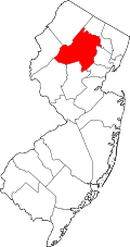
Oak Ridge is an unincorporated community and census-designated place (CDP) [5] located in West Milford Township in Passaic County and Jefferson Township in Morris County, in the U.S. state of New Jersey. [6] The area is served as United States Postal Service ZIP Code 07438.

Contents

As of the 2020 United States census, the population was 10,996. [2]

Geography

The Oak Ridge CDP is located in northern Morris County and western Passaic County and includes several communities, including Oak Ridge proper in Passaic County on the Pequannock River along Route 23 and the New York, Susquehanna & Western Railroad main line. In Morris County, the communities of Milton, [7] Petersburg, and Woodstock are within the Oak Ridge CDP. [8] [9] County Route 699 (Oak Ridge Road) runs south from the junction with Route 23 and is the main north–south local route in the community.

According to the U.S. Census Bureau, the Oak Ridge CDP has a total area of 14.26 square miles (36.9 km2), of which 13.31 square miles (34.5 km2) are land and 0.95 square miles (2.46 km2), or 6.65%, are water. [1] The Pequannock River, forming the Passaic/Morris county line, takes a winding course through the northern part of the CDP, separating Oak Ridge proper from the communities of Milton and Petersburg. The Pequannock is an east-flowing tributary of the Pompton River and part of the Passaic River watershed. Oak Ridge Reservoir on the Pequannock lies on part of the northwest border of the CDP. A low height of land just south of the Pequannock River places the southern part of the CDP within the watershed of the Rockaway River, a south-flowing tributary that also leads to the Passaic. White Rock Lake, Mitt Pond, Moosepac Pond, Cozy Lake, Lake Swannanoa, and Oak Ridge lake are all within the CDP and drained by the Rockaway River. [9]

Green Pond Mountain, rising to over 1,260 feet (380 m) above sea level, forms the southern border of Oak Ridge and the border with Rockaway Township. Bowling Green Mountain, elevation 1,380 feet (420 m), borders the community to the southwest. [9]

Demographics

The Oak Ridge CDP was first listed for the 2020 census.

Historical population
CensusPop.Note
2020 10,996
U.S. Decennial Census [10]
2020 [2]

Climate

This climatic region is typified by large seasonal temperature differences, with warm to hot (and often humid) summers and cold (sometimes severely cold) winters. According to the Köppen Climate Classification system, Oak Ridge has a humid continental climate, abbreviated "Dfb" on climate maps. [11]

Government and infrastructure

The postal addresses within the CDP, including the communities within Jefferson Township, read "Oak Ridge, New Jersey". [7]

Education

The respective school districts are Jefferson Township Public Schools for sections in Jefferson Township, Morris County; [12] and West Milford Township Public Schools for sections in West Milford Township, Passaic County. [13]

The respective public high schools are Jefferson Township High School and West Milford High School.

Notable people

People who were born in, residents of, or otherwise closely associated with Oak Ridge include:

Related Research Articles

<span class="mw-page-title-main">New Jersey Route 23</span> State highway in northern New Jersey, US

Route 23 is a state highway in the northern part of New Jersey, United States. The route runs 52.63 miles (84.70 km) from Bloomfield Avenue and Prospect Avenue (CR 577) in Verona, Essex County, northwest to the border with New York at Montague Township in Sussex County, where the road continues to Port Jervis, New York, as CR 15. Route 23 heads through Essex and Passaic counties as a two- to four-lane surface road and becomes a six-lane freeway north of a complex interchange with U.S. Route 46 (US 46) and Interstate 80 (I-80) in Wayne. The freeway carries Route 23 north to a concurrency with US 202. Past the freeway portion, the route heads northwest along the border of Morris and Passaic counties as a four- to six-lane arterial road with a wide median at places, winding through mountainous areas and crossing the interchange with I-287 in Riverdale. The route continues northwest through Sussex County as a mostly two-lane surface road that passes through farmland and woodland as well as the communities of Franklin, Hamburg, and Sussex before reaching the New York state line, just south of an interchange with I-84 and US 6 in Port Jervis, in Montague Township near High Point State Park.

<span class="mw-page-title-main">Kinnelon, New Jersey</span> Borough in Morris County, New Jersey, US

Kinnelon is a borough in Morris County, in the U.S. state of New Jersey, located approximately 33 miles (53 km) west of New York City. As of the 2020 United States census, the borough's population was 9,966, a decrease of 282 (−2.8%) from the 2010 census count of 10,248, which in turn reflected an increase of 883 (+9.4%) from the 9,365 counted in the 2000 census. It is a low-density, suburban community, with many parks and trails.

<span class="mw-page-title-main">Lake Telemark, New Jersey</span> Populated place in Morris County, New Jersey, US

Lake Telemark is an unincorporated community and census-designated place (CDP) in Rockaway Township, Morris County, New Jersey, United States. As of the 2020 census, the CDP's population was 1,172.

<span class="mw-page-title-main">Pequannock Township, New Jersey</span> Township in Morris County, New Jersey, US

Pequannock Township is a township in Morris County, in the U.S. state of New Jersey. As of the 2020 United States census, the township's population was 15,571, an increase of 31 (+0.2%) from the 2010 census count of 15,540, which in turn reflected an increase of 1,652 (+11.9%) from the 13,888 counted in the 2000 census. The primary community in the township is the census-designated place of Pompton Plains.

<span class="mw-page-title-main">Rockaway Township, New Jersey</span> Township in Morris County, New Jersey, US

Rockaway Township is a township in Morris County, in the U.S. state of New Jersey. As of the 2020 United States census, the township's population was 25,341, an increase of 1,185 (+4.9%) from the 2010 census count of 24,156, which in turn reflected an increase of 1,226 (+5.3%) from the 22,930 counted in the 2000 census.

<span class="mw-page-title-main">West Milford, New Jersey</span> Township in Passaic County, New Jersey, US

West Milford is a township in Passaic County, in the U.S. state of New Jersey. As of the 2020 United States census, the township's population was 24,862, a decrease of 988 (−3.8%) from the 2010 census count of 25,850, which in turn reflected a decline of 560 (−2.1%) from the 26,410 counted in the 2000 census. It is the largest in the county by total area, covering 80.32 square miles (208.0 km2) and more than 40% of the county.

<span class="mw-page-title-main">Hardyston Township, New Jersey</span> Township in Sussex County, New Jersey, US

Hardyston Township is a township in Sussex County, in the U.S. state of New Jersey. As of the 2020 United States census, the township's population was 8,125, a decrease of 88 (−1.1%) from the 2010 census count of 8,213, which in turn reflected an increase of 2,042 (+33.1%) from the 6,171 counted in the 2000 census.

<span class="mw-page-title-main">Jefferson Township, New Jersey</span> Township in Morris County, New Jersey, US

Jefferson Township is the northernmost township in Morris County, in the U.S. state of New Jersey. As of the 2020 United States census, the township's population was 20,538, a decrease of 776 (−3.6%) from the 2010 census count of 21,314, which in turn reflected an increase of 1,597 (+8.1%) from the 19,717 counted in the 2000 census.

<span class="mw-page-title-main">Newfoundland, New Jersey</span> Populated place in Morris and Passaic counties, New Jersey, US

Newfoundland is an unincorporated community and census-designated place (CDP) covering portions of both West Milford in Passaic County, and Jefferson Township in Morris County, in the U.S. state of New Jersey. It is located along Route 23 and is the mailing address of Green Pond, a private lake in Rockaway Township. As of the 2020 United States census, the CDP's population was 1,145.

<span class="mw-page-title-main">Pompton Plains, New Jersey</span> Populated place in Morris County, New Jersey, US

Pompton Plains is a census-designated place (CDP) and unincorporated community constituting the majority of Pequannock Township, Morris County, in the U.S. state of New Jersey. As of the 2020 United States census, the CDP's population was 11,144. The community was first listed as a CDP in advance of the 2020 census.

New Jersey's 11th congressional district is a suburban district in northern New Jersey. The district includes portions of Essex, Morris, and Passaic Counties. It is centered in Morris County.

Mount Hope is an unincorporated community and census-designated place (CDP) that is a part of Rockaway Township in Morris County, New Jersey, United States. As of the 2020 United States census, the population was 2,930.

<span class="mw-page-title-main">Hibernia, New Jersey</span> Populated place in Morris County, New Jersey, US

Hibernia is an unincorporated community and census-designated place (CDP) located along County Route 513 in Rockaway Township of Morris County, in the U.S. state of New Jersey. The area is served as United States Postal Service ZIP Code 07842. The community takes its name from Hibernia, the classical name for Ireland.

Lake Hiawatha is an unincorporated community and census-designated place (CDP) located within Parsippany–Troy Hills Township in Morris County, in the U.S. state of New Jersey. The U.S. Postal Service serves the community as ZIP Code 07034. As of the 2020 census, the population was 10,194.

<span class="mw-page-title-main">Pine Brook, Morris County, New Jersey</span> Populated place in Morris County, New Jersey, US

Pine Brook, sometimes spelled Pinebrook, is a census-designated place (CDP) and unincorporated community located within Montville in Morris County, in the U.S. state of New Jersey. As of the 2020 United States census, the CDP had a population of 5,675.

The Butler Public Schools is a comprehensive community public school district that serves students in kindergarten through twelfth grade from Butler, in Morris County, in the U.S. state of New Jersey.

<span class="mw-page-title-main">Gillette, New Jersey</span> Place in Morris County, New Jersey, United States

Gillette is an unincorporated community and census-designated place (CDP) in Long Hill Township, Morris County, New Jersey, United States. The area is served as United States Postal Service ZIP Code 07933. As of the 2020 United States census, the CDP had a population of 2,956.

Butler High School is a four-year public high school that serves students in ninth through twelfth grades from Butler, in Morris County, in the U.S. state of New Jersey, operating as the lone secondary school of the Butler Public Schools.

<span class="mw-page-title-main">Lower Berkshire Valley, New Jersey</span> Populated place in Morris County, New Jersey, US

Lower Berkshire Valley is a census-designated place (CDP) in Roxbury and Jefferson townships, Morris County, New Jersey, in the United States. As of the 2020 census, it had a population of 617.

Upper Greenwood Lake is a census-designated place (CDP) in Passaic and Sussex counties, in the U.S. state of New Jersey. It includes residential neighborhoods around the northern and central parts of its namesake lake. It is primarily in West Milford Township in Passaic County but extends to the northwest into Vernon Township in Sussex County. It is bordered to the west by Wawayanda State Park, to the southeast by Abram S. Hewitt State Forest, and to the northeast by the town of Warwick in Orange County, New York.

References

  1. 1 2 "2024 U.S. Gazetteer Files: New Jersey". United States Census Bureau. Retrieved October 31, 2024.
  2. 1 2 3 QuickFacts Oak Ridge CDP, New Jersey, United States Census Bureau. Accessed June 25, 2023.
  3. Geographic Codes Lookup for New Jersey, Missouri Census Data Center. Accessed June 9, 2023.
  4. "Oak Ridge". Geographic Names Information System . United States Geological Survey, United States Department of the Interior . Retrieved September 23, 2012.
  5. State of New Jersey Census Designated Places - BVP20 - Data as of January 1, 2020, United States Census Bureau. Accessed December 1, 2022.
  6. Locality Search, State of New Jersey. Accessed June 8, 2016.
  7. 1 2 Zimmer, David M.; Sheingold, Dave; Shkolnikova, Svetlana; Fagan, Matt (June 14, 2018). "Sorry, your New Jersey hometown may not be a town at all". northjersey.com . Retrieved June 29, 2023.
  8. "TIGERweb: Oak Ridge CDP, New Jersey". Geography Division, U.S. Census Bureau. Retrieved October 31, 2024.
  9. 1 2 3 "Oak Ridge NJ (USA Topo)". ACME Mapper 2.2. Retrieved October 31, 2024.
  10. Census of Population and Housing, United States Census Bureau. Accessed June 1, 2023.
  11. Climate Summary for Oak Ridge, New Jersey
  12. "2020 CENSUS - SCHOOL DISTRICT REFERENCE MAP: Morris County, NJ" (PDF). U.S. Census Bureau . Retrieved June 29, 2023.
  13. "2020 CENSUS - SCHOOL DISTRICT REFERENCE MAP: Passaic County, NJ" (PDF). U.S. Census Bureau . Retrieved June 29, 2023.
  14. Biography, YeoDoug.com. Accessed March 28, 2023. "Bass Trombonist Douglas Yeo was born in Monterey, California and grew up in Queens and Valley Stream, New York (where he began playing the trombone at the age of nine in the Hewlett-Woodmere school system), and Oak Ridge, New Jersey (where he graduated from Jefferson Township High School in 1973)."