| This article is part of the highway renumbering series. | |
|---|---|
| Alabama | 1928, 1957 |
| Arkansas | 1926 |
| California | 1964 |
| Colorado | 1953, 1968 |
| Connecticut | 1932, 1963 |
| Florida | 1945 |
| Indiana | 1926 |
| Iowa | 1926, 1969 |
| Louisiana | 1955 |
| Maine | 1933 |
| Massachusetts | 1933 |
| Minnesota | 1934 |
| Missouri | 1926 |
| Montana | 1932 |
| Nebraska | 1926 |
| Nevada | 1976 |
| New Jersey | 1927, 1953 |
| New Mexico | 1988 |
| New York | 1927, 1930 |
| North Carolina | 1934, 1937, 1940, 1961 |
| Ohio | 1923, 1927, 1962 |
| Pennsylvania | 1928, 1961 |
| Puerto Rico | 1953 |
| South Carolina | 1928, 1937 |
| South Dakota | 1927, 1975 |
| Texas | 1939 |
| Utah | 1962, 1977 |
| Virginia | 1923, 1928, 1933, 1940, 1958 |
| Washington | 1964 |
| Wisconsin | 1926 |
| Wyoming | 1927 |
The topic of this article may not meet Wikipedia's general notability guideline .(March 2023) |
In 1977, the Utah State Legislature changed its system of how state route numbers were used and assigned. Prior to 1977 Utah used a system where every U.S. Highway and Interstate Highway traversing the state was assigned a different Utah state route number. There were many instances where having different route numbers for signing and legislative purposes could cause confusion. For example, the highway signed Interstate 15 in Utah was legislatively defined State Route 1, not route 15. State Route 15 also existed, but was a different route that passed through Zion National Park. [1]
In 1977, the state changed to a system where all highways would have the same legislative route number as its signed route number. For example, Interstate 15 would also be route 15 for legislative purposes. Many state routes were re-numbered to eliminate instances where a state route used the same number as a U.S. Highway or Interstate Highway traversing the state. [2]
In cases where two or more routes overlapped, only one of the route numbers sharing the same roadbed would be used in the legislative designation. The other routes in the overlap would have a discontinuity in the legislative description. For example, the stretch of highway between Green River and Crescent Junction is legislatively designated only Interstate 70. The other highways using this same pavement, U.S. Route 6, U.S. Route 50 and U.S. Route 191 all have legislative gaps in their routes for this portion. [3]
| Pre 1977 state route number | Route description | Post 1977 state route number | Notes |
|---|---|---|---|
| 1 | Legislative designation for I-15 also US-91 prior to 1974. | 15 | [3] |
| 2 | Legislative designation for I-80 | 80 | [3] |
| 3 | Legislative designation for I-84 | 84 | [3] |
| 4 | Legislative designation for I-70 | 70 | [3] |
| 5 | Legislative designation for Interstate 215 | 215 | [3] |
| 6 | Legislative designation for US-40 | 40 | SR-6 immediately re-used as legislative designation for US-6 [3] |
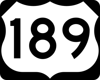
| 7 | Legislative designation for US-189 | 189 | SR-7 was later re-used for an unrelated highway. [3] |
| 8 | Legislative designation for U.S. Route 89 from Moark Junction to north of Lehi | 89 | SR-8 was later re-used for an unrelated highway. [3] |
| 9 | Legislative designation for current US-191 between Crescent Junction and Monticello and US-491 between Monticello and Colorado. At one time these highways had a single signed designation, U.S. Route 160 | 163, 666 | SR-9 was immediately re-used on an unrelated highway. This portion of 163 has since been re-numbered 191, and 666 has been completely replaced with 491. [3] |
| 11 | Legislative designation for US-89 and US-89A from state line to junction with I-70 | 89/89A | Kept and signed as designation for US-89A south of Kanab. Formally replaced with route 89A in 2008. |
| 13 | Legislative designation for US-89 from Logan to Bear Lake | 89 | SR-13 immediately re-used for an unrelated route. |
| 15 | Zion Park Scenic Byway | 9 | SR-15 immediately re-used as the legislative designation for I-15 [1] |
| 16 | Route along the western shore of Bear Lake from the Wyoming state line near Woodruff to the state line near Paris, Idaho | 16, Eastern segment of 30, 89 | Route truncated, the southern portion remains SR-16 today, while the northern portion was transferred to other routes, including the part signed as US-89. |
| 26 | A signed route between Delta and Salina, now part of US-50. | 50 | SR-26 immediately re-used for former SR-50. SR-50 and 26 exchanged designations [3] |
| 27 | Legislative designation for US-6 from the Nevada state line to Green River | 6 | [3] |
| 28 | Route formerly continued south of its current terminus at Gunnison as a legislative designation for a portion of US-89 to Salina | 89, 28 | Portion used for US-89 truncated, independent portion kept [3] |
| 32 | Legislative designation for U.S. Route 89 from SR-28 at Gunnison to US-6 at Thistle, Utah | 89 | SR-32 eventually reused for a former portion of U.S. Route 189 [3] |
| 35 | Route formerly continued north from current terminus as the legislative designation for US-189 north to I-80 | 189, 35 | Portion used for US-189 truncated, independent portion kept [3] |
| 40 | North–south road west of Ogden | 134 | SR-40 immediately re-used as the legislative designation for US-40 [3] |
| 47 | Legislative designation for U.S. Route 163 from Arizona to Monticello, was signed prior to 1971. | 163 | North of Bluff has since been redesignated US-191 [3] |
| 49 | Legislative designation for US-89 between I-15 near Lagoon to I-84 near Ogden | 89 | [3] |
| 50 | Riverdale Road in Riverdale and Ogden | 26 | SR-50 immediately re-used as the legislative designation for US-50. SR-50 and 26 exchanged designations [3] |
| 51 | Connector between SR-16 and the Wyoming state line in the far north eastern corner of Utah | Eastern segment of 30 | |
| 69 | Alternate route between Brigham City and Logan via Bear River canyon. | Central segment of 30, 69 | The southern portion of the route (south of Deweyville) kept the SR-69 designation; later extended north to Collinston; to be later renumbered SR-38 |
| 70 | Route along the north shore of the Great Salt Lake in extreme northern part of the state | Western segment of 30 | SR-70 immediately re-used as the legislative designation for I 70. [3] |
| 80 | Alpine Loop Scenic Byway | 92 | SR-80 immediately re-used as the legislative designation for I-80 [3] |
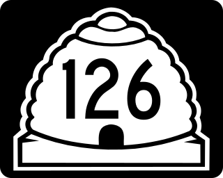
| 84 | Segment of former US-91 near Roy | 126, 13 | SR-84 immediately re-used as the legislative designation for I-84 [3] |
| 85 | Legislative Designation for the reroute of US-91 bypassing downtown Brigham City | 91 | [3] |
| 89 | Bypass of Eden, Utah | 169 | SR-89 immediately re-used as the legislative designation for US-89 [3] SR-169 has since been removed from the state route system. |
| 102 | East of Lampo Junction to Deweyville | 30, 102 | |
| 106 | Becks to Farmington (part was the legislate route of US 89) | 89, 106 | |
| 151 | Legislative designation for US-189 from Francis to Hailstone Junction | 189 | |
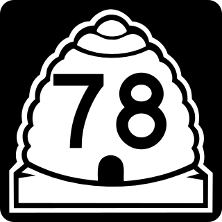
| 163 | Segment of former US-91 near Levan | 78 | SR-163 immediately re-used as the legislative designation for US-163 [2] |
| 169 | Legislative designation for US-89 from SR 106 in Bountiful to north of Bountiful | 89 | |
| 259 | Legislative designation for US-89 from Kanab to the Arizona border | 89 | |
| 271 | Legislative designation for U.S. Route 89 from Near Draper Crossroads to SR 106 in Becks | 89 |