Beaver County is a county in west central Utah, United States. As of the 2020 United States Census, the population was 7,072, up from the 2010 figure of 6,629. Its county seat and largest city is Beaver. The county was named for the abundance of beaver in the area.

Juab County is a county in western Utah, United States. As of the 2020 United States Census, the population was 11,786. Its county seat and largest city is Nephi.

Millard County is a county in the U.S. state of Utah. As of the 2020 United States Census, the population was 12,975. Its county seat is Fillmore, and the largest city is Delta.

Sanpete County is a county in the U.S. state of Utah. As of the 2020 United States Census, the population was 28,437. Its county seat is Manti, and its largest city is Ephraim. The county was created in 1850.

Weber County is a county in the U.S. state of Utah. As of the 2020 census, the population was 262,223, making it Utah's fourth-most populous county. Its county seat and largest city is Ogden, the home of Weber State University. The county was named after a fur trapper John Weber.

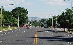
Nephi is a city in Juab County, Utah, United States. It is part of the Provo–Orem metropolitan area. The population was 6,443 at the 2020 census. It is the county seat of Juab County. It was settled by Mormon pioneers in 1851 as Salt Creek, and it acquired its current name in 1882. It is the principal city in the Juab Valley, an agricultural area. Nephi was named after Nephi, son of Lehi, from the Book of Mormon.

Rocky Ridge is a town on the northeastern edge of Juab County, Utah, United States. As of the 2010 census it had a population of 733, and in 2018 the estimated population was 833.

Delta is the largest city in Millard County, Utah, United States. It is located in the northeastern area of Millard County along the Sevier River and is surrounded by farmland. The population was 3,622 at the 2020 census.

Fillmore is a city and the county seat of Millard County, Utah, United States. The population was 2,592 at the 2020 United States Census. It is named for the thirteenth U.S. President Millard Fillmore, who was in office when Millard County was created by the Utah Territorial legislature.

Centerfield is a city in southwestern Sanpete County, Utah, United States. The population was 1,341 at the 2020 census. Although Centerfield was a town in 2000, it has since been classified as a fifth-class city by state law. The community was so named because of its location in the center of a wide valley.

Ephraim is a city in Sanpete County, Utah, United States. The population was 5,611 at the 2020 census, making it the largest city in Sanpete County. It is the location of Snow College and is located along U.S. Route 89.

Fayette is a town in Sanpete County, Utah, United States. The population was 204 at the 2000 census.

Manti is a city in and the county seat of Sanpete County, Utah, United States. The population was 3,429 at the 2020 United States Census.

Mayfield is a town in southwestern Sanpete County, Utah, United States. The population was 496 at the 2010 census.

Moroni is a city in Sanpete County, Utah, United States. The population was 1,423 at the 2010 census.

Mount Pleasant is a city in the U.S. state of Utah. Located in Sanpete County, Mt. Pleasant is known for being home to Wasatch Academy. As of the 2010 census, the city's population was 3,260.

Sterling is a town in Sanpete County, Utah, United States. The population was 235 at the 2000 census.

Wales is a town in Sanpete County, Utah, United States. The population was 219 at the 2000 census. The town is governed by a mayor and several council members. As of December 2008, Wales had no stores, gas stations, or stoplights. It does have a park, fire station, library and cemetery.
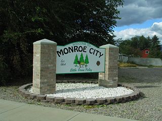
Monroe is a city in Sevier County, Utah, United States. The population was 2,256 at the 2010 United States Census.
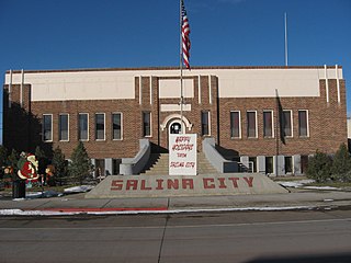
Salina is a city in Sevier County, Utah, United States. The population was 2,660 at the 2020 census.