Utah is a state in the Mountain West subregion of the Western United States. Utah is a landlocked U.S. state bordered to its east by Colorado, to its northeast by Wyoming, to its north by Idaho, to its south by Arizona, and to its west by Nevada. Utah also touches a corner of New Mexico in the southeast. Of the fifty U.S. states, Utah is the 13th-largest by area; with a population over three million, it is the 30th-most-populous and 11th-least-densely populated. Urban development is mostly concentrated in two areas: the Wasatch Front in the north-central part of the state, which is home to roughly two-thirds of the population and includes the capital city, Salt Lake City; and Washington County in the southwest, with more than 180,000 residents. Most of the western half of Utah lies in the Great Basin.
Morgan County is a county in northern Utah, United States. As of the 2010 census, the population was 9,469. Its county seat and largest city is Morgan. Morgan County is part of the Ogden-Clearfield, UT Metropolitan Statistical Area as well as the Salt Lake City-Provo-Orem, UT Combined Statistical Area.

Wasatch County is a county in the U.S. state of Utah. As of the 2010 United States Census, the population was 23,530. Its county seat and largest city is Heber City. The county was named for a Ute Indian word meaning mountain pass or low place in the high mountains.

Utah County is the second-most populous county in the U.S. state of Utah. The county seat and largest city is Provo, which is the state's third-largest city, and the largest outside of Salt Lake County. As of the 2020 United States Census, the population was 665,665.
Baldwin is a hamlet and census-designated place (CDP) located in the Town of Hempstead in Nassau County, on Long Island, in New York, United States. The population was 24,033 at the 2010 census.

Milburn is a town in Johnston County, Oklahoma, United States, along the Blue River. The population was 317 at the 2010 census, an increase of 1.6 percent from the figure of 312 in 2000. The town is notable as the location of the Chickasaw White House, the former home of Chickasaw Governor Douglas H. Johnston. This home is now a museum and is listed on the NRHP.

Cottonwood Heights is a city located in Salt Lake County, Utah, United States, along the east bench of the Salt Lake Valley. It lies south of the cities of Holladay and Murray, east of Midvale, and north of Sandy within the Salt Lake City, Utah Metropolitan Statistical Area. Following a successful incorporation referendum in May 2004, the city was incorporated on January 14, 2005. Cottonwood Heights had been a Census-designated place (CDP) before incorporation. The population as of the 2010 census was 33,433. This is a significant increase over the CDP's 2000 census count of 27,569.

Holladay is a city in central Salt Lake County, Utah, United States. It is part of the Salt Lake City, Utah Metropolitan Statistical Area. The population was 26,472 at the 2010 census, a significant increase from 14,561 in 2000. The city was incorporated on November 29, 1999, as Holladay-Cottonwood, and the name was shortened to Holladay on December 14 of that year. It was reported in the 1990 census as the Holladay-Cottonwood CDP.

Fountain Green is a city in Sanpete County, Utah, United States. The population was 1,071 at the 2010 census.

Fairfield is a town in Utah County, Utah, United States. It is part of the Provo–Orem, Utah Metropolitan Statistical Area. It is located in the southwest corner of Cedar Valley about 50 miles (80 km) southwest of Salt Lake City and 5 miles (8.0 km) south of Cedar Fort on Utah State Route 73, west of Utah Lake. The population was 119 at the 2010 census.

The United States census of 2000, conducted by the Census Bureau, determined the resident population of the United States on April 1, 2000, to be 281,421,906, an increase of 13.2 percent over the 248,709,873 people enumerated during the 1990 census. This was the twenty-second federal census and was at the time the largest civilly administered peacetime effort in the United States.

Echo is a census-designated place located in northwestern Summit County, Utah, United States. The population was 56 at the 2010 census.

Dammeron Valley is a census-designated place in central Washington County, Utah, United States. The population was 803 at the 2010 census. Although Dammeron Valley is unincorporated, it has its own ZIP code of 84783.
Jensen is a census-designated place in eastern Uintah County, Utah, United States. The population was 412 at the 2010 census. It lies along the Green River and U.S. Route 40, southeast of the city of Vernal, the county seat of Uintah County, and about 17 miles west of the Colorado border. Although Jensen is unincorporated, it has a post office, with the ZIP code of 84035.

Thatcher is a census-designated place in Box Elder County, Utah, United States. It is a small farming community, located 3 miles (5 km) southwest of Bothwell and 7 miles (11 km) west of Tremonton. The population was 789 at the 2010 census.

Deseret is a census-designated place in Millard County, Utah, United States. The population was 353 at the 2010 census. Deseret is located approximately 10 miles (16 km) southwest of Delta, and about 150 miles (240 km) southwest of Salt Lake City. The name Deseret comes from the Book of Mormon.

The San Pitch River, extending 65 miles (105 km), is the primary water course of the Sanpete Valley and drains into the Sevier River in southwestern Sanpete. The river is named for the Ute chief Sanpitch, who also gives his name to the San Pitch Mountains and Sanpete County.
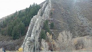
State Route 231 (SR-231) is the shortest state highway in the U.S. state of Utah. It serves as a connection between U.S. Route 89 (US-89) and SR-31 in Fairview.