The Roan Cliffs are a series of desert mountains and cliffs in eastern Utah and western Colorado, in the western United States that are distinct from the Book Cliffs.
Hamiltons Fort is an unincorporated community in south-central Iron County, Utah, United States.
Black Rock is an unincorporated community and near-ghost town in the Beaver Bottoms in southern Millard County, Utah, United States, approximately 20 miles (32 km) north of Milford.
Birdseye is an unincorporated community in southeastern Utah County, Utah, United States.

Vivian Park is an unincorporated community in northeastern Utah County, Utah, United States.
The Kern Mountains are a mountain range primarily on the eastern edge of White Pine County, Nevada, United States, but extending slightly east into western Juab County, Utah.

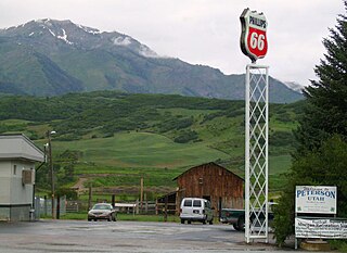
Peterson is an unincorporated community in northwestern Morgan County, Utah, United States.
Burmester is an unincorporated community in northeastern Tooele County, Utah, United States.

Moore is an unincorporated community in west central Emery County, Utah, United States, at the edge of the San Rafael Swell.
Rosette is an unincorporated ranching community in northwestern Box Elder County, Utah, United States.
Trout Creek is an unincorporated community, in far western Juab County, Utah, United States.
Shivwits is an unincorporated community in west-central Washington County, Utah, United States. It is occupied by the Shivwits Band of Paiutes.

The Juab Valley is a 40-mile (64 km) long valley located on the eastern edge of Juab County, Utah, United States.
Maple Canyon is a canyon in the northeastern San Pitch Mountains in northern Sanpete County, Utah, United States Nearly all of the canyon, except the western end, is located within the Uinta National Forest. The mouth of the canyon is in the northwestern Sanpete Valley, south of Fountain Green and just northwest of the unincorporated community of Freedom, at an elevation of 6,017 feet (1,834 m).
Beaver Dam is an unincorporated community on the northeastern edge of Box Elder County, Utah, United States.

Salduro is a ghost town located in Tooele County, Utah, United States.
Crouse Creek is a stream in the Uinta Mountains near the eastern edge of Daggett County, Utah, United States.

Spanish Valley is a flat in Grand and San Juan counties in Utah, United States, south of Moab.
Diamond Gulch is a gulch in eastern Juab County, Utah, United States.
Currant Creek is a stream in eastern Juab County and southern Utah County in northern Utah, United States.


