
Route 18 is a 47.92-mile-long (77.12 km) state highway in the central part of the US state of New Jersey. It begins at an intersection with Route 138 in Wall Township, Monmouth County, and ends at Interstate 287 (I-287) in Piscataway, Middlesex County. Route 18 is a major route through Central New Jersey that connects the Jersey Shore to the Raritan Valley region, connecting the seats of Monmouth County (Freehold) and Middlesex County respectively. The route runs through Ocean Township, Marlboro, East Brunswick, and is the main thoroughfare for Rutgers University. Much of the route is a freeway. The remainder of the route is an arterial road with traffic lights in the East Brunswick and Old Bridge areas, and a boulevard in the remainder of Piscataway. Route 18 was designated in 1939 as a proposed freeway from Old Bridge to Eatontown. The section west of Old Bridge was formerly designated as part Route S28, a prefixed spur of State Highway Route 28 from Middlesex to Matawan. The designation, assigned in the 1927 renumbering, remained until a second renumbering in 1953. At that point, Route S28 was redesignated as Route 18, though the section from Old Bridge to Matawan was signed as TEMP 18, as this section would be decommissioned when the Route 18 freeway was built.

Route 34 is a state highway in the central part of the U.S. state of New Jersey. The route runs 26.7 mi (43.0 km) from an intersection of Route 35 and Route 70 in Wall Township, Monmouth County, north to an interchange with US 9 in Old Bridge, Middlesex County. The route is a four-lane divided highway between its southern terminus and the north end of the Route 33 concurrency in Howell; along this stretch, the route interchanges with the Garden State Parkway and I-195/Route 138 within a short distance of each other. North of Route 33, Route 34 is an undivided two- to four-lane road that interchanges with Route 18 in Colts Neck and intersects with Route 79 in Matawan. Route 34 passes through mostly suburban areas along its route.

Route 35 is a state highway in the U.S. state of New Jersey, primarily traveling through the easternmost parts of Middlesex, Monmouth, and Ocean counties. It runs 58.1 mi (93.5 km) from the entrance to Island Beach State Park in Berkeley Township, Ocean County, to an intersection with Lincoln Highway/St. Georges Avenue (Route 27) in Rahway, Union County. Between Seaside Park and Mantoloking, Route 35 follows the right-of-way of the former Pennsylvania Railroad along the Jersey Shore. The route heads through Point Pleasant Beach and crosses the Manasquan River on the Brielle Bridge, meeting the intersection of Route 34 and Route 70 at the former Brielle Circle in Wall Township. From there, Route 35 heads north and interchanges with Route 138, an extension of I-195, continuing north through Monmouth County before crossing the Victory Bridge over the Raritan River into Perth Amboy, where the route continues north to Rahway.

Route 70 is a state highway located in the U.S. state of New Jersey. It extends 59.8 mi (96.24 km) from an interchange with Route 38 in Pennsauken, Camden County, east to an intersection with Route 34 and Route 35 in Wall Township, Monmouth County. Route 70 cuts across the middle of the state as a two-lane highway through the Pine Barrens in Burlington and Ocean counties. A popular truck route, it provides access between Philadelphia and the surrounding Philadelphia metro area and the Jersey Shore resorts, particularly Long Beach Island by way of Route 72. It is also a congested commercial route within Philadelphia's New Jersey suburbs. The western section in Cherry Hill and Marlton is a four- to eight-lane divided highway that serves as a major suburban arterial and is locally known as Marlton Pike. The eastern section in Monmouth and Ocean counties is also a multilane divided highway that runs through suburban areas.

Route 33 is a state highway in the central part of the US state of New Jersey. The highway extends 42.03 miles (67.64 km), from an interchange with US 1 in Trenton, Mercer County, east to an intersection of Main Street (Route 71) in Neptune, Monmouth County. Route 33 is a major route through Central New Jersey, as it runs from the greater state capital area in the Delaware Valley Region, through a mixture of farmland, housing, and commercial developments in the lower Raritan Valley Region, en route to the greater Asbury Park area on the Jersey Shore. The route traverses through historic towns such as Hightstown, Monroe Township, Manalapan, Freehold, and Tinton Falls. There are several intersections on Route 33 with future developments.

Route 36 is a state highway in Monmouth County, New Jersey, United States. The 24.4-mile (39.27 km) long route, shaped as a backwards C, begins at an intersection of the Garden State Parkway and Hope Road on the border of Tinton Falls and Eatontown and runs east to Long Branch. From Long Branch, the route follows the Atlantic Ocean north to Sea Bright and turns west, running to the south of the Raritan Bay. Route 36 ends in Keyport at an interchange with the Garden State Parkway and Route 35. It varies in width from a six-lane divided highway to a two-lane undivided road. The route is signed east–west between Eatontown and Long Branch and north–south between Long Branch and Keyport.

Route 50 is a state highway in the southern part of the U.S. state of New Jersey. It runs 26.02 mi (41.88 km) from an intersection with U.S. Route 9 and the Garden State Parkway in Upper Township, Cape May County, north to an intersection with US 30 and County Route 563 in Egg Harbor City, Atlantic County. The route, which is mostly a two-lane undivided road, passes through mostly rural areas of Atlantic and Cape May counties as well as the communities of Tuckahoe, Corbin City, Estell Manor, and Mays Landing. Route 50 intersects several roads, including Route 49 in Tuckahoe, US 40 in Mays Landing, and US 322 and the Atlantic City Expressway in Hamilton Township.

Tinton Falls is a borough in Monmouth County, in the U.S. state of New Jersey. Located within the heart of the Jersey Shore region, the borough is a commercial hub of Central Jersey and is an established bedroom suburb of New York City, in the New York metropolitan area. As of the 2020 United States census, the borough's population was 19,181, an increase of 1,289 (+7.2%) from the 2010 census count of 17,892, which in turn reflected an increase of 2,839 (+18.9%) from the 15,053 counted in the 2000 census.

Route 71 is a state highway in New Jersey that runs 16.7 miles (26.9 km) near the shore in Monmouth County. It begins at Route 35 in Brielle just north of the Manasquan River and the Ocean County line and heads north to Route 35 in Eatontown with a four block concurrency with Route 35 in Belmar. Monmouth University is located off Route 71 in West Long Branch.

Route 72 is a state highway in the U.S. state of New Jersey. It runs 28.7 mi (46.19 km) from the Four Mile Circle with Route 70 in Woodland Township in Burlington County to Long Beach Boulevard in Ship Bottom on Long Beach Island in Ocean County. Route 72 travels through the Pine Barrens as a two-lane undivided road. After an interchange with the Garden State Parkway, the route becomes a four- to six-lane divided highway through built-up areas of Manhawkin and crosses the Manahawkin Bay via the Manahawkin Bay Bridge onto Long Beach Island.
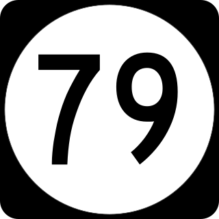
Route 79 is a state highway located in Monmouth County in the U.S. state of New Jersey. It runs 12.1 mi (19.5 km) from an intersection of US 9 in Freehold Township north to an intersection of Route 34 and Main Street in Matawan. The route is a mostly two-lane undivided road that passes through a mixture of suburban residential, urban commercial, and open rural areas. The route interchanges with Route 33 in Freehold Township, intersects with Business Route 33 and CR 537 in Freehold, interchanges with Route 18 and intersects with CR 520 in Marlboro, and intersects with CR 516 in Matawan.

The Garden State Parkway (GSP) is a controlled-access toll road that stretches the north–south length of eastern New Jersey from the state's southernmost tip near Cape May north to the New York state line at Montvale. Its name refers to New Jersey's nickname, the "Garden State". The parkway has an unsigned reference number of Route 444 by the New Jersey Department of Transportation (NJDOT). At its north end, the road becomes the Garden State Parkway Connector, a component of the New York State Thruway system that connects to the Thruway mainline in Ramapo, New York.
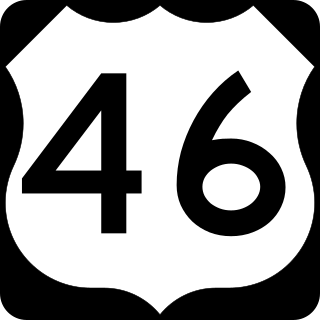
U.S. Route 46 (US 46) is an east–west U.S. Highway completely within the state of New Jersey, and runs for 75.34 mi (121.25 km). The west end is at an interchange with Interstate 80 (I-80) and Route 94 in Columbia, Warren County, on the Delaware River. The east end is in the middle of the George Washington Bridge over the Hudson River in Fort Lee, Bergen County, while the route is concurrent with I-95 and US 1-9. Throughout much of its length, US 46 is closely paralleled by I-80. US 46 is a major local and suburban route, with some sections built to or near freeway standards and many other sections arterials with jughandles. The route runs through several communities in the northern part of New Jersey, including Hackettstown, Netcong, Dover, Parsippany–Troy Hills, Wayne, Clifton, Ridgefield Park, Palisades Park, and Fort Lee. It crosses over the Upper Passaic River at several points. The road has been ceremonially named the United Spanish–American War Veterans Memorial Highway.

Route 168 is a 10.7-mile (17.22 km) state highway in the southern part of New Jersey. The route's southern terminus is an interchange with Route 42 and the Atlantic City Expressway in the Turnersville section of Washington Township, Gloucester County. The northern terminus is an intersection of Ferry Avenue on the border of Camden and Woodlynne in Camden County. At this point, the route continues toward Downtown Camden as Mt Ephraim Avenue. Route 168 follows the Black Horse Pike for most of its length, running through suburban areas in Gloucester Township, Runnemede, Bellmawr, and Mount Ephraim. It intersects and interchanges many major roads, including the Route 42 freeway in Gloucester Township, Route 41 in Runnemede, the New Jersey Turnpike and I-295 in Bellmawr, Route 76C in Haddon Township, and US 130 in Camden.
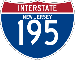
Interstate 195 (I-195) is an auxiliary route of the Interstate Highway System located in the US state of New Jersey. Its western end is at I-295 and Route 29 just south of Trenton in Hamilton Township, Mercer County, while its eastern end is at the Garden State Parkway, Route 138, and Route 34 in Wall Township, Monmouth County. I-195 is 34.17 miles (54.99 km) in length. The route is mostly a four-lane highway that mainly runs through agrarian and wooded areas in Central Jersey. It has an interchange with the New Jersey Turnpike (I-95) in Robbinsville and serves as a main access road to New Jersey's state capital of Trenton, the Horse Park of New Jersey, the Six Flags amusement park, and the Jersey Shore. I-195 is occasionally referred to as the Central Jersey Expressway. On April 6, 1988, President Ronald Reagan signed H.R. 4263 naming I-195 in New Jersey the James J. Howard Interstate Highway, in honor of the late James J. Howard.

County Route 549 (CR 549) is a county highway in the U.S. state of New Jersey. The highway extends 17.8 miles (28.6 km) from Main Street (Route 166) and Water Street (CR 527) in Toms River to Lakewood-Farmimgdale Road (CR 547) and Old Tavern Road (CR 21) in Howell. The highway has the distinction of being the only 500-series route left with two separate spur routes.
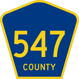
County Route 547 is a county highway in the U.S. state of New Jersey. The highway extends 30.36 miles (48.86 km) from Route 70 in Lakehurst to the intersection of Broadway and Myrtle Avenue in Long Branch. Near its southern terminus, it passes the East Gate of the Lakehurst Maxfield Field portion of Joint Base McGuire–Dix–Lakehurst, known as Lakehurst Naval Air Station in the past, and the site of the crash of the Hindenburg in 1937.

County Route 537 is a county highway in the U.S. state of New Jersey. The highway extends 66.2 miles (106.5 km) from Delaware Avenue in Camden to Oceanport Avenue in Oceanport. It is the state's fourth-longest 500 series county route.

U.S. Route 9 (US 9) is a United States Numbered Highway in the Mid-Atlantic region of the United States, running from Laurel, Delaware, to Champlain, New York. In New Jersey, the route runs 166.80 miles (268.44 km) from the Cape May–Lewes Ferry terminal in North Cape May, Cape May County, where the ferry carries US 9 across the Delaware Bay to Lewes, Delaware, north to the George Washington Bridge in Fort Lee, Bergen County, where the route along with Interstate 95 (I-95) and US 1 continue into New York City. US 9 is the longest U.S. Highway in the state.

County Route 520 (CR 520) is a county highway in the U.S. state of New Jersey. CR 520 is a major road across Monmouth County connecting the county's central towns to the Jersey Shore at Sea Bright. The highway extends 22.3 miles (35.9 km) from Englishtown Road (CR 527) in Old Bridge to Ocean Avenue (Route 36) in Sea Bright.


