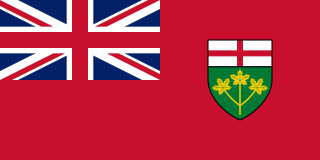
Ontario is one of the thirteen provinces and territories of Canada. Located in Central Canada, it is Canada's most populous province, with 38.3 percent of the country's population, and is the second-largest province by total area. Ontario is Canada's fourth-largest jurisdiction in total area when the territories of the Northwest Territories and Nunavut are included. It is home to the nation's capital city, Ottawa, and the nation's most populous city, Toronto, which is also Ontario's provincial capital.
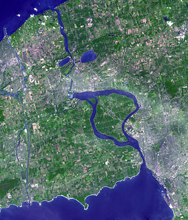
The Niagara River is a river that flows north from Lake Erie to Lake Ontario. It forms part of the border between the province of Ontario in Canada and the state of New York in the United States. There are differing theories as to the origin of the river's name. According to Iroquoian scholar Bruce Trigger, Niagara is derived from the name given to a branch of the locally residing native Neutral Confederacy, who are described as being called the Niagagarega people on several late-17th-century French maps of the area. According to George R. Stewart, it comes from the name of an Iroquois town called Ongniaahra, meaning "point of land cut in two".
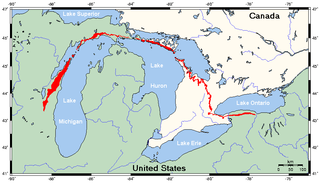
The Niagara Escarpment is a long escarpment, or cuesta, in Canada and the United States that runs predominantly east–west from New York through Ontario, Michigan, Wisconsin, and Illinois. The escarpment is most famous as the cliff over which the Niagara River plunges at Niagara Falls, for which it is named.
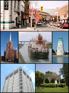
St. Catharines is the largest city in Canada's Niagara Region and the sixth largest urban area in the province of Ontario. As of 2016, it has an area of 96.13 square kilometres (37.12 sq mi), 133,113 residents, and a metropolitan population of 406,074. It lies in Southern Ontario, 51 kilometres (32 mi) south of Toronto across Lake Ontario, and is 19 kilometres (12 mi) inland from the international boundary with the United States along the Niagara River. It is the northern entrance of the Welland Canal. Residents of St. Catharines are known as St. Cathariners. St. Catharines carries the official nickname "The Garden City" due to its 1,000 acres (4 km2) of parks, gardens, and trails.

Grimsby is a town on Lake Ontario in the Niagara Region, Ontario, Canada. Grimsby is a part of the Hamilton Census Metropolitan Area. It is named after the English fishing town of Grimsby in north-east Lincolnshire. The majority of residents reside in the area bounded by Lake Ontario and the Niagara Escarpment. The escarpment is home to a section of the Bruce Trail.

The Golden Horseshoe is a secondary region of Southern Ontario, Canada, which lies at the western end of Lake Ontario, with outer boundaries stretching south to Lake Erie and north to Lake Scugog and Lake Simcoe. It includes the Greater Toronto Area and adjacent upper-tier municipalities with substantial urban agglomerations. The region is the most densely populated and industrialized in Canada. With a population of 7,826,367 people in its core and 9,245,438 in its greater area, the Golden Horseshoe accounts for over 21 percent of the population of Canada and more than 55 percent of Ontario's population. It is part of the Quebec City–Windsor Corridor, itself part of the Great Lakes Megalopolis.
The Ontario tobacco belt is the tobacco-growing region located in Norfolk County and eastern Elgin County in Southwestern Ontario, Canada. The region is close to the north shore of Lake Erie, with a moderate climate and sandy, silt-loam soils that are well-suited to a wide variety of crops.

At the end of 2016, the installed capacity for wind power in Minnesota was 3,500 megawatts (MW). Wind power generated nearly 18 percent of Minnesota’s electricity in 2016, ranking sixth in the nation for wind energy as a share of total electricity generation.

EDF Renewables is a wholly owned subsidiary of the French utility EDF Group, specializing in renewable energy production. As an integrated operator, the Group develops and finances the construction of renewable energy facilities, and manages operations and maintenance for its own account and for third parties.

Wind power in Belgium depends partially on regional governments and partially on the Belgian federal government. Wind energy producers in both the Flemish and Walloon regions get green certificates but not with the same conditions.
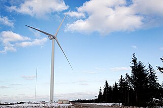
The Vestas V164 is a three-bladed offshore wind turbine, produced by Vestas, with a nameplate capacity of up to 10 megawatts, a world record. Vestas revealed the V164's design in 2011 with the first prototype unit operated at Østerild in northern Denmark in January 2014. The first industrial units were installed in 2016 at Burbo Bank, off the west coast of the United Kingdom. By 2021, Vestas had produced 500 of the series.
Envision Energy headquartered in Shanghai provides wind turbines and energy management software.

Wind power in Nebraska remains largely untapped in comparison with its potential. In the Great Plains, with more than 47,000 farms and open skies it ranks near the top in the United States in its ability to generate energy from wind. As of 2015, the state had not adopted a renewable portfolio standard. Omaha Public Power District (OPPD) is one of the state's largest purchasers of wind energy.
Los Vientos Wind Farm is a 912 megawatt (MW) wind farm in Starr and Willacy counties in South Texas. It is the second largest wind farm in the United States behind the Alta Wind Energy Center in California.


