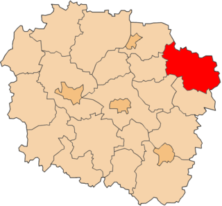
Sławoszowice is a village in the administrative district of Gmina Milicz, within Milicz County, Lower Silesian Voivodeship, in south-western Poland. Prior to 1945 it was in Germany.
Standard Shaft is located in Mount Pleasant Township, Westmoreland County, Pennsylvania. It is a community located near Mount Pleasant, Pennsylvania.

Płazowo is a village in the administrative district of Gmina Lubiewo, within Tuchola County, Kuyavian-Pomeranian Voivodeship, in north-central Poland. It lies approximately 9 kilometres (6 mi) north-west of Lubiewo, 10 km (6 mi) south-east of Tuchola, and 47 km (29 mi) north of Bydgoszcz.
Paryż is a village in the administrative district of Gmina Żnin, within Żnin County, Kuyavian-Pomeranian Voivodeship, in north-central Poland.

Ossowo is a village in the administrative district of Gmina Lubraniec, within Włocławek County, Kuyavian-Pomeranian Voivodeship, in north-central Poland. It lies approximately 5 kilometres (3 mi) east of Lubraniec, 17 km (11 mi) south-west of Włocławek, and 59 km (37 mi) south of Toruń.

Wolne is a village in the administrative district of Gmina Sztabin, within Augustów County, Podlaskie Voivodeship, in north-eastern Poland. It lies approximately 4 kilometres (2 mi) north-east of Sztabin, 21 km (13 mi) south-east of Augustów, and 66 km (41 mi) north of the regional capital Białystok.

Chlewisk Dolny is a village in the administrative district of Gmina Suchowola, within Sokółka County, Podlaskie Voivodeship, in north-eastern Poland. It lies approximately 4 kilometres (2 mi) east of Suchowola, 30 km (19 mi) north-west of Sokółka, and 51 km (32 mi) north of the regional capital Białystok.
Werechanie-Kolonia is a settlement in the administrative district of Gmina Rachanie, within Tomaszów Lubelski County, Lublin Voivodeship, in eastern Poland.

Grzymała is a village in the administrative district of Gmina Tuczępy, within Busko County, Świętokrzyskie Voivodeship, in south-central Poland. It lies approximately 3 kilometres (2 mi) north-west of Tuczępy, 20 km (12 mi) east of Busko-Zdrój, and 47 km (29 mi) south-east of the regional capital Kielce.

Serbinów is a village in the administrative district of Gmina Mniów, within Kielce County, Świętokrzyskie Voivodeship, in south-central Poland. It lies approximately 5 kilometres (3 mi) north-east of Mniów and 19 km (12 mi) north of the regional capital Kielce.

Mączniki is a village in the administrative district of Gmina Kraszewice, within Ostrzeszów County, Greater Poland Voivodeship, in west-central Poland. It lies approximately 20 kilometres (12 mi) north-east of Ostrzeszów and 131 km (81 mi) south-east of the regional capital Poznań.
Borzykowo is a settlement in Gmina Miastko, Bytów County, Pomeranian Voivodeship, in northern Poland.
Kuźniczka is a village in the administrative district of Gmina Praszka, within Olesno County, Opole Voivodeship, in south-western Poland.
Zamełowo is a settlement in the administrative district of Gmina Słupsk, within Słupsk County, Pomeranian Voivodeship, in northern Poland.

Szypułki-Zaskórki is a village in the administrative district of Gmina Janowiec Kościelny, within Nidzica County, Warmian-Masurian Voivodeship, in northern Poland. It lies approximately 3 kilometres (2 mi) north of Janowiec Kościelny, 9 km (6 mi) south-east of Nidzica, and 53 km (33 mi) south of the regional capital Olsztyn.
Łączno is a village in the administrative district of Gmina Borne Sulinowo, within Szczecinek County, West Pomeranian Voivodeship, in north-western Poland.
Kasti is a village in Märjamaa Parish, Rapla County in western Estonia.
Aruste is a village in Saaremaa Parish, Saare County in western Estonia.

Masthope Mountain Community is a census-designated place located in Lackawaxen Township, Pike County in the state of Pennsylvania. The community is located in far northeastern Pike County near the New York border. As of the 2010 census the population was 685.
Lakaica is a village in Municipality of Struga, Macedonia.


