Czerniewice is a village in Tomaszów Mazowiecki County, Łódź Voivodeship, in central Poland. It is the seat of the gmina called Gmina Czerniewice. It lies on the Krzemionka River, approximately 19 kilometres (12 mi) north-east of Tomaszów Mazowiecki and 50 km (31 mi) east of the regional capital Łódź. It was probably founded in the 14th century.
Krępiny is a village in the administrative district of Gmina Fabianki, within Włocławek County, Kuyavian-Pomeranian Voivodeship, in north-central Poland.
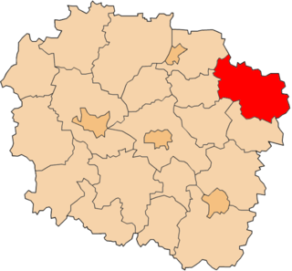
Okszów-Kolonia is a village in the administrative district of Gmina Chełm, within Chełm County, Lublin Voivodeship, in eastern Poland.
Rynkojeziory is a village in the administrative district of Gmina Sejny, within Sejny County, Podlaskie Voivodeship, in north-eastern Poland, close to the border with Lithuania.
Rzędków is a village in the administrative district of Gmina Daszyna, within Łęczyca County, Łódź Voivodeship, in central Poland.

Abdinli is a village in the Yardymli Rayon of Azerbaijan. The village forms part of the municipality of Yeni Abdinli.
Dąbrowa is a village in the administrative district of Gmina Łęki Szlacheckie, within Piotrków County, Łódź Voivodeship, in central Poland.
Wiertelaki is a village in the administrative district of Gmina Brąszewice, within Sieradz County, Łódź Voivodeship, in central Poland. It lies approximately 4 kilometres (2 mi) north-west of Brąszewice, 26 km (16 mi) west of Sieradz, and 79 km (49 mi) west of the regional capital Łódź.
Przybysławice is a village in the administrative district of Gmina Zielonki, within Kraków County, Lesser Poland Voivodeship, in southern Poland. It lies approximately 12 km (7 mi) north of the regional capital Kraków.
Wyszyna Fałkowska is a village in the administrative district of Gmina Ruda Maleniecka, within Końskie County, Świętokrzyskie Voivodeship, in south-central Poland. It lies approximately 5 kilometres (3 mi) west of Ruda Maleniecka, 19 km (12 mi) west of Końskie, and 44 km (27 mi) north-west of the regional capital Kielce.
Czarna is a village in the administrative district of Gmina Stąporków, within Końskie County, Świętokrzyskie Voivodeship, in south-central Poland. It lies approximately 3 kilometres (2 mi) south-west of Stąporków, 10 km (6 mi) south-east of Końskie, and 30 km (19 mi) north of the regional capital Kielce.
Malice Kościelne is a village in the administrative district of Gmina Lipnik, within Opatów County, Świętokrzyskie Voivodeship, in south-central Poland. It lies approximately 5 kilometres (3 mi) north-east of Lipnik, 8 km (5 mi) south-east of Opatów, and 65 km (40 mi) east of the regional capital Kielce.
Łagówka is a village in the administrative district of Gmina Bogoria, within Staszów County, Świętokrzyskie Voivodeship, in south-central Poland. It lies approximately 9 kilometres (6 mi) north-west of Bogoria, 16 km (10 mi) north of Staszów, and 44 km (27 mi) south-east of the regional capital Kielce.
Biel is a village in the administrative district of Gmina Siedlce, within Siedlce County, Masovian Voivodeship, in east-central Poland.
Kosy ,(German: Kossi) is a village in the administrative district of Gmina Kartuzy, within Kartuzy County, Pomeranian Voivodeship, in northern Poland. It lies approximately 4 kilometres (2 mi) south-west of Kartuzy and 32 km (20 mi) west of the regional capital Gdańsk.
Swochowo is a village in the administrative district of Gmina Słupsk, within Słupsk County, Pomeranian Voivodeship, in northern Poland.
Bałkany is a settlement in the administrative district of Gmina Osieczna, within Starogard County, Pomeranian Voivodeship, in northern Poland. It lies approximately 6 kilometres (4 mi) north-west of Osieczna, 30 km (19 mi) south-west of Starogard Gdański, and 69 km (43 mi) south-west of the regional capital Gdańsk.
Wólka is a village in the administrative district of Gmina Kołobrzeg, within Kołobrzeg County, West Pomeranian Voivodeship, in north-western Poland.
Hradčany is a village and municipality in Nymburk District in the Central Bohemian Region of the Czech Republic.
Otoka is a village in the administrative district of Gmina Łoniów, within Sandomierz County, Świętokrzyskie Voivodeship, in south-central Poland. It lies approximately 6 kilometres (4 mi) south of Łoniów, 25 km (16 mi) south-west of Sandomierz, and 76 km (47 mi) south-east of the regional capital Kielce.