Frydrychowo is a village in the administrative district of Gmina Kowalewo Pomorskie, within Golub-Dobrzyń County, Kuyavian-Pomeranian Voivodeship, in north-central Poland. It lies 2 kilometres (1 mi) east of Kowalewo Pomorskie, 12 km (7 mi) north-west of Golub-Dobrzyń, and 25 km (16 mi) north-east of Toruń.

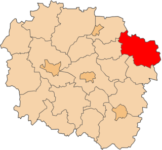
Karolewo is a village in the administrative district of Gmina Świecie nad Osą, within Grudziądz County, Kuyavian-Pomeranian Voivodeship, in north-central Poland. It lies approximately 5 kilometres (3 mi) east of Świecie nad Osą, 27 km (17 mi) east of Grudziądz, and 59 km (37 mi) north-east of Toruń.

Lisnowo is a village in the administrative district of Gmina Świecie nad Osą, within Grudziądz County, Kuyavian-Pomeranian Voivodeship, in north-central Poland. It lies approximately 5 kilometres (3 mi) north-east of Świecie nad Osą, 26 km (16 mi) east of Grudziądz, and 61 km (38 mi) north-east of Toruń. Among dr Marian Majkowski’s notable designs is the church in this village.
Karpaty is a village in the administrative district of Gmina Cekcyn, within Tuchola County, Kuyavian-Pomeranian Voivodeship, in north-central Poland. It lies approximately 7 kilometres (4 mi) south-east of Cekcyn, 17 km (11 mi) south-east of Tuchola, and 46 km (29 mi) north of Bydgoszcz.
Wełpin is a village in the administrative district of Gmina Lubiewo, within Tuchola County, Kuyavian-Pomeranian Voivodeship, in north-central Poland. It lies approximately 7 kilometres (4 mi) north of Lubiewo, 14 km (9 mi) south-east of Tuchola, and 46 km (29 mi) north of Bydgoszcz.
Gościmowice Pierwsze is a village in the administrative district of Gmina Moszczenica, within Piotrków County, Łódź Voivodeship, in central Poland.
Kliszów is a village in the administrative district of Gmina Kije, within Pińczów County, Świętokrzyskie Voivodeship, in south-central Poland. It lies approximately 4 kilometres (2 mi) west of Kije, 10 km (6 mi) north of Pińczów, and 31 km (19 mi) south of the regional capital Kielce.
Nowa Wieś is a village in the administrative district of Gmina Sienno, within Lipsko County, Masovian Voivodeship, in east-central Poland.
Budy Barcząckie is a village in the administrative district of Gmina Mińsk Mazowiecki, within Mińsk County, Masovian Voivodeship, in east-central Poland.
Owink is a settlement in the administrative district of Gmina Chojnice, within Chojnice County, Pomeranian Voivodeship, in northern Poland. It lies approximately 16 kilometres (10 mi) north of Chojnice and 93 km (58 mi) south-west of the regional capital Gdańsk.
Marynowy is a village in the administrative district of Gmina Nowy Dwór Gdański, within Nowy Dwór Gdański County, Pomeranian Voivodeship, in northern Poland. It lies approximately 7 kilometres (4 mi) south of Nowy Dwór Gdański and 38 km (24 mi) south-east of the regional capital Gdańsk.
Dziewięć Włók is a settlement in the administrative district of Gmina Stary Targ, within Sztum County, Pomeranian Voivodeship, in northern Poland. It lies approximately 3 kilometres (2 mi) north of Stary Targ, 9 km (6 mi) east of Sztum, and 59 km (37 mi) south-east of the regional capital Gdańsk.
Matyjaszki is a village in the administrative district of Gmina Bartoszyce, within Bartoszyce County, Warmian-Masurian Voivodeship, in northern Poland, close to the border with the Kaliningrad Oblast of Russia. It lies approximately 16 kilometres (10 mi) south-east of Bartoszyce and 53 km (33 mi) north-east of the regional capital Olsztyn.
Marózek is a village in the administrative district of Gmina Olsztynek, within Olsztyn County, Warmian-Masurian Voivodeship, in northern Poland. It lies approximately 12 kilometres (7 mi) south-east of Olsztynek and 30 km (19 mi) south of the regional capital Olsztyn.
Pacółtówko is a village in the administrative district of Gmina Grunwald, within Ostróda County, Warmian-Masurian Voivodeship, in northern Poland. It lies approximately 22 kilometres (14 mi) south-east of Ostróda and 35 km (22 mi) south-west of the regional capital Olsztyn.
Trzygłów is a village in the administrative district of Gmina Gryfice, within Gryfice County, West Pomeranian Voivodeship, in north-western Poland. It lies approximately 7 kilometres (4 mi) south of Gryfice and 63 km (39 mi) north-east of the regional capital Szczecin.
Łubnica is a village in the administrative district of Gmina Gryfino, within Gryfino County, West Pomeranian Voivodeship, in north-western Poland, close to the German border. It lies approximately 9 kilometres (6 mi) north of Gryfino and 12 km (7 mi) south of the regional capital Szczecin.
Strzmiele is a village in the administrative district of Gmina Radowo Małe, within Łobez County, West Pomeranian Voivodeship, in north-western Poland. It lies approximately 6 kilometres (4 mi) east of Radowo Małe, 7 km (4 mi) west of Łobez, and 68 km (42 mi) north-east of the regional capital Szczecin.
Sławno is a village in the administrative district of Gmina Grzmiąca, within Szczecinek County, West Pomeranian Voivodeship, in north-western Poland. It lies approximately 19 kilometres (12 mi) north-west of Szczecinek and 138 km (86 mi) east of the regional capital Szczecin.
Krąpiel is a village in the administrative district of Gmina Człopa, within Wałcz County, West Pomeranian Voivodeship, in north-western Poland. It lies approximately 6 kilometres (4 mi) north-east of Człopa, 26 km (16 mi) south-west of Wałcz, and 110 km (68 mi) east of the regional capital Szczecin.