Rudniki is a village in Olesno County, Opole Voivodeship, in south-western Poland. It is the seat of the gmina called Gmina Rudniki. It lies approximately 23 kilometres (14 mi) north-east of Olesno and 63 km (39 mi) north-east of the regional capital Opole.
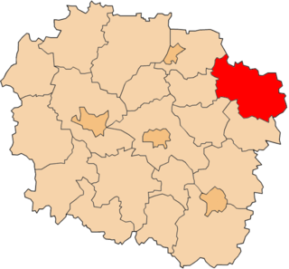
Stare Świerczyny is a village in the administrative district of Gmina Bartniczka, within Brodnica County, Kuyavian-Pomeranian Voivodeship, in north-central Poland.

Stare Błonowo is a village in the administrative district of Gmina Łasin, within Grudziądz County, Kuyavian-Pomeranian Voivodeship, in north-central Poland. It lies approximately 4 kilometres (2 mi) north of Łasin, 22 km (14 mi) east of Grudziądz, and 66 km (41 mi) north-east of Toruń.

Stare Jeżewo is a village in the administrative district of Gmina Tykocin, within Białystok County, Podlaskie Voivodeship, in north-eastern Poland. It lies approximately 9 kilometres (6 mi) south of Tykocin and 30 km (19 mi) west of the regional capital Białystok.

Kotowo Stare is a village in the administrative district of Gmina Jedwabne, within Łomża County, Podlaskie Voivodeship, in north-eastern Poland. It lies approximately 6 kilometres (4 mi) south of Jedwabne, 18 km (11 mi) north-east of Łomża, and 59 km (37 mi) west of the regional capital Białystok.
Mikołajew is a settlement in the administrative district of Gmina Łomża, within Łomża County, Podlaskie Voivodeship, in north-eastern Poland.

Złotowizna is a village in the administrative district of Gmina Brzeźnio, within Sieradz County, Łódź Voivodeship, in central Poland. It lies approximately 5 kilometres (3 mi) north of Brzeźnio, 13 km (8 mi) south-west of Sieradz, and 67 km (42 mi) south-west of the regional capital Łódź.
Zygmuntów is a village in the administrative district of Gmina Fałków, within Końskie County, Świętokrzyskie Voivodeship, in south-central Poland.

Wielka Wieś is a village in the administrative district of Gmina Stąporków, within Końskie County, Świętokrzyskie Voivodeship, in south-central Poland. It lies approximately 6 kilometres (4 mi) north-east of Stąporków, 13 km (8 mi) east of Końskie, and 35 km (22 mi) north of the regional capital Kielce.

Stare Niemyje is a village in the administrative district of Gmina Szydłowo, within Mława County, Masovian Voivodeship, in east-central Poland. It lies approximately 12 kilometres (7 mi) east of Mława and 107 km (66 mi) north of Warsaw.

Stare Kosiny is a village in the administrative district of Gmina Wiśniewo, within Mława County, Masovian Voivodeship, in east-central Poland.
Stare Prażuchy is a village in the administrative district of Gmina Ceków-Kolonia, within Kalisz County, Greater Poland Voivodeship, in west-central Poland.
Goczki Polskie is a village in the administrative district of Gmina Wierzbinek, within Konin County, Greater Poland Voivodeship, in west-central Poland.
Kolonia Lisewo is a settlement in the administrative district of Gmina Pyzdry, within Września County, Greater Poland Voivodeship, in west-central Poland.

Stare Dłutowo is a village in the administrative district of Gmina Lidzbark, within Działdowo County, Warmian-Masurian Voivodeship, in northern Poland. It lies approximately 12 kilometres (7 mi) south-east of Lidzbark, 17 km (11 mi) west of Działdowo, and 76 km (47 mi) south-west of the regional capital Olsztyn.

Stare Krzywe is a village in the administrative district of Gmina Stare Juchy, within Ełk County, Warmian-Masurian Voivodeship, in northern Poland. It lies approximately 5 kilometres (3 mi) south-west of Stare Juchy, 19 km (12 mi) north-west of Ełk, and 107 km (66 mi) east of the regional capital Olsztyn.
Jabłonka is a settlement in the administrative district of Gmina Ostróda, within Ostróda County, Warmian-Masurian Voivodeship, in northern Poland.
Stare Leśno is a settlement in the administrative district of Gmina Police, within Police County, West Pomeranian Voivodeship, in north-western Poland, close to the German border.

Jelonki is a settlement in the administrative district of Gmina Połczyn-Zdrój, within Świdwin County, West Pomeranian Voivodeship, in north-western Poland. It lies approximately 5 kilometres (3 mi) south of Połczyn-Zdrój, 24 km (15 mi) east of Świdwin, and 107 km (66 mi) east of the regional capital Szczecin.

Hladila is a village in the municipality of Novo Goražde, Republika Srpska, Bosnia and Herzegovina.


