
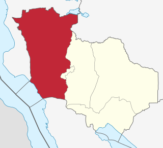
Rukwa Region(Mkoa wa Rukwa in Swahili) is one of Tanzania's 31 administrative regions The region covers a land area of 27,765 km2 (10,720 sq mi). The region is comparable in size to the combined land area of the nation state of Haiti. Rukwa Region is bordered to the north by Katavi Region, to the east by Songwe Region, to the south by the nation of Zambia and to the west by Lake Tanganyika, which forms a border between Tanzania and the Democratic Republic of the Congo. The regional capital is the municipality of Sumbawanga. According to the 2022 national census, the region had a population of 1,540,519.

Sumbawanga is a city located in western Tanzania. It is the capital of Rukwa Region and the municipal seat of Sumbawanga Urban District with postcode number 55100. The district had a population of approximately 303,986 based on the 2022 census. Sumbawanga lies in the territory of the Wafipa Fipa tribe and so many people speak Kifipa, as well as Kiswahili, the most widely used language of Tanzania. The name of the town literally translates as "throw away your witchcraft", thought to be a warning from local spiritual "healers" to any bringing in superstitions and practices relating to spiritual healers from other areas. Until the 1980s approximately, Sumbawanga was a place where many witch doctors were located. Though fewer in numbers, there are still some healers who practice both in town and in the surrounding smaller villages on the plateau. The town has the largest hospital in the region, Rukwa General Hospital, which is government funded, as well as the smaller Dr. Atiman Hospital administrated and run by the Catholic Diocese of Sumbawanga.
Mpanda District is one of the five districts of the Katavi Region of Tanzania. Its administrative seat is the city of Mpanda. The district is bordered to the northwest by the Kigoma Region, to the northeast by the Tabora Region, to the east by the Mbeya Region, to the southeast by the Sumbawanga Urban District, to the southwest by the Nkasi District and to the west by Lake Tanganyika.

Sumbawanga Urban District is one of the four districts in the Rukwa Region of Tanzania. It is bordered to the north by Lake Rukwa, to the east by the Mbeya Region, to the south by the Sumbawanga Rural District and to the west by the Nkasi District. The district capital is Sumbawanga.

Sumbawanga Rural District is one of three districts of the Rukwa Region of Tanzania. It is bordered to the northeast by the Sumbawanga Urban District, to the south by Zambia and to the northwest by the Nkasi District.
The Fipa are a Bantu ethno-linguistic group based in the Sumbawanga Rural and Nkasi districts of Rukwa Region in southwestern Tanzania speaking the Fipa and Mambwe languages. In 1992, the Fipa population was estimated to number 200,000, reduced to 195,000 in the 2002 census.

Uvinza is one of the eight administrative districts of Kigoma Region in Tanzania. Uvinza is bordered to the northwest by Kigoma District and Kigoma-Ujiji District. North of the district is bordered by Kasulu District. Lake Tanganyika borders the district on the west. Mpanda District in Katavi Region boders the district to the south and Kaliua District in Tabora Region borders the district to the east. The district is named in honor of the Vinza people whom the western part of district was their historic kingdom. Southern Uvinza District is home to the Mahale Mountains National Park. A unique park that is home to both Chimpanzees and lions in the same habitat.
Malangali is a ward in the city of Sumbawanga in Rukwa Region, Tanzania. According to the 2002 census, the ward has a total population of 4,050.
Mpanda is a city in Katavi Region of Tanzania, East Africa with a postcode number 50100. It is the administrative centre of Katavi Region, Mpanda District and is itself one of the four districts of the region.

Katavi Region is one of Tanzania's 31 administrative regions. The region covers an area of 45,843 km2 (17,700 sq mi). The region is comparable in size to the combined land area of the nation state of Estonia. Katavi Region is bordered to the east by Tabora Region. The region is bordered to the south by Rukwa Region and Songwe Region. Lastly, Katavi borders DRC on Lake Tanganyika to the west. The region derives its name from Katavi, the spirit of lake Tanganyika. The regional capital city is Mpanda. According to the 2022 national census, the region had a population of 1,152,958.

Kalambo District is one of the four districts of the Rukwa Region of Tanzania, East Africa. The administrative seat is in Matai. The Kalambo River flows through the district and its mouth on Lake Tanganyika is about 15 km south of the town of Kasanga.

Songwe Region is one of Tanzania's 31 administrative regions. The region covers a land area of 27,656 km2 (10,678 sq mi). The region is comparable in size to the combined land area of the nation state of Haiti. Songwe Region borders the countries of Zambia and Malawi to the south: Tunduma is the main entry point into Zambia while Isongole is the main entry point into Malawi. Songwe also borders the Tanzanian regions of Rukwa and Katavi in the west, Tabora in the north, and Mbeya in the east. Lake Rukwa is a major body of water in the western part of the region. The region was created on 29 January 2016 from the western half of Mbeya Region. The regional capital is Vwawa. According to the 2022 national census, the region had a population of 1,344,687.
The Ufipa Plateau is a highland in southwestern Tanzania. It lies mostly in Rukwa Region, near the border with Zambia. The plateau is named for the Fipa people who inhabit it.

Rusimbi is an administrative ward in Kigoma-Ujiji District of Kigoma Region in Tanzania. The ward covers an area of 0.7 km2 (0.27 sq mi), and has an average elevation of 783 m (2,569 ft). In 2016 the Tanzania National Bureau of Statistics report there were 7,462 people in the ward, from 6,779 in 2012.
Rubuga is an administrative ward in Kigoma-Ujiji District of Kigoma Region in Tanzania. The ward covers an area of 1.2 km2 (0.46 sq mi), and has an average elevation of 784 m (2,572 ft). In 2016 the Tanzania National Bureau of Statistics report there were 2,899 people in the ward, from 2,634 in 2012.
Sunuka is an administrative ward in Uvinza District of Kigoma Region in Tanzania. The ward covers an area of 799 km2 (308 sq mi), and has an average elevation of 930 m (3,050 ft). In 2016 the Tanzania National Bureau of Statistics report there were 39,651 people in the ward, from 36,023 in 2012.
Mpimbwe District is a district council in the Katavi Region of Tanzania's Southern Highlands established in 2012. The district lies in the south of the region on Lake Rukwa.
Nsimbo District is a district council in the Katavi Region of Tanzania's Southern Highlands established in 2012. The district lies in the middle of the region east of the city of Mpanda. It is a tropical environment of mostly forest reserves and agricultural economy.
