
The River Stour(, rhymes with "flour") is a river in Kent, England that flows into the North Sea at Pegwell Bay. Above Plucks Gutter, where the Little Stour joins it, the river is normally known as the Great Stour. The upper section of the river, above its confluence with the East Stour at Ashford is sometimes known as the Upper Great Stour or West Stour. In the tidal lower reaches, the artificial Stonar Cut short cuts a large loop in the natural river.

The City of Canterbury is a local government district with city status in Kent, England. As well as Canterbury itself, the district extends north to the coastal towns of Whistable and Herne Bay.

Chartham is a village and civil parish in the Canterbury district of Kent, England. It is situated on the Ashford side of the city, and is in the North Downs area of Outstanding Natural Beauty, 2.3 mi (4 km) south west of Canterbury, England. The Great Stour Way path passes through the village. A paper mill in the village has specialised in the production of tracing paper since 1938. There are numerous arable farms and orchards in the parish. The village has an unstaffed station, Chartham, and a staffed level crossing. It has an outlying locality sharing in many of the community resources, Chartham Hatch. It’s current Lord Mayor is Gary Dodd
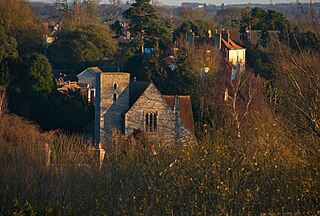
Harbledown is a village in Kent, England, immediately west of Canterbury and contiguous with the city. At local government level the village is designated as a separate civil parish, that of Harbledown and Rough Common. The High Street is a conservation area with many listed buildings, including a tall and intact Georgian terrace on the south side. The area includes several orchards for fruit on its outskirts, within the parish boundaries.

The Stour Valley Walk is a recreational walking route that follows the River Stour, through the Low Weald and Kent Downs, from its source at Lenham to its estuary at Pegwell Bay.

Trimley Marshes is a 77 hectare nature reserve west of Trimley St Mary, on the outskirts of Felixstowe in Suffolk. It is managed by the Suffolk Wildlife Trust. It is in the Suffolk Coast and Heaths Area of Outstanding Natural Beauty, the Orwell Estuary Site of Special Scientific Interest, the Stour and Orwell Estuaries Ramsar site internationally important wetland site and Special Protection Area under the European Union Directive on the Conservation of Wild Birds.

Sutton Ecology Centre Grounds is a 1.3 hectare Local Nature Reserve and Site of Borough Importance for Nature Conservation, Grade 1, in Carshalton in the London Borough of Sutton. It is owned by Sutton Council and managed by the Council together with the Friends of Sutton Ecology Centre.
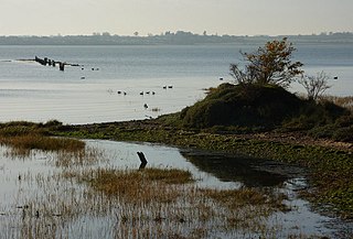
Stour Estuary is a 2,523 hectare biological and geological Site of Special Scientific Interest which stretches from Manningtree to Harwich in Essex and Suffolk. It is also an internationally important wetland Ramsar site, a Special Protection Area and a Nature Conservation Review site. It is part of the Suffolk Coast and Heaths Area of Outstanding Natural Beauty, and there are Geological Conservation Review sites in Wrabness, Stutton, and Harwich Part of the site is managed by the Royal Society for the Protection of Birds, and a small area is Wrabness Nature Reserve, a Local Nature Reserve managed by the Essex Wildlife Trust.

Swallowfield Meadow is a 0.7-hectare (1.7-acre) Local Nature Reserve in Swallowfield, south of Reading in Berkshire. It is owned and managed by Swallowfield Parish Council.

Tyler Hill Meadow is a 0.8-hectare (2.0-acre) Local Nature Reserve in Hackington, north of Canterbury in Kent. It is owned by Hackington Parish Council and managed by the council together with the Kentish Stour Countryside Project.

Stodmarsh SSSI is a 623.2-hectare (1,540-acre) biological Site of Special Scientific Interest near Stodmarsh, north-east of Canterbury in Kent. Parts of it are a Nature Conservation Review site, Grade I, a National Nature Reserve, a Ramsar internationally important wetland site, a Special Area of Conservation and a Special Protection Area under the European Union Directive on the Conservation of Wild Birds.
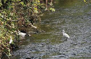
Bus Company Island is a 1.1-hectare (2.7-acre) Local Nature Reserve in Canterbury in Kent. It is owned and managed by Canterbury City Council.

Prince's Beachlands is a 6-hectare (15-acre) Local Nature Reserve north of Sandwich in Kent. It is owned by Dover Town Council and managed by Kent Wildlife Trust as part of the Sandwich Bay to Hacklinge Marshes nature reserve. It is part of the Sandwich and Pegwell Bay Nature Conservation Review site, Grade I, Thanet Coast and Sandwich Bay Ramsar site, Sandwich Bay Special Area of Conservation, Thanet Coast and Sandwich Bay Special Protection Area and Sandwich Bay to Hacklinge Marshes Site of Special Scientific Interest.

Whitehall Meadows is a 11.6-hectare (29-acre) Local Nature Reserve in Canterbury in Kent. It is owned and managed by Canterbury City Council.

Southrepps Common is a 5.6-hectare (14-acre) biological Site of Special Scientific Interest north of North Walsham in Norfolk. A larger area of 12.9-hectare (32-acre) is a Local Nature Reserve. It is owned by Southrepps Parish Council and managed by Southrepps Common Group. It is part of the Norfolk Valley Fens Special Area of Conservation.
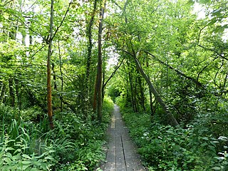
Brundall Church Fen is a 2.8-hectare (6.9-acre) Local Nature Reserve Norfolk. It is owned by Brundall Parish Council and managed by Brundall Parish Council and Norfolk County Council and the Broads Authority.
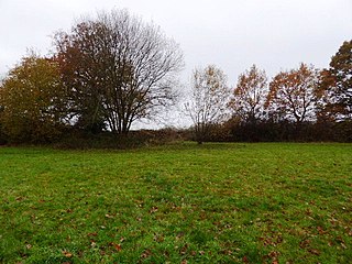
Centenary Fields is a 4.2-hectare (10-acre) Local Nature Reserve in Lingfield in Surrey. It is owned by Lingfield Parish Council and managed by Lingfield Wildlife Area Committee.

Shawford Down is a 19.6-hectare (48-acre) Local Nature Reserve south of Winchester in Hampshire. It is owned by Hampshire County Council and managed by Hampshire Countryside Service.


