The London Borough of Barnet is a local authority area on the northern outskirts of London. The borough was formed in 1965 from parts of the ceremonial counties of Middlesex and Hertfordshire. It is the second largest London borough by population with 389,344 inhabitants as of 2021, also making it the 17th largest district in England. The borough covers an area of 86.74 square kilometres (33 sq mi), the fourth highest of the 32 London boroughs, and has a population density of 45.8 people per hectare, which ranks it 25th.

The London Borough of Barking and Dagenham is a London borough in East London. It lies around 9 miles (14 km) east of Central London. The borough was created in 1965 as the London Borough of Barking; the name was changed in 1980. It is an Outer London borough and the south is within the London Riverside section of the Thames Gateway; an area designated as a national priority for urban regeneration. At the 2011 census it had a population of 187,000. The borough's three main towns are Barking, Chadwell Heath and Dagenham. The local authority is the Barking and Dagenham London Borough Council. Barking and Dagenham was one of six London boroughs to host the 2012 Summer Olympics.

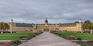
Karlsruhe is the third-largest city of the German state of Baden-Württemberg, after its capital Stuttgart and Mannheim, and the 22nd-largest city in the nation, with 308,436 inhabitants. It is also a former capital of Baden, a historic region named after Hohenbaden Castle in the city of Baden-Baden. Located on the right bank of the Rhine near the French border, between the Mannheim-Ludwigshafen conurbation to the north and Strasbourg to the south, Karlsruhe is Germany's legal center, being home to the Federal Constitutional Court, the Federal Court of Justice and the Public Prosecutor General.

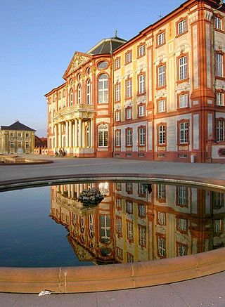
Bruchsal is a city at the western edge of the Kraichgau, approximately 20 km northeast of Karlsruhe in the state of Baden-Württemberg, Germany. It is located on Bertha Benz Memorial Route.

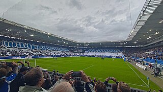
Karlsruher Sport-Club Mühlburg-Phönix e. V., better known as Karlsruher SC, is a German association football club, based in Karlsruhe, Baden-Württemberg that currently plays in the 2. Bundesliga, the second tier of German football. Domestically, the club was crowned German champion in 1909 and won the DFB-Pokal in 1955 and 1956. In Europe, KSC won the UEFA Intertoto Cup in 1996, which remains the club's last major honor.

Wildparkstadion, currently known as BBBank Wildpark for sponsorship reasons, is a football stadium located in Karlsruhe, Germany. It is the home of the football club Karlsruher SC.

The Karlsruhe Institute of Technology is both a German public research university in Karlsruhe, Baden-Württemberg, and a research center of the Helmholtz Association.

Germersheim station is a junction station in the town of Germersheim in the German state of Rhineland-Palatinate. Deutsche Bahn classifies it as a category 5 station and it has four platform tracks. The station is located in the network of the Karlsruher Verkehrsverbund and belongs to fare zone 575. Since 1996, Germersheim has also been part of the area where the tickets of the Verkehrsverbund Rhein-Neckar are accepted at a transitional rate. The address of the station is Bahnhofstraße 13.

The Hardt Railway is a railway line in the Karlsruhe region of Germany. Originally built as part of the Rhine Railway, a through main line, it now forms a branch line from Karlsruhe to Hochstetten. The line runs along the western edge of the forest of Hardtwald, from which it takes its name.

Grötzingen is a district in Karlsruhe, Germany. On December 31, 2020, it had a population of 9,156. It contains the Augustenburg Castle church and the Grötzingen Jewish Cemetery. Pfinztal lies just to the southeast.

The Karlsruhe tramway network is a network of tramways forming part of the public transport system in Karlsruhe, a city in the federal state of Baden-Württemberg, Germany.

Daxlanden is a district of Karlsruhe, Germany. The former fishing village lies west of the city center of Karlsruhe, near the Rhine on the river Alb and comprises about 11,500 inhabitants.

Grünwinkel is a district in the southwest of Karlsruhe, Germany.

The Dreieck Karlsruhe is a half-stack interchange in the German state of Baden-Württemberg.

Neureut is the northernmost district of Karlsruhe, Germany. It was the most populous rural community of Baden-Württemberg before being incorporated into Karlsruhe on February 14, 1975. Its population is about 18,920 people as of December 31, 2020.

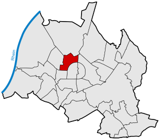
The Nordstadt is a district of Karlsruhe, Germany. It is the newest district and was founded on January 1, 1996.
The Karlsruhe Municipal Hospital is a hospital in Karlsruhe, Germany and the largest hospital in the middle upper rhine region. It is located in the Nordweststadt borough and has 1,591 beds. Of a total of 4,756 employees, 664 are physicians. In 2022, 191,585 people received outpatient care and 51,435 people received inpatient care. The Karlsruhe Municipal Hospital is a medical school hospital of the University Medical Center Freiburg.

Weststadt is a district in the west of Karlsruhe between the city center and the older district of Mühlburg. The most famous part of the district is the avenue Kaiserallee.

Südweststadt is a borough in Karlsruhe, Germany, located between Kriegsstraße and the main train station and west of the Karlsruhe Zoo.

Innenstadt-Ost is a district in the eastern center of Karlsruhe, Germany. The district, along with Innenstadt-West, forms the city center. Innenstadt-Ost is the oldest district of Karlsruhe and is located in the area of the former Klein-Karlsruhe, a village from which the city of Karlsruhe later developed.


