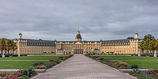
Karlsruhe is the third-largest city of the German state of Baden-Württemberg, after its capital Stuttgart and Mannheim, and the 22nd-largest city in the nation, with 308,436 inhabitants. It is also a former capital of Baden, a historic region named after Hohenbaden Castle in the city of Baden-Baden. Located on the right bank of the Rhine near the French border, between the Mannheim-Ludwigshafen conurbation to the north and Strasbourg to the south, Karlsruhe is Germany's legal center, being home to the Federal Constitutional Court, the Federal Court of Justice and the Public Prosecutor General.
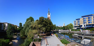
Pforzheim is a city of over 125,000 inhabitants in the federal state of Baden-Württemberg, in the southwest of Germany.
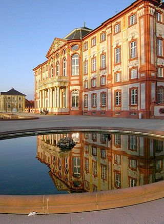
Bruchsal is a city at the western edge of the Kraichgau, approximately 20 km northeast of Karlsruhe in the state of Baden-Württemberg, Germany. It is located on Bertha Benz Memorial Route.
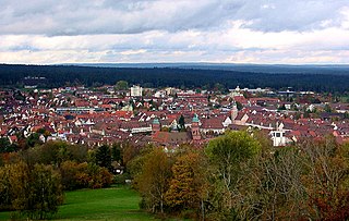
Freudenstadt is a town in Baden-Württemberg in southern Germany. It is the capital of the district Freudenstadt. The closest population centres are Offenburg to the west and Tübingen to the east.

Ettlingen is a town in Baden-Württemberg, Germany, about 8 kilometres (5 mi) south of the city of Karlsruhe and approximately 15 kilometres (9 mi) from the border with Lauterbourg, in France's Bas-Rhin department. Ettlingen is the second largest town in the district of Karlsruhe, after Bruchsal.
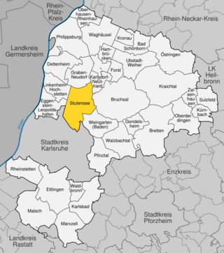
Stutensee is a town in northern Karlsruhe district in Baden-Württemberg, Germany.

Bietigheim-Bissingen is the second-largest town in the district of Ludwigsburg, Baden-Württemberg, Germany with 42,515 inhabitants in 2007. It is situated on the river Enz and the river Metter, close to its confluence with the Neckar, about 19 km north of Stuttgart, and 20 km south of Heilbronn.

Gaggenau is a town in the district of Rastatt, in Baden-Württemberg, Germany. It is located some 8 km northeast of Baden-Baden.

St Thomas' Church is a historic building in Strasbourg, eastern France. It is the main Lutheran church of the city since its cathedral became Catholic again after the annexation of the town by France in 1681. It is nicknamed the "Protestant Cathedral" or the Old Lady, and the only example of a hall church in the Alsace region. The building is located on the Route Romane d'Alsace. It is classified as a Monument historique by the French Ministry of Culture since 1862. Its congregation forms part of the Protestant Church of Augsburg Confession of Alsace and Lorraine.
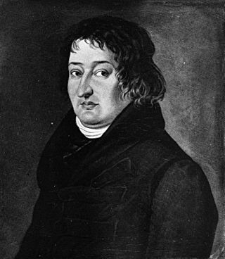
Friedrich Weinbrenner was a German architect and city planner admired for his mastery of classical style.

The Rhine Railway is a railway line in the German state of Baden-Württemberg, running from Mannheim via Karlsruhe to Rastatt, partly built as a strategic railway and formerly continuing to Haguenau in Alsace, now in France.

The Karlsruhe tramway network is a network of tramways forming part of the public transport system in Karlsruhe, a city in the federal state of Baden-Württemberg, Germany.

Karlsruhe-Hagsfeld station is a railway station in the Hagsfeld district in the municipality of Karlsruhe, located in Baden-Württemberg, Germany.

Rüppurr is a district in the south of Karlsruhe, Baden-Württemberg, Germany, with around 11,000 inhabitants. The district borders on the neighboring town of Ettlingen and is considered to be one of the more affluent residential areas in Karlsruhe.

The Hauptfriedhof in Karlsruhe is one of the oldest German communal rural cemeteries. In 1871, the first plans to build a new burial ground outside the city center began. The cemetery was laid out in 1874 by Josef Durm in the Rintheim district, east of the actual city, after the inner-city Alter Friedhof Karlsruhe in the Oststadt had become too small. The main cemetery has grown from its original size of 15.3 hectares in 1873 to over 34 hectares. The graves of more than 32,000 deceased are currently in the cemetery.

Beiertheim-Bulach is a district of Karlsruhe between Ebertstraße, Hofgut Scheibenhardt, Oberreut and Weiherfeld-Dammerstock. It consists of the formerly independent districts of Beiertheim and Bulach, which are separated by the Alb.

Oberreut is a district in the south of Karlsruhe. The town is located around 2.5 kilometers southwest of the city center of Karlsruhe and south of the Bundesstraße 10.

Knielingen is located in the northwest of Karlsruhe on the Rhine and is the oldest documented borough and, with around 2,000 hectares, the second largest borough in terms of area, after Durlach.

Weiherfeld-Dammerstock is a southern borough of Karlsruhe. In the north it is bordered by the Südtangente and in the east by Ettlinger Straße. The two districts of Weiherfeld and Dammerstock are separated by the Alb and are only connected by a road bridge and two pedestrian bridges.
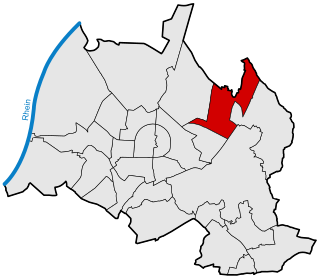
Hagsfeld is a borough in the north east of Karlsruhe. Hagsfeld borders the Stutensee borough of Blankenloch in the north, Weingarten in the northeast and the Karlsruhe boroughs Grötzingen in the east, Durlach in the southeast, Rintheim in the south and Waldstadt in the west.


