Nore

Last updated

Lightship Nore Lv-Nore.jpg
Lightship Nore

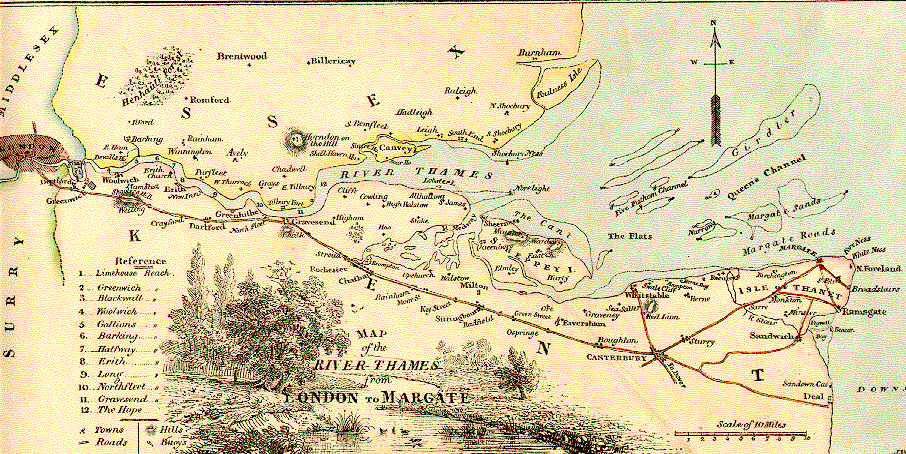
The Nore is a long bank of sand and silt running along the south-centre of the final narrowing of the Thames Estuary, England. Its south-west is the very narrow Nore Sand. Just short of the Nore's easternmost point where it fades into the channels it has a notable point once marked by a lightship on the line where the estuary of the Thames nominally becomes the North Sea. A lit buoy today stands on this often map-marked divisor: between Havengore Creek in east Essex and Warden Point on the Isle of Sheppey in Kent.

Contents

Until 1964 it marked the seaward limit of the Port of London Authority. As the sandbank was a major hazard for shipping coming in and out of London, in 1732 it received the world's first lightship. This became a major landmark, and was used as an assembly point for shipping. Today it is marked by the Sea Reach No. 1 Buoys.

The Nore is an anchorage, or open roadstead, used by the Royal Navy's North Sea Fleet, and to its local Command. It was the site of a notorious mutiny in 1797. The Great Nore is the cul-de-sac deep channel to the south of the Nore which opens out to the locally most deep water to the east, the Sheerness Approach.

Lightship and shape of shoal

The Nore is a hazard to shipping, so in 1732 the world's first lightship was moored over it [1] in an experiment by Robert Hamblin, who patented the idea. [2] This must have proved successful, as by 1819 England had nine lightships. [1] The Nore lightship was run by Trinity House, the general lighthouse authority for England, Wales, the Channel Islands and Gibraltar.

The early Nore lightships were small wooden vessels, often Dutch-built galliots. [1] By the end of the 19th century a larger ship with a revolving light had been instituted, but after about 1915 the authorities ceased to use one. Sea Reach No. 1 Buoy, as at 2006, marks the anchorage-point where the No.3 lightship stood, about midway between Shoeburyness, Essex and Sheerness, Kent.

The earlier line crossing the deeper eastern part of the shoal where No.1 lightship stood, the line between Havengore Creek, Essex and Warden Point, Kent remains the nominal (conventional) limit of the Thames with the North Sea.

Admiralty Chart No 1975 Kentish Knock and the Naze to The Nore, published 1934 Admiralty Chart No 1975 Kentish Knock and the Naze to The Nore, Published 1934.jpg
Admiralty Chart No 1975 Kentish Knock and the Naze to The Nore, published 1934

Royal Navy

The Nore has been the site of a Royal Navy anchorage since the age of sail, being adjacent to both the city and port of London and to the Medway, England's principal naval base and dockyard on the North Sea.

During the French Revolutionary War it was the scene of a notorious mutiny, when seamen protesting against their poor pay and working conditions refused orders and seized control of their ships in May 1797. The mutiny ended in June, and while the ringleaders were punished, much was done by the Admiralty to improve pay and conditions for the seamen.

In 1804, Jonathan Martin, would-be York Minster arsonist, was stationed aboard the 74-gun HMS Hercule here. [3]

From 1899 to 1955, the Royal Navy maintained a Commander-in-Chief, The Nore, a senior officer responsible for protecting the entrance to the port of London, and merchant traffic along the east coast of Britain. In the First World War the Nore Command principally had a supply and administrative function, [4] but in the Second World War it oversaw naval operations in the North Sea along the East coast of Britain, guarding against invasion and protecting trade. [5]

Fort

Also during the Second World War a series of defensive towers known as Maunsell Forts was built in the Thames estuary to protect the approach to London from air and sea attack. The Nore was the site of one of these, the Great Nore Tower. It was equipped with a battery of anti-aircraft guns and manned by a unit of the British Army. It was completed in 1943, but was abandoned at the end of hostilities. [6] It was badly damaged in a collision in 1953 and dismantled in 1959–1960.

Related Research Articles

<span class="mw-page-title-main">Trinity House</span> Official authority for lighthouses in England

The Corporation of Trinity House of Deptford Strond, also known as Trinity House, is the official authority for lighthouses in England, Wales, the Channel Islands and Gibraltar. Trinity House is also responsible for the provision and maintenance of other navigational aids, such as lightvessels, buoys, and maritime radio/satellite communication systems. It is also an official deep sea pilotage authority, providing expert navigators for ships trading in Northern European waters.

<span class="mw-page-title-main">Lightvessel stations of Great Britain</span>

The history of the many lightvessel stations of Great Britain goes back over 250 years to the placement of the world's first lightship at the Nore in the early 18th century.

<span class="mw-page-title-main">The Downs (ship anchorage)</span> Roadstead near the English Channel

The Downs is a roadstead in the southern North Sea near the English Channel off the east Kent coast, between the North and the South Foreland in southern England. During the month of August, 1511, Andrew Barton (privateer) was executed under wishes of Henry VIII as a result of his (Andrew's) interference with English cargoes. In 1639 the Battle of the Downs took place here, when the Dutch navy destroyed a Spanish fleet which had sought refuge in neutral English waters. From the Elizabethan era onwards, the presence of the Downs helped to make Deal one of the premier ports in England, and in the 19th century, it was equipped with its own telegraph and timeball tower to enable ships to set their marine chronometers.

<span class="mw-page-title-main">Port of London Authority</span> Port authority in the United Kingdom

The Port of London Authority (PLA) is a self-funding public trust established on 31 March 1909 in accordance with the Port of London Act 1908 to govern the Port of London. Its responsibility extends over the Tideway of the River Thames and its continuation. It maintains and supervises navigation, and protects the river's environment.

<span class="mw-page-title-main">Isle of Grain</span> Village in Kent, England

Isle of Grain is a village and the easternmost point of the Hoo Peninsula within the district of Medway in Kent, south-east England. No longer an island and now forming part of the peninsula, the area is almost all marshland and is a major habitat for diverse wetland birds. The village constitutes a civil parish, which at the 2011 census had a population of 1,648, a net decrease of 83 people in 10 years.

<span class="mw-page-title-main">Spithead and Nore mutinies</span> Two mutinies by British sailors in 1797

The Spithead and Nore mutinies were two major mutinies by sailors of the Royal Navy in 1797. They were the first in an increasing series of outbreaks of maritime radicalism in the Atlantic World. Despite their temporal proximity, the mutinies differed in character. The Spithead mutiny was a simple, peaceful, successful strike action to address economic grievances, while the Nore mutiny was a more radical action, articulating political ideals as well, which failed.

<span class="mw-page-title-main">Maunsell Forts</span> Series of historic fortified towers on the coast of England

The Maunsell Forts are armed towers built in the Thames and Mersey estuaries during the Second World War to help defend the United Kingdom. They were operated as army and navy forts, and named after their designer, Guy Maunsell. The forts were decommissioned during the late 1950s and later used for other activities including pirate radio broadcasting. One of the forts is managed by the unrecognised Principality of Sealand; boats visit the remaining forts occasionally, and a consortium named Project Redsands is planning to conserve the fort situated at Red Sands. The aesthetic attraction of the Maunsell forts has been considered to be associated with the aesthetics of decay, transience and nostalgia.

<span class="mw-page-title-main">Thames Estuary</span> Estuary in which the River Thames meets the waters of the North Sea

The Thames Estuary is where the River Thames meets the waters of the North Sea, in the south-east of Great Britain.

<span class="mw-page-title-main">HM Fort Roughs</span> Naval fort off the coasts of Suffolk and Essex, United Kingdom

HM Fort Roughs was one of several World War II installations that were designed by Guy Maunsell and known collectively as His Majesty's Forts or as Maunsell Sea Forts; the purpose of which was to guard the port of Harwich, Essex, and more broadly, the Thames estuary. This 4,500 ton artificial naval installation is similar in some respects to "fixed" offshore oil platforms. It is situated on Rough Sands, a sandbar located approximately 11 kilometres (6 nmi) from the coast of Suffolk and 13 kilometres (7 nmi) from the coast of Essex. Today it is the location and de facto capital of the unrecognised, self-proclaimed state of Sealand.

MV <i>Havengore</i>

Havengore is a former hydrographic survey launch, originally launched in 1956 for service with the Port of London Authority (PLA). After her withdrawal from service and sale in 1995, she was re-registered as a passenger vessel for up to 40 passengers. Based on the River Thames, Havengore has also served as a ceremonial vessel. She is best known for carrying the body of Sir Winston Churchill as part of his state funeral in 1965.

<span class="mw-page-title-main">Commander-in-Chief, The Nore</span> Military unit

The Commander-in-Chief, The Nore, was an operational commander of the Royal Navy. His subordinate units, establishments, and staff were sometimes informally known as the Nore Station or Nore Command. The Nore is a sandbank at the mouth of the Thames Estuary and River Medway. In due course the Commander-in-Chief became responsible for sub-commands at Chatham, London, Sheerness, Harwich and the Humber.

<span class="mw-page-title-main">Tideway</span> Part of the River Thames subject to tides

The Tideway is a part of the River Thames in England which is subject to tides. This stretch of water is downstream from Teddington Lock. The Tideway comprises the upper Thames Estuary including the Pool of London.

<span class="mw-page-title-main">Ambrose Channel</span> Only shipping channel in and out of the Port of New York and New Jersey.

Ambrose Channel is the only shipping channel in and out of the Port of New York and New Jersey. The channel is considered to be part of Lower New York Bay and is located several miles off the coasts of Sandy Hook, New Jersey, and Breezy Point, New York. Ambrose Channel terminates at Ambrose Anchorage, just south of the Verrazzano Narrows Bridge, the gateway to New York Harbor, where it becomes known as the Anchorage Channel. It is named for John Wolfe Ambrose, an engineer from New York.

English ship <i>London</i> (1656) HMS London (1656), 76-gun second-rate ship of the line

London was a 76-gun second-rate ship of the line in the Navy of the Commonwealth of England, originally built at Chatham Dockyard by shipwright John Taylor, and launched in June 1656. She gained fame as one of the ships that escorted Charles II from Holland back to England during the English Restoration, carrying Charles' younger brother James Duke of York, and commanded by Captain John Lawson.

The Black Deep is in the outer Thames Estuary. It is the greatest of three mainly natural shipping channels linking the Tideway to central zones of the North Sea without shoals, the others being the Barrow Deep and Princes Channel. Between these, a few others, and the shores of Kent, Suffolk and Essex are many long shoals in the North Sea, broadly shallow enough to wreck vessels of substantial draft at low tide.

The Kentish Knock is a long shoal in the North Sea east of Essex, England. It is the most easterly of those of the Thames Estuary and its core, which is shallower than 18 feet (5.5 m), extends 6 miles (9.7 km). Thus it is a major hazard to deep-draught navigation. It is exactly 28 miles (45 km) due east of Foulness Point, Essex and is centred about 15 miles (24 km) NNE of North Foreland, Kent – both are extreme points of those counties.

<span class="mw-page-title-main">Shoeburyness Boom</span> Defensive barrier in the Thames Estuary, England

<span class="mw-page-title-main">Swin (Thames)</span> A passage in the Thames estuary

The Swin is a passage in the Thames estuary between Maplin Sands, Foulness Sand and Gunfleet Sand northwest and the Barrow and Sunk sand ridges (shoals), southeast. The Swin was used by barges and leisure craft from the Essex rivers, and coasters and colliers from Hull, Great Grimsby, North East England, Edinburgh and other similar sets of trading ports.

Brighlingsea Naval Base was an installation of the British Royal Navy located at Brightlingsea, Essex, on the East Coast of England. In both wars it was part of the Nore Command, which had its HQ at Chatham, and in the Second was part of Harwich Sub-Command. It existed from late 1914 to 1921, and from early 1940 to 1947,

SB <i>George Smeed</i> A Thames sailing barge built in 1882

George Smeed is a Thames barge built in 1882 by Smeed Dean & Co. Ltd. in Murston.

References

  1. 1 2 3 "Trinity House: Lightvessels" PortCities London Archived 29 December 2007 at the Wayback Machine
  2. Chisholm, Hugh, ed. (1911). "Nore, The"  . Encyclopædia Britannica . Vol. 19 (11th ed.). Cambridge University Press. p. 742.
  3. The Prometheans: John Martin and the Generation that Stole the Future Max Adams (2010, Quercus), p.60
  4. The Nore Command during WWI at navalhistory.net. Retrieved 1 May 2016
  5. The Nore Command during WWII at navalhistory.net. Retrieved 1 May 2016
  6. Shepherd, E. W. (1979). The story of Southend Pier and its associations. Letchworth: Egon Publishers Ltd. ISBN   0-905858-11-5.

51°28′30″N0°46′40″E / 51.47500°N 0.77778°E / 51.47500; 0.77778