The Montana Department of Corrections is a state agency of Montana that operates state prisons and manages community-corrections programs. The agency has its headquarters in Helena.

The Inland Northwest or Inland Empire is a region of the Pacific Northwest centered on the Greater Spokane Area, that includes all of Eastern Washington and North Idaho. Western Montana is sometimes considered part of the Inland Northwest, but generally is not considered part of the Inland Empire. Under some definitions, the term Inland Empire also excludes Central Washington.
As of 2016 the U.S. Census Bureau estimated the region's population at 2,240,645, comparable to that of New Mexico. Its Canadian counterpart, north of the border, is the British Columbia Interior. Significant urban centers include the Spokane–Coeur d'Alene area and the Tri-Cities.

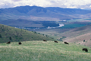
The Clark Fork, or the Clark Fork of the Columbia River, is a river in the U.S. states of Montana and Idaho, approximately 310 miles (500 km) long. The largest river by volume in Montana, it drains an extensive region of the Rocky Mountains in western Montana and northern Idaho in the watershed of the Columbia River. The river flows northwest through a long valley at the base of the Cabinet Mountains and empties into Lake Pend Oreille in the Idaho Panhandle. The Pend Oreille River in Idaho, Washington, and British Columbia, Canada which drains the lake to the Columbia in Washington, is sometimes included as part of the Clark Fork, giving it a total length of 479 miles (771 km), with a drainage area of 25,820 square miles (66,900 km2). In its upper 20 miles (32 km) in Montana near Butte, it is known as Silver Bow Creek. Interstate 90 follows much of the upper course of the river from Butte to northwest of Missoula. The highest point within the river's watershed is Mount Evans at 10,641 feet (3,243 m) in Deer Lodge County, Montana along the Continental Divide.
Foothills or piedmont are geographically defined as gradual increases in elevation at the base of a mountain range, higher hill range or an upland area. They are a transition zone between plains and low relief hills and the adjacent topographically higher mountains, hills, and uplands. Frequently foothills consist of alluvial fans, coalesced alluvial fans and dissected plateaus.

Montana Highway 200 (MT 200) in the U.S. state of Montana is a route running east-west covering the entire state of Montana. From the starting point at ID 200, near Heron, Montana the highway runs east to ND 200 near Fairview, Montana. It is part of a chain of state highways numbered 200 which extend from Idaho across Montana, North Dakota and Minnesota. Montana Highway 200 is also the longest route signed as a state highway in the United States.
Interstate 90 in Montana (I-90) is a portion of the east–west transcontinental Interstate 90 across the northern United States, linking Seattle to Boston. The portion in the state of Montana is 554.10 miles (891.74 km) in length, passing through fourteen counties in central and southern Montana.

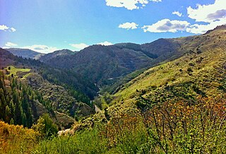
The Boulder Hills, el. 5,768 feet (1,758 m), is a set of foothills north of Boulder, Montana in Jefferson County, Montana.
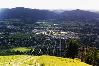
In Montana, the South Hills are the small foothills in various Montana communities, most notably those at el. 3,592 feet (1,095 m), south of Missoula, Montana in Missoula County, Montana. Several districts of Missoula, Montana are, also, in the South Hills.

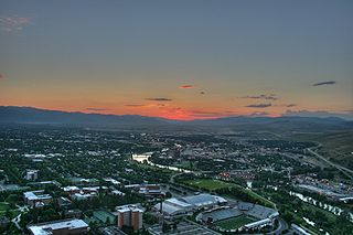
Downtown Missoula is the central business district in Missoula, Montana, and West-Central Montana. Downtown Missoula's rough boundaries are the Clark Fork River to its south, Madison St. to its east, the old U.S 93 highway/ North Orange St. to its west, and West Alder St. to its north, though parts south of the Clark Fork River are also at times mentioned. It is home to Ogren Park at Allegiance Field which is the venue for the Missoula Osprey. Downtown is also home to several parks, and historic buildings such as the Wilma Building.
The Montana Valley and Foothill grasslands are an ecoregion of northwestern North America in the northern United States and southern Canada.
Mount Jumbo, called by some locals as "Mount Loyola", is an iconic mountain that overlooks the city of Missoula, Montana. The mountain is northeast of the city’s downtown and, in its majority, is publicly owned. In 1996, Jumbo was purchased from private landowners and protected from development. Funding for this purchase came from an open space bond, federal and non-profit agencies and thousands of local contributors. Additional land parcels have been purchased since then, increasing the easement to its current 1,800 acres.
There is a list of neighborhoods that reside in the Sections of Missoula, Montana.
Note: The section names are in Bold and the zones that reside in a neighborhood are in italic.

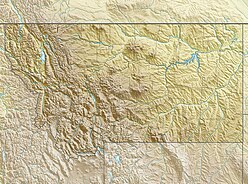
The Regional designations of Montana vary widely within the U.S state of Montana. The state is a large geographical area that is split by the Continental Divide, resulting in watersheds draining into the Pacific Ocean, Gulf of Mexico and Hudson's Bay. The state is approximately 545 miles (877 km) east to west along the Canada–United States border and 320 miles (510 km) north to south. The fourth largest state in land area, it has been divided up in official and unofficial ways into a variety of regions. Additionally, Montana is part of a number of larger federal government administrative regions.
The history of Missoula, Montana begins as early as 12,000 years ago with the end of the region's glacial lake period with western exploration dating back to the Lewis and Clark Expedition of 1804–1806. The first permanent settlement was founded in 1860.
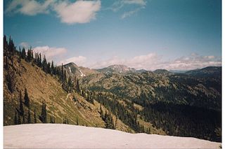
The Rattlesnake Mountains are a prominent mountain range located just 4 miles north of Missoula, Montana, USA. The highest point in the range is McLeod Peak,. Much of the range is protected in the Rattlesnake Wilderness and Rattlesnake National Recreation Area on the Lolo National Forest. An additional 36,000 acres (15,000 ha) of the range are protected on the Flathead Indian Reservation as the South Fork Tribal Primitive Area; this area is off-limits to non-tribal members. Including the Tribal Primitive Area, then, about 100,000 acres (40,000 ha) of the Rattlesnakes are roadless.

Frank Hargrave Woody was, among many occupations, the first mayor of Missoula, Montana. He was born in Chatham County, North Carolina and attended New Garden Boarding School in Greensboro, North Carolina. After teaching for several years he began moving westward in 1852 before eventually settling in what was then called Flathead county (today's Ravalli and Missoula Counties in Washington Territory where he was paid to drive supplies for trade with the native populations. Woody accompanied Christopher P. Higgins and Frank Worden in the establishment of Hellgate Village and later Missoula, Montana.
U.S. Highway 93 is a north–south United States Numbered Highway in the state of Montana.