
Jackson County is a county located in the U.S. state of Colorado. As of the 2020 census, the population was 1,379, and it was the fourth least populated in the state. The county is named after the United States President Andrew Jackson. The county seat and only municipality in the county is Walden.
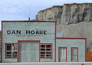
The Town of Kremmling is a Statutory Town in Grand County, Colorado, United States. The town population was 1,509 at the 2020 United States Census. The town sits along the upper Colorado River in the lower arid section of Middle Park between Byers Canyon and Gore Canyon. The town was founded in 1881 during the Colorado Silver Boom days, but the lack of mineral resources in the nearby mountains made the town grow very slowly in the early days.

Emery is a town in Emery County, Utah, United States. The population was 288 at the 2010 census.
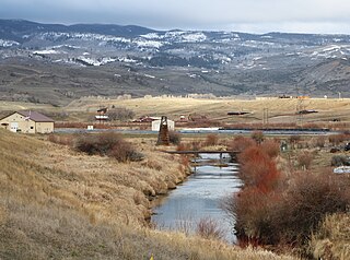
Muddy Creek is a tributary of the Colorado River, approximately 60.5 miles (97.4 km) long, in north central Colorado in the United States.

The Fremont River is a 95-mile (153 km) long river in southeastern Utah, United States that flows from the Johnson Valley Reservoir, which is located on the Wasatch Plateau near Fish Lake, southeast through Capitol Reef National Park to the Muddy Creek near Hanksville where the two rivers combine to form the Dirty Devil River, a tributary of the Colorado River.

North Park is a high, sparsely populated basin in the Rocky Mountains in north central Colorado in the United States. It encompasses a wide valley in Jackson County rimmed by mountain ranges at the headwaters of the North Platte River and several smaller tributaries, including the Michigan River, Illinois River, and Canadian River. The valley receives its name from being the northernmost of the three large mountain valleys in Colorado on the western side of the Front Range. The others are Middle Park and South Park respectively.
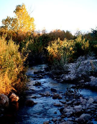
The Muddy River, formerly known as the Moapa River, is a short river located in Clark County, in southern Nevada, United States. It is in the Mojave Desert, approximately 60 miles (97 km) north of Las Vegas.

Muddy Pass is a high mountain pass in the Rocky Mountains of northern Colorado in the United States.

The Rabbit Ears Range is a mountain range of the Rocky Mountains in north-central Colorado in the United States. The range stretches east–west along the continental divide, forming the border between Grand and Jackson counties, and separating Middle Park (south) from North Park (north).
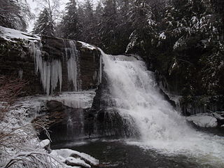
Swallow Falls State Park is a public recreation area located on the west bank of the Youghiogheny River nine miles (14 km) northwest of Oakland in Garrett County, Maryland, in the United States. The state park features Maryland's highest free-falling waterfall, the 53-foot (16 m) Muddy Creek Falls, as well as smaller waterfalls on the Youghiogheny River and Tolivar Creek. The park is notable for its stand of old hemlock trees, some more than 300 years old, "the last stand of its kind in Maryland."

The North River is a 55.3-mile-long (89.0 km) river in the mountains and Shenandoah Valley of northern Virginia, the United States. It joins the South River at Port Republic to form the South Fork Shenandoah River.

Mount Ellen is a mountain located in Garfield County, Utah, United States.
The Black Mountains, a mid-Miocene formation, in Nevada are a series of rugged, arid rocky volcanic mountains ranging in elevations to 3310 ft. The range lies on the north shore of Lake Mead, at the southwest corner of the Overton Arm, about 25 mi south of Overton, Nevada.

The Muddy Mountains are a large mountain range in Clark County, Nevada.
Muddy Fork is a tributary, about 6 miles (10 km) long, of the Sandy River in the U.S. state of Oregon. Arising at the base of Sandy Glacier on the west slope of Mount Hood, it flows west through the Mount Hood Wilderness in the Mount Hood National Forest. It joins the Sandy River in Old Maid Flat, about 5 miles (8 km) northeast of Rhododendron. The stream offers limited fishing for coastal cutthroat trout.
Muddy Creek is a tributary of the Willamette River that flows through parts of Lane and Linn counties in the U.S. state of Oregon. It begins near Coburg Ridge, northeast of Eugene, and meanders north across the floor of the Willamette Valley roughly parallel to the river. It joins the East Channel of the Willamette upstream of Corvallis.

Muddy Mountains Wilderness Area is a 48,154-acre wilderness area, which is a part of the Muddy Mountains in Clark County, Nevada. The area is a part of the Lake Mead National Recreation Area.
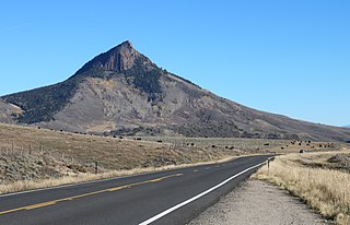
Whiteley Peak, elevation 10,092 ft (3,076 m), is a mountain in Grand County, Colorado north of Kremmling and close to U.S. Highway 40. The mountain is in the Rabbit Ears Range, a range composed chiefly of volcanic rock, and Whiteley Peak has some columnar jointing near the top.


