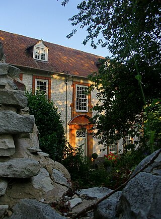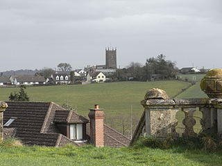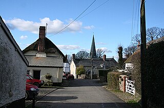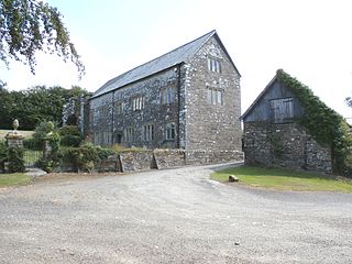
Callington is a civil parish and town in east Cornwall, England, United Kingdom about 7 miles (11 km) north of Saltash and 9 miles (14 km) south of Launceston.

South Molton is a town and civil parish in the North Devon district, in the county of Devon, England. The town is on the River Mole. In 2021 it had a population of 6225.

Boyton is a civil parish and village in Cornwall, England, United Kingdom. It is situated close to the River Tamar and the border with Devon about six miles (10 km) north of Launceston. According to the 2001 census it had a population of 378.This increased to 457 at the 2011 census.

Trotton with Chithurst is a civil parish in the Chichester district of West Sussex, England. Trotton is on the A272 road 7 miles (11 km) west of Midhurst. Chithurst is about 1 mile (1.6 km) north west of Trotton. The parish also contains the hamlet of Dumpford.

Treyford is a hamlet, Anglican parish and former civil parish, now in the civil parish of Elsted and Treyford, in the Chichester district of West Sussex, England. The hamlet sits on the Elsted to Bepton Road 4 miles (6.4 km) southwest of Midhurst. In 1931 the civil parish had a population of 104.

St Giles in the Wood is a village and civil parish in the Torridge district of Devon, England. The village lies about 2.5 miles east of the town of Great Torrington, and the parish, which had a population of 566 in 2001 compared with 623 in 1901, is surrounded clockwise from the north by the parishes of Huntshaw, Yarnscombe, High Bickington, Roborough, Beaford, Little Torrington and Great Torrington. Most of the Victorian terraced cottages in the village, on the east side of the church, were built by the Rolle Estate.

Cardinham is a civil parish and a village in mid Cornwall, England. The village is approximately three-and-a-half miles (6 km) east-northeast of Bodmin. The hamlets of Fletchersbridge, Millpool, Milltown, Mount, Old Cardinham Castle and Welltown are in the parish.

Filleigh is a small village, civil parish and former manor in North Devon, on the southern edge of Exmoor, 3.5 miles (5.6 km) west of South Molton. The village centre's street was, until the 1980s opening of the North Devon Link Road, the main highway between the North Devon administrative centre of Barnstaple and South Molton, leading westwards to Taunton. Much of the village's land is contained within grade I listed park and garden, Castle Hill, which straddles both sides of the Link Road providing a glimpse of some of it.

Old Arley is a village in the civil parish of Arley, in the north of Warwickshire, England, 5.5 miles (8.9 km) west of Nuneaton and 10 miles (16 km) north west of the city of Coventry.

Semer is a small village and civil parish in Suffolk, England. Located adjacent to a bridge over the River Brett on the B1115 between Hadleigh and Stowmarket, it is part of Babergh district. The parish also contains the hamlets of Ash Street and Drakestone Green.

Knowstone is a village and civil parish situated in the North Devon district of Devon, England, halfway between the Mid Devon town of Tiverton, Devon and the North Devon town of South Molton. The hamlet of East Knowstone lies due east of the village. Knowstone was the birthplace of Admiral Sir John Berry (1635–1691), second son of Rev. Daniel Berry (1609–1654), vicar of Knowstone cum Molland. An elaborate mural monument erected by Sir John in 1684 to the memory of his parents survives in Molland Church.

Swimbridge is a village, parish and former manor in Devon, England. It is situated 4 miles (6.4 km) south-east of Barnstaple and twinned with the town of St.Honorine Du Fay in Normandy, France. It was the home of the Rev. John "Jack" Russell who first bred the Jack Russell Terrier.

Molland is a small village, civil parish, dual ecclesiastical parish with Knowstone, located in the foothills of Exmoor in Devon, England. It lies within the North Devon local government district. At the time of the 2001 Census, the village had 203 inhabitants. Molland was first referenced as the Manor of Molland in the Domesday Book. The village contains a church dating back to the 1400s.

King's Nympton is a village, parish and former manor in the North Devon district, in Devon, England, in the heart of the rolling countryside between Exmoor and Dartmoor, some 4½ miles (7 km) S.S.W. of South Molton and 4 miles (6 km) N. of Chulmleigh. The parish exceeds 5,500 acres (2,226 ha) in area and sits mostly on a promontory above the River Mole which forms nearly half of its parish boundary. In 2021 the parish had a population of 444.
Chevithorne is a small village near Tiverton, Devon. It lies three miles to the North East of Tiverton. 'Chenetorne' is identified in two entries of Domesday Book: The first entry tells us the manor of Chevithorne, had a taxable value 0.6 geld units, and worth £2.3 to the lord in 1086. The holding was populated by 4 villagers. 2 smallholders. 8 slaves. There was enough ploughland for 2 lord's plough teams. and 2 men's plough teams and had, in addition, 0.12 lord's lands. 8 acres of meadow. 15 acres in pasture. and 3 acres of woodland. There were also 10 cattle and 60 sheep. The 'Lords' of this holding in 1086: are named as Alwin, and Beatrix . Ralph de Pomeroy was Tenant-in-chief, He was a large land holder in Devon, and his brother William held several properties as both lord and Tenant-in-Chief.
The Manor of Loxhore was a manor in the parish of Loxhore, North Devon, England.

South Radworthy is a hamlet in the civil parish of North Molton, in the North Devon District of the county of Devon, England. It is about three miles to the north of the village of North Molton and about fifteen miles to the east of the town of Barnstaple. The hamlet sits on an unclassified road and is surrounded by woodland.

Bremridge is a historic estate within the former hundred of South Molton in Devon, England. It is now within the parish of Filleigh but was formerly in that of South Molton. It is situated 8 miles north-west of South Molton. Since the construction of the nearby A361 North Devon Link Road direct access has been cut off from Bremridge to Filleigh and South Molton. The surviving wing of the mansion house built in 1654 is a Grade II* listed building. Bremridge Wood is the site of an Iron Age enclosure or hill fort, the earthwork of which is situated on a hillside forming a promontory above the River Bray. In Bremridge Wood survives a disused tunnel of the former Great Western Railway line between South Molton and Barnstaple, much of the course of which has been used for the A361. The tunnel is 319 yards long and was identified as "Bremridge Tunnel" in the 1889 Ordnance Survey map but as "Castle Hill Tunnel" in subsequent editions.
Kingthorpe is a hamlet in the West Lindsey district of Lincolnshire, England. The hamlet is in the civil parish of Apley, and is 10 miles (16 km) east from the city of Lincoln and 9 miles (14 km) south from the market town of Market Rasen. It sits on the B1202 road from Wragby to Bardney, and 1 mile (1.6 km) to the east from the parish village of Apley.

Harewood House was an ancient manor house, built originally by the Saxons, in Cornwall, England. Harewood Estate is surrounded by old mine workings, so the house faces towards Morwellham Quay.


