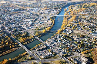
Red Deer is a city in central Alberta, Canada. It is located near the midpoint of the Calgary–Edmonton Corridor and is surrounded by Red Deer County. With a recorded population of 100,418 in the Canada 2016 census, Red Deer became the third Alberta city to surpass 100,000 people. The city is located in aspen parkland, a region of rolling hills that is home to oil, grain, and cattle production. It is a centre for oil and agriculture distribution, and the surrounding region is a major centre for petrochemical production.

Sherwood Park is a large hamlet in Alberta, Canada within Strathcona County that is recognized as an urban service area. It is located adjacent to the City of Edmonton's eastern boundary, generally south of Highway 16, west of Highway 21 and north of Highway 630. Other portions of Sherwood Park extend beyond Yellowhead Trail and Wye Road, while Anthony Henday Drive (Highway 216) separates Refinery Row to the west from the balance of the hamlet to the east.

Grande Prairie is a city in northwest Alberta, Canada within the southern portion of an area known as Peace River Country. It is located at the intersection of Highway 43 and Highway 40, approximately 456 km (283 mi) northwest of Edmonton. The city is surrounded by the County of Grande Prairie No. 1.

Leduc is a city in the province of Alberta, Canada. It is 33 km (21 mi) south of the provincial capital of Edmonton and is part of the Edmonton Metropolitan Region.

Sylvan Lake is a town in central Alberta, Canada. It is approximately 25 kilometres (16 mi) west of the City of Red Deer along Highway 11 or Highway 11A. It is on the southeast edge of Sylvan Lake, a 15-kilometre-long (9.3 mi) freshwater lake that straddles the boundary between Red Deer County and Lacombe County.

Drumheller is a town on the Red Deer River in the badlands of east-central Alberta, Canada. It is 110 kilometres (68 mi) northeast of Calgary and 97 kilometres (60 mi) south of Stettler. The Drumheller portion of the Red Deer River valley, often referred to as Dinosaur Valley, has an approximate width of 2 kilometres (1.2 mi) and an approximate length of 28 kilometres (17 mi).

Wetaskiwin is a city in the province of Alberta, Canada. The city is located 70 kilometres (43 mi) south of the provincial capital of Edmonton. The city name comes from the Cree word wītaskiwinihk, meaning "the hills where peace was made".
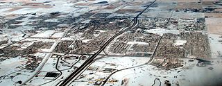
Airdrie is a city in Alberta, Canada within the Calgary Region. It is located north of Calgary within the Calgary–Edmonton Corridor at the intersection of Queen Elizabeth II Highway and Highway 567.
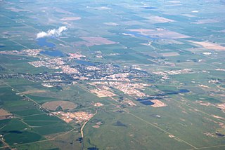
Brooks is a city in southeast Alberta, Canada that is surrounded by the County of Newell. It is located on Highway 1 and the Canadian Pacific Railway, approximately 186 km (116 mi) southeast of Calgary, and 110 km (68 mi) northwest of Medicine Hat. The city has an elevation of 760 m (2,490 ft).

Stony Plain is a town in the Edmonton Metropolitan Region of Alberta, Canada that is surrounded by Parkland County. It is west of Edmonton adjacent to the City of Spruce Grove and sits on Treaty 6 land.

Strathmore is a town located in southern Alberta, Canada that is surrounded by Wheatland County. It is along the Trans-Canada Highway approximately 50 kilometres (30 mi) east of Calgary.

Lacombe is a city in central Alberta, Canada. It is located approximately 25 kilometres (16 mi) north of Red Deer, the nearest major city, and 125 kilometres (78 mi) south of Edmonton, the nearest metropolitan area. The city is set in the rolling parkland of central Alberta, between the Rocky Mountains foothills to the west and the flatter Alberta prairie to the east.
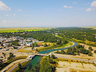
High River is a town within the Calgary Metropolitan Region of Alberta, Canada. It is approximately 68 kilometres (42 mi) south of Calgary, at the junction of Alberta Highways 2 and 23. High River had a population of 13,584 in 2006.

Strathcona was a city in Alberta, Canada on the south side of the North Saskatchewan River. Originally founded in 1891, it amalgamated with the City of Edmonton in 1912.

Central Alberta is a region located in the Canadian province of Alberta.

Beverly is a former urban municipality within the Edmonton Capital Region of Alberta, Canada. Beverly incorporated as a village on March 22, 1913 and became the Town of Beverly on July 13, 1914. It later amalgamated with the City of Edmonton on December 30, 1961. The population of Beverly was 8,969 at the time of amalgamation.
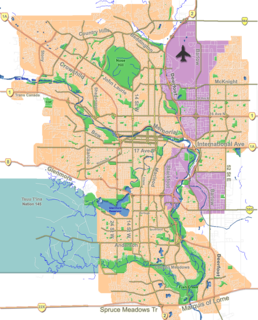
Forest Lawn is a neighbourhood and former town in the southeast quadrant of the city of Calgary, Alberta, Canada. The neighbourhood is bound by 26 Avenue SE to the south, 36 Street SE to the west, 8 Avenue SE to the north and portions of 52 Street SE and 48 Street SE to the east. The former town comprises the entire current Forest Lawn neighbourhood as well as portions of Southview and Albert Park/Radisson Heights to the west, and portions of Penbrooke Meadows and Forest Lawn Industrial to the east. Both the neighbourhood and the former town are bisected by the multicultural 17 Avenue SE. Forest Lawn has an area redevelopment plan in place and is part of the International Avenue Business Revitalization Zone.
According to the 2011 census, the City of Edmonton had a population of 812,201 residents, compared to 3,645,257 for all of Alberta, Canada. The total population of the Edmonton census metropolitan area (CMA) was 1,159,869, making it the sixth-largest CMA in Canada, while Statistics Canada estimated the CMA's 2011 population to be 1,196,342. In 2014, a municipal census indicated the city had a population of 877,926.

North Edmonton is a former village in Alberta, Canada that was absorbed by the City of Edmonton. The approximate geographic centre of the former village is the current intersection of Fort Road, 66 Street and 127 Avenue in northeast Edmonton. Its land is now occupied by the Edmonton neighbourhoods of Balwin, Belvedere, Industrial Heights, Kennedale Industrial and Yellowhead Corridor East.

In the 2011 Census, the City of Calgary had a population of 1,096,833 residents, representing 30% of the 3,645,257 residents in all of Alberta, and 3% compared to a population of 33,476,688 in all of Canada. The total population of the Calgary census metropolitan area (CMA) was 1,214,839. Calgary is the largest city in Alberta, and the third-largest municipality and fourth-largest metropolitan area in Canada, as of 2016.


