
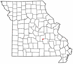
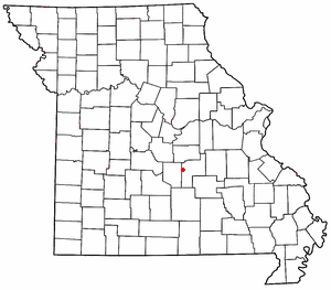
Northwye is a former community in Phelps County, Missouri, United States. [1] It lies at the north junction of U.S. Routes 63 and 66, approximately one mile north of Rolla. [2] The name refers to the Y-intersection of the two roads north of town.
Northwye is a former community in Phelps County, Missouri, United States. [1] It lies at the north junction of U.S. Routes 63 and 66, approximately one mile north of Rolla. [2] The name refers to the Y-intersection of the two roads north of town.

Phelps County is a county in the central portion of the U.S. state of Missouri. As of the 2020 United States Census, the population was 44,638. The largest city and county seat is Rolla. The county was organized on November 13, 1857, and was named for U.S. Representative and Governor of Missouri John Smith Phelps.
The Bourbeuse River is a river located in east-central Missouri, in the Ozarks region, and is one of two major tributaries of the Meramec River, the other being the Big River. The Bourbeuse flows to the northeast from its source near the locale of Dillon just northeast of Rolla in Phelps County, through Maries, Gasconade, Crawford, and Franklin counties, where it discharges into the Meramec River near Moselle. The elevation of the river at its source is approximately 1,140 feet (350 m) above sea level and at its mouth about 463 feet (141 m). The total length of the river is 154 miles (248 km), while the airline distance between source and mouth is 53 miles (85 km). The watershed area is 842.9 square miles (2,183 km2).

Lake Spring is an unincorporated community in northwest Dent County, Missouri, United States. It is located approximately twelve miles southeast of Rolla on Route 72.
Lecoma is an unincorporated community in northwestern Dent County, Missouri, United States. It is located approximately twelve miles south of Rolla.

Seaton is an unincorporated community in southeastern Phelps County, Missouri, United States. It is located approximately thirteen miles southeast of Rolla.
Flat is an unincorporated community in southern Phelps County, Missouri, United States. It is located approximately sixteen miles southwest of Rolla. The community is at the intersection of Missouri routes M and T. Edgar Springs lies about four miles to the southeast at the intersection of route M and U.S. Route 63. The headwaters of Mill Creek are just to the east of the community. The village lies within the boundaries of the Mark Twain National Forest.
Jerome is an unincorporated community in western Phelps County, Missouri, United States. It is located on the Gasconade River near Interstate 44, and is approximately ten miles west of Rolla, near the edge of the Mark Twain National Forest.

Vichy is an unincorporated community in southern Maries County, Missouri, United States. It is located on U.S. Route 63, approximately ten miles north of Rolla. The community was founded in 1880 and is named after Vichy, France. A post office called Vichy has been in operation since 1880. The Rolla National Airport, a former U.S. Army airfield owned and operated by the City of Rolla, with two 5,500 ft (1,700 m) asphalt runways, is located nearby. The ZIP Code for Vichy is 65580.
Knox National Forest was established in Kentucky by the U.S. Forest Service on June 5, 1925 with 22,660 acres (91.7 km2) from part of the Camp Knox Military Reservation. On April 6, 1928 the executive order for its creation was rescinded and the forest was abolished.
Vida is an unincorporated community in Phelps County, Missouri, United States. Vida is approximately six miles south of Rolla, near the junction of US Highway 63 and Missouri Route W. Vida is located at an elevation of 1033 feet above sea level. Vida can be found on Phelps County plat maps in Section 10, Township 36 N, Range 9 W.
Fort Wyman was an earthen fort built by the Union Army near Rolla, Missouri during the American Civil War.
Fort Dette, or as it was sometimes known, Star Fort, was a double-deck fortification built in a Greek Cross or "+" configuration in Rolla, Missouri. A blockhouse built in East Rolla, it was named Fort Dette, after Captain John F. W. Dette, an officer who supervised most of its construction. It was arranged for emplacement of artillery on the ends of both decks, it had a light field piece on the bottom deck, and a larger caliber gun, probably a 32- or 24- pounder, on the deck above. The upper deck was supported by upright log and timber walls below, which were pierced at regular intervals with loopholes for riflemen. The structure was one hundred and forty feet long across each arm, and was surrounded by a moat or ditch eight feet wide and four feet deep. A twenty-foot square powder magazine was safely buried below the bottom gun deck, and the works were crowned with a small guard house and observation platform in the middle of the upper deck.
Anutt is an unincorporated community in western Dent County, in the U.S. state of Missouri.
Lois is an unincorporated community in eastern Maries County, in the U.S. state of Missouri.
Spring Creek is a stream in Maries and Phelps counties of Missouri. It is a tributary of Gasconade River.
Dillon is an unincorporated community in Phelps County, in the U.S. state of Missouri. The community is located along the BNSF railroad line between Rolla and St. James.
Elk Prairie is an unincorporated community in Phelps County, in the U.S. state of Missouri. The community was located on Missouri Route 72 approximately seven miles south-southeast of Rolla.
Macedonia is an extinct town in northern Phelps County, in the U.S. state of Missouri.
Tick Creek is a tributary of the Gasconade River in northwestern Phelps County in the Ozarks of Missouri.
Rolla Township is an inactive township in Phelps County, in the U.S. state of Missouri.
Municipalities and communities of Phelps County, Missouri, United States | ||
|---|---|---|
| Cities |  | |
| Townships | ||
| Unincorporated communities | ||
| Ghost towns | ||
37°58′30″N91°45′21″W / 37.97500°N 91.75583°W
| | This Phelps County, Missouri state location article is a stub. You can help Wikipedia by expanding it. |