Related Research Articles

Phelps County is a county located in the central portion of the U.S. state of Missouri. As of the 2010 census, the population was 45,156. The largest city and county seat is Rolla. The county was officially organized on November 13, 1857, and was named after U.S. Representative and Governor of Missouri John Smith Phelps.

Camden County is a county located in the U.S. state of Missouri. As of the 2010 Census, the population was 44,002. Its county seat is Camdenton. The county was organized on January 29, 1841 as Kinderhook County and renamed Camden County in 1843 after Charles Pratt, 1st Earl Camden, Lord Chancellor of the United Kingdom and leader of the British Whig Party.

Hazelgreen is an unincorporated community in eastern Laclede County, Missouri, United States. It lies along historic U.S. Route 66, now an outer road of Interstate 44. The town is split by I-44, one mile west of the I-44 - Missouri Route 133 junction in adjacent Pulaski County. The Gasconade River is just north and west of the site.

Sherrill is an unincorporated community in northern Texas County, Missouri, United States. It is located approximately six miles north of Licking and is located just west of U.S. Route 63. Sherrill Creek flows past the north side of the community. The community of Beulah lies about 2.5 miles northwest on Sherrill Creek in Phelps County.
Plato is an incorporated village in northwestern Texas County, Missouri, United States. It is located approximately 20 miles northwest of Houston and 10 miles south of Fort Leonard Wood on Route 32. The population was 109 at the 2010 census.
Flat is an unincorporated community in southern Phelps County, Missouri, United States. It is located approximately sixteen miles southwest of Rolla. The community is at the intersection of Missouri routes M and T. Edgar Springs lies about four miles to the southeast at the intersection of route M and U.S. Route 63. The headwaters of Mill Creek are just to the east of the community. The village lies within the boundaries of the Mark Twain National Forest.

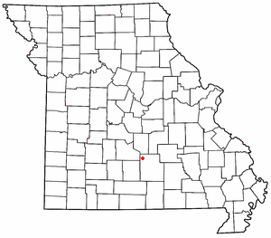
Laquey is an unincorporated community in Pulaski County, Missouri, United States.
Bloodland is a former community in southern Pulaski County, Missouri, United States. The community lies within Ft. Leonard Wood. The location is about 3.5 miles west-northwest of the community of Big Piney which sits adjacent to the east boundary of the Fort Leonard Wood and 4.5 miles north of the community of Palace, which is just outside the southern boundary of Fort Leonard Wood.
Cookville is an extinct town in southwestern Pulaski County, in the U.S. state of Missouri. The GNIS classifies it as a populated place. The town site is along Roubidoux Creek within the southern part of Fort Leonard Wood. The community of Greenview is located two miles to the west on Missouri Route 17 along the western boundary of the military reservation and adjacent to the Pulaski-Laclede county line.
Hatton is an unincorporated community in northwest Callaway County, in the U.S. state of Missouri. The community is on Missouri Route E 6.5 miles west of Auxvasse.
Tavern Creek is a stream in Miller and Pulaski counties in the U.S. state of Missouri. It is a tributary of the Osage River. The stream headwaters are at 37°54′42″N92°22′19″W and the confluence with the Osage is at 38°19′04″N92°17′24″W.
De Camp is an extinct town in eastern Phelps County, in the U.S. state of Missouri. The community was located on the Elliott Branch of Norman Creek, approximately three-quarters of one mile east of Missouri Route F and about six miles south of St. James.
Little Piney Creek is a stream in the Phelps, Texas and Dent counties of the Ozarks of southern Missouri. It is a tributary of the Gasconade River.
Mungy Branch is a stream in northwestern Phelps and northeastern Pulaski counties in the Ozarks of the U.S. state of Missouri. It is a tributary of Duncan Creek.
Relfe is an extinct town in western Phelps County, in the U.S. state of Missouri. The GNIS classifies it as a populated place.
Yancy Mills is an unincorporated community in Phelps County, Missouri, United States.
Spring Creek Township is an inactive township in Phelps County, in the U.S. state of Missouri.
Hanna is a former community in southwestern Pulaski County, in the U.S. state of Missouri.
Hawkeye is an unincorporated community in the northwest corner of Pulaski County, in the U.S. state of Missouri. The Pulaski-Camden county line is one-half mile to the west and the Pulaski-Miller county line is one mile to the north. Missouri Route U passes through the community. The community is on a ridge at an elevation of 1106 feet at the head of the north flowing Barren Fork, the northeast flowing Clinkingbeard Creek to the east and tributaries of west flowing Deane Creek to the south and west.
Ladd is an unincorporated community in northwestern Texas County, in the U.S. state of Missouri.
References
- ↑ U.S. Geological Survey Geographic Names Information System: Spring Creek
- ↑ Devils Elbow, Missouri, 7.5 Minute Topographic Quadrangle, USGS, 1954 (1985 rev)
- ↑ Missouri Atlas & Gazetteer, DeLorme, 1998, First edition, pp. 46 and 54, ISBN 0-89933-224-2
- ↑ "Post Offices". Jim Forte Postal History. Retrieved 5 December 2016.
- ↑ "Phelps County Place Names, 1928–1945". The State Historical Society of Missouri. Archived from the original on June 24, 2016. Retrieved December 5, 2016.
Municipalities and communities of Phelps County, Missouri, United States | ||
|---|---|---|
| Cities |  | |
| Townships | ||
| Unincorporated communities | ||
| Ghost towns | ||
Coordinates: 37°45′45″N92°01′27″W / 37.76250°N 92.02417°W
| This United States ghost town-related article is a stub. You can help Wikipedia by expanding it. |
| This Phelps County, Missouri state location article is a stub. You can help Wikipedia by expanding it. |