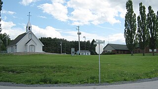
Notre-Dame-de-Ham

Last updated
Notre-Dame-de-Ham
Municipality
Notre-Dame-de-Ham Quebec location diagram.png
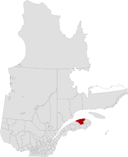
Location within Arthabaska RCM.
Canada Southern Quebec location map.png
Red pog.svg
Notre-Dame-de-Ham
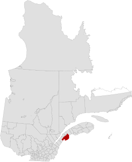
Location in southern Quebec.
Coordinates: 45°54′N71°44′W / 45.900°N 71.733°W / 45.900; -71.733 Coordinates: 45°54′N71°44′W / 45.900°N 71.733°W / 45.900; -71.733 [1]
CountryFlag of Canada.svg  Canada
Province Flag of Quebec.svg  Quebec
Region Centre-du-Québec
RCM Arthabaska
Constituted October 7, 1898
Government [2]
  Mayor France McSween
   Federal riding Richmond—Arthabaska
   Prov. riding Drummond–Bois-Francs
Area [2] [3]
  Total 32.90 km2 (12.70 sq mi)
  Land 32.18 km2 (12.42 sq mi)
Population (2011) [3]
  Total 414
  Density 12.9/km2 (33/sq mi)
  Pop 2006-2011Decrease2.svg 2.4%
Time zone EST (UTC−5)
  Summer (DST) EDT (UTC−4)
Postal code(s) G0P 1C0
Area code(s) 819
HighwaysQc161.svg Route 161
Website www.notre-dame-de-ham.ca

Notre-Dame-de-Ham, Quebec is a municipality in Centre-du-Québec, Quebec, Canada.

Centre-du-Québec Region in Quebec, Canada

Centre-du-Québec is a region of Quebec, Canada. The main centres are Drummondville, Victoriaville, and Bécancour. It has a land area of 6,928.78 km² and a 2006 census population of 224,200 inhabitants.
Quebec Province of Canada

Quebec is one of the thirteen provinces and territories of Canada. It is bordered to the west by the province of Ontario and the bodies of water James Bay and Hudson Bay; to the north by Hudson Strait and Ungava Bay; to the east by the Gulf of Saint Lawrence and the province of Newfoundland and Labrador; and to the south by the province of New Brunswick and the U.S. states of Maine, New Hampshire, Vermont, and New York. It also shares maritime borders with Nunavut, Prince Edward Island, and Nova Scotia. Quebec is Canada's largest province by area and its second-largest administrative division; only the territory of Nunavut is larger. It is historically and politically considered to be part of Central Canada.

Canada Country in North America

Canada is a country in the northern part of North America. Its ten provinces and three territories extend from the Atlantic to the Pacific and northward into the Arctic Ocean, covering 9.98 million square kilometres, making it the world's second-largest country by total area. Canada's southern border with the United States, stretching some 8,891 kilometres (5,525 mi), is the world's longest bi-national land border. Its capital is Ottawa, and its three largest metropolitan areas are Toronto, Montreal, and Vancouver. As a whole, Canada is sparsely populated, the majority of its land area being dominated by forest and tundra. Consequently, its population is highly urbanized, with over 80 percent of its inhabitants concentrated in large and medium-sized cities, with 70% of citizens residing within 100 kilometres (62 mi) of the southern border. Canada's climate varies widely across its vast area, ranging from arctic weather in the north, to hot summers in the southern regions, with four distinct seasons.

Related Research Articles

Rivière-du-Loup City in Quebec, Canada

Rivière-du-Loup is a small city on the south shore of the Saint Lawrence River in Quebec. The city is the seat for the Rivière-du-Loup Regional County Municipality and the judicial district of Kamouraska.

Beauharnois-Salaberry Regional County Municipality Regional county municipality in Quebec, Canada

Beauharnois-Salaberry is a regional county municipality in the Montérégie region of Quebec, Canada. Its seat is Beauharnois.

Bécancour Regional County Municipality Regional county municipality in Quebec, Canada

Bécancour is a regional county municipality in the Centre-du-Québec region of Quebec, Canada. Its seat is Bécancour.

La Haute-Gaspésie Regional County Municipality Regional county municipality in Quebec, Canada

La Haute-Gaspésie is a regional county municipality in the Gaspésie–Îles-de-la-Madeleine region of eastern Quebec, Canada, on the Gaspé peninsula. The regional county municipality seat is in Sainte-Anne-des-Monts.

Marguerite-DYouville Regional County Municipality Regional county municipality in Quebec, Canada

Marguerite-D'Youville is a regional county municipality located in the Montérégie region of southwestern Quebec, Canada. The seat is in Verchères.

La Rivière-du-Nord Regional County Municipality Regional county municipality in Quebec, Canada

La Rivière-du-Nord is a regional county municipality in the Laurentides region of Quebec, Canada. The seat is in Saint-Jérôme. It is named for the river that runs through it, the Rivière du Nord.

Minganie Regional County Municipality Regional county municipality in Quebec, Canada

Minganie is a regional county municipality in the Côte-Nord region of Quebec, Canada. It includes Anticosti Island. Its seat is Havre-Saint-Pierre.

Rivière-du-Loup Regional County Municipality Regional county municipality in Quebec, Canada

Rivière-du-Loup is a regional county municipality in the Bas-Saint-Laurent region of Quebec, Canada. Its most important city is Rivière-du-Loup, which contains more than half of the population.

Robert-Cliche Regional County Municipality Regional county municipality in Quebec, Canada

Robert-Cliche is a regional county municipality in the Chaudière-Appalaches region in southeastern Quebec, Canada, on the Chaudière River, between La Nouvelle-Beauce Regional County Municipality and Beauce-Sartigan Regional County Municipality.

Témiscamingue Regional County Municipality Regional county municipality in Quebec, Canada

Témiscamingue is a regional county municipality in the Abitibi-Témiscamingue region of western Quebec, Canada. The county seat is Ville-Marie.

Témiscouata Regional County Municipality Regional county municipality in Quebec, Canada

Témiscouata is a regional county municipality in the Bas-Saint-Laurent region of Quebec, Canada. It is located southeast of Rivière-du-Loup, bordering New Brunswick, and is centred on Lake Témiscouata. Its seat is Témiscouata-sur-le-Lac.

Beauceville, Quebec City in Quebec, Canada

Beauceville is a city in, and the seat of, the Municipalité régionale de comté Robert-Cliche in Quebec, Canada. It is part of the Chaudière-Appalaches region and the population was 6,354 as of the Canada 2011 Census.

Lotbinière, Quebec Municipality in Quebec, Canada

Lotbinière is a municipality in Lotbinière Regional County Municipality in Quebec, Canada. It is part of the Chaudière-Appalaches region and the population was 887 as of the Canada 2011 Census. It is named after the seigneurie of which it was part. Bordered in the northwest by the Saint Lawrence River, Lotbinière is part of the Most Beautiful Villages of Quebec network.

Wôlinak, Quebec First Nations reserve in Quebec, Canada

Wôlinak is an Abenaki First Nations reserve in the Centre-du-Québec region, Quebec, Canada. An enclave within the city of Bécancour, it was one of the Seven Nations of Canada.

Sacré-Cœur-de-Jésus, Quebec Parish municipality in Quebec, Canada

Sacré-Cœur-de-Jésus is a parish municipality located in Les Appalaches Regional County Municipality in the Chaudière-Appalaches region of Quebec, Canada. Its population was 564 as of the Canada 2011 Census.

Saint-Camille-de-Lellis, Quebec Parish municipality in Quebec, Canada

Saint-Camille-de-Lellis is a parish in the Les Etchemins Regional County Municipality in Quebec, Canada. It is part of the Chaudière-Appalaches region and the population is 844 as of the Canada 2011 Census. It is named after Saint Camillus de Lellis, but also commemorates Reverend Camille-Stanislas Brochu, first priest of the parish.

Saint-Lambert-de-Lauzon, Quebec Municipality in Quebec, Canada

Saint-Lambert-de-Lauzon is a municipality in La Nouvelle-Beauce Regional County Municipality in Quebec, Canada. It is part of the Chaudière-Appalaches region and the population is 6,177 as of the Canada 2011 Census. Prior to June 22, 2013 it was a parish municipality.

Sainte-Marie, Quebec City in Quebec, Canada

Sainte-Marie is a city in the province of Quebec. It is the seat of the Municipalité régionale de la Nouvelle-Beauce, in Chaudière-Appalaches. The population was 12,889 as of the Canada 2011 Census, and was 99.0% French-speaking as of 2006. It is located 59 kilometres (37 mi) south-east of Quebec City, on the Chaudière River.

Saint-Just-de-Bretenières Municipality in Quebec, Canada

Saint-Just-de-Bretenières is a municipality in Quebec. It is located on the Canada–United States border.

Whitworth, Quebec Indian reserve in Quebec, Canada

Whitworth is an Indian reserve in the Bas-Saint-Laurent region of Quebec. It is geographically located within the territory of Rivière-du-Loup Regional County Municipality but is not legally part of it. Its population was 0 in the Canada 2006 Census and it appears to have been left out of the Canada 2011 Census.

References