Oberhausen (near Neuburg)

Last updated
Oberhausen
Oberhausen (bei Neuburg an der Donau) St. Clemens 956.jpg
Church of Saint Clemens
Wappen Oberhausen bei Neuburg.svg
Location of Oberhausen within Neuburg-Schrobenhausen district
Oberhausen in ND.svg
Germany adm location map.svg
Red pog.svg
Oberhausen
Bavaria location map.svg
Red pog.svg
Oberhausen
Coordinates: 48°43′N11°7′E / 48.717°N 11.117°E / 48.717; 11.117 Coordinates: 48°43′N11°7′E / 48.717°N 11.117°E / 48.717; 11.117
Country Germany
State Bavaria
Admin. region Oberbayern
District Neuburg-Schrobenhausen
Government
   Mayor (202026) Fridolin Gößl [1] (CSU)
Area
  Total31.94 km2 (12.33 sq mi)
Highest elevation
445 m (1,460 ft)
Lowest elevation
420 m (1,380 ft)
Population
 (2020-12-31) [2]
  Total3,098
  Density97/km2 (250/sq mi)
Time zone UTC+01:00 (CET)
  Summer (DST) UTC+02:00 (CEST)
Postal codes
86697
Dialling codes 08431
Vehicle registration ND
Website https://oberhausen-donau.de/

Oberhausen is a municipality in the Neuburg-Schrobenhausen district in the state of Bavaria in Germany.

Contents

Oberhausen combines historic Oberhausen, Unterhausen, Sinning and Kreut.

Neighboring communities include Rennertshofen, Burgheim, Ehekirchen, Rohrenfels, Königsmoos and Neuburg an der Donau.

Bahnhof Unterhausen is the local train station.

Population

The population as of January, 2005:

municipality total2,618
Oberhausen1,079
Sinning781
Unterhausen722
Kreut36

History

In 1214, Oberhausen and Unterhausen were documented.

There were heavy casualties and great damage to Oberhausen and Unterhausen during World War II. In the woods just outside Sinning, there are reinforced, concrete bunkers built during World War II that still exist today.

In 1972, Oberhausen, Unterhausen and Sinning were combined under the name Oberhausen. In 1994, Kreut was added to the municipality.

The four communities

Oberhausen is made up of Oberhausen, Unterhausen, Sinning, Kreut.

Oberhausen

Oberhausen was first documented in 1214.

Unterhausen

Grumoldshausen or Grünwaldshausen oder Grimoldshausen, the original name of Unterhausen, was created in the 8th century.

Sinning

Sinning was first documented in 1176.

Kreut

Kreut joined the municipality in 1994.

Related Research Articles

Flossenbürg, Bavaria Municipality in Bavaria, Germany

Flossenbürg is a municipality in the district of Neustadt an der Waldnaab in Bavaria in Germany. The state-approved leisure area is located in the Bavarian Forest and borders Bohemia in the east. During World War II, the Flossenbürg concentration camp was located here.

Bergheim, Bavaria Municipality in Bavaria, Germany

Bergheim is a municipality in the Neuburg-Schrobenhausen district of the state of Bavaria in Germany.

Burgheim Municipality in Bavaria, Germany

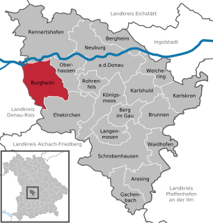
Burgheim is a municipality in the Neuburg-Schrobenhausen district in the state of Bavaria in Germany. It is a market town.

Gunzenhausen Town in Bavaria, Germany

Gunzenhausen is a town in the Weißenburg-Gunzenhausen district, in Bavaria, Germany. It is situated on the river Altmühl, 19 kilometres (12 mi) northwest of Weißenburg in Bayern, and 45 kilometres (28 mi) southwest of Nuremberg. Gunzenhausen is a nationally recognized recreation area. It is noted as being at one end of part of The Limes Germanicus, a Roman border wall, and a UNESCO World Heritage Site.

Schmidmühlen Municipality in Bavaria, Germany

Schmidmühlen is a municipality in the district of Amberg-Sulzbach in Bavaria in Germany. It is situated at the junction of the Vils and Lauterach rivers.

Mistelgau Municipality in Bavaria, Germany

Mistelgau is a municipality in the district of Bayreuth in Bavaria in Germany. The eponymous village is the seat of both the municipality as well as the municipality association Mistelgau.

Neuburg an der Kammel Municipality in Bavaria, Germany

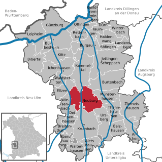
Neuburg is a municipality in the district of Günzburg in Bavaria in Germany.

Saal an der Donau Place in Bavaria, Germany

Saal is a municipality in the district of Kelheim in Bavaria in Germany. It is located along the banks of the Danube River, around 25 km southwest of Regensburg.

Aresing Municipality in Bavaria, Germany

Aresing is a municipality in the district of Neuburg-Schrobenhausen in Bavaria in Germany.

Berg im Gau Municipality in Bavaria, Germany

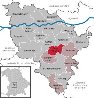
Berg im Gau is a municipality in the district of Neuburg-Schrobenhausen in Bavaria in Germany.

Brunnen, Bavaria Municipality in Bavaria, Germany

Brunnen is a municipality in the district of Neuburg-Schrobenhausen in Bavaria in Germany.

Ehekirchen Municipality in Bavaria, Germany

Ehekirchen is a municipality in the district of Neuburg-Schrobenhausen in Bavaria, Germany.

Gachenbach Municipality in Bavaria, Germany

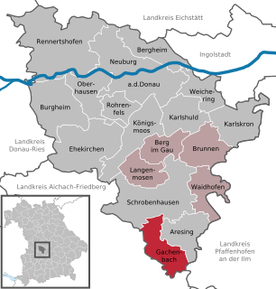
Gachenbach is a municipality in the district of Neuburg-Schrobenhausen in Bavaria in Germany.

Karlshuld Municipality in Bavaria, Germany

Karlshuld is a municipality in the district of Neuburg-Schrobenhausen in Bavaria in Germany.

Königsmoos Municipality in Bavaria, Germany

Königsmoos is a municipality in the district of Neuburg-Schrobenhausen in Bavaria in Germany.

Rennertshofen Municipality in Bavaria, Germany

Rennertshofen is a municipality in the district of Neuburg-Schrobenhausen in Bavaria in Germany.

Rohrenfels Municipality in Bavaria, Germany

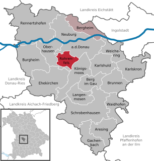
Rohrenfels is a municipality in the district of Neuburg-Schrobenhausen in Bavaria in Germany.

Waidhofen, Bavaria Municipality in Bavaria, Germany

Waidhofen is a municipality in the district of Neuburg-Schrobenhausen in Bavaria in Germany.

Reichertshausen Municipality in Bavaria, Germany

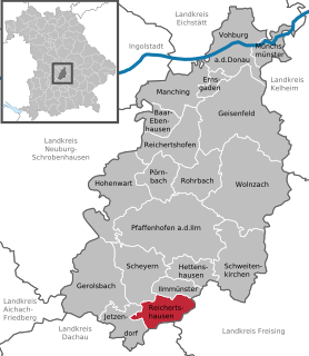
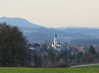
Reichertshausen is a municipality in the district of Pfaffenhofen in Bavaria in Germany and is near the A9 and between Munich and Ingolstadt.

Oberhausen, Weilheim-Schongau Municipality in Bavaria, Germany

Oberhausen is a municipality in the Weilheim-Schongau district, in Bavaria, Germany.

References

  1. Liste der ersten Bürgermeister/Oberbürgermeister in kreisangehörigen Gemeinden, Bayerisches Landesamt für Statistik, 15 July 2021.
  2. "Tabellenblatt "Daten 2", Statistischer Bericht A1200C 202041 Einwohnerzahlen der Gemeinden, Kreise und Regierungsbezirke". Bayerisches Landesamt für Statistik (in German). June 2021.