
The Alpine region of Switzerland, conventionally referred to as the Swiss Alps, represents a major natural feature of the country and is, along with the Swiss Plateau and the Swiss portion of the Jura Mountains, one of its three main physiographic regions. The Swiss Alps extend over both the Western Alps and the Eastern Alps, encompassing an area sometimes called Central Alps. While the northern ranges from the Bernese Alps to the Appenzell Alps are entirely in Switzerland, the southern ranges from the Mont Blanc massif to the Bernina massif are shared with other countries such as France, Italy, Austria and Liechtenstein.

The Swiss rail network is noteworthy for its density, its coordination between services, its integration with other modes of transport, timeliness and a thriving domestic and trans-alp freight system. This is made necessary by strong regulations on truck transport, and is enabled by properly coordinated intermodal logistics.

Mount Whitney is the tallest mountain in the contiguous United States and the Sierra Nevada, with an elevation of 14,505 feet (4,421 m). It is located in East–Central California, on the boundary between California's Inyo and Tulare counties, 84.6 miles (136.2 km) west-northwest of the lowest point in North America at Badwater Basin in Death Valley National Park at 282 ft (86 m) below sea level. The west slope of the mountain is in Sequoia National Park and the summit is the southern terminus of the John Muir Trail which runs 211.9 mi (341.0 km) from Happy Isles in Yosemite Valley. The east slope is in the Inyo National Forest in Inyo County.

The Matterhorn is a mountain of the Alps, straddling the main watershed and border between Switzerland and Italy. It is a large, near-symmetric pyramidal peak in the extended Monte Rosa area of the Pennine Alps, whose summit is 4,478 metres (14,692 ft) high, making it one of the highest summits in the Alps and Europe. The four steep faces, rising above the surrounding glaciers, face the four compass points and are split by the Hörnli, Furggen, Leone/Lion, and Zmutt ridges. The mountain overlooks the Swiss town of Zermatt, in the canton of Valais, to the north-east and the Italian town of Breuil-Cervinia in the Aosta Valley to the south. Just east of the Matterhorn is Theodul Pass, the main passage between the two valleys on its north and south sides, and a trade route since the Roman Era.

Zermatt is a municipality in the district of Visp in the German-speaking section of the canton of Valais in Switzerland. It has a population of about 5,800 inhabitants and is classified as a town by the Swiss Federal Statistical Office (FSO).
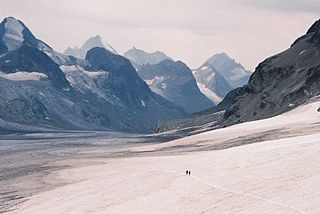
The Haute Route, is the name given to a route undertaken on foot or by ski touring between Chamonix in France and Zermatt in Switzerland.

The Kleine Scheidegg is a mountain pass at an elevation of 2,061 m (6,762 ft), situated below and between the Eiger and Lauberhorn peaks in the Bernese Oberland region of Switzerland. The name means "minor watershed", even though it is actually higher than the neighbouring Grosse Scheidegg. Possibly this is because Kleine Scheidegg is a watershed between the two arms of the Lütschine river, while Grosse Scheidegg divides the Lütschine from the Rychenbach stream.

Mount Baw Baw is a mountain on the Baw Baw Plateau and Great Dividing Range, located in Victoria, Australia. The mountain peak falls within the boundaries of the Mount Baw Baw Alpine Resort, which is an unincorporated area of Victoria separate from the Shire of Baw Baw.
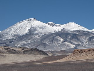
Peak bagging or hill bagging is an activity in which hikers, climbers, and mountaineers attempt to reach a collection of summits, published in the form of a list. This activity has been popularized around the world, with lists such as 100 Famous Japanese Mountains, the Sacred Mountains of China, the Seven Summits, and the eight-thousanders becoming the subject of mass public interest.

The Dufourspitze is the highest peak of Monte Rosa, a huge ice-covered mountain massif in the Alps. Dufourspitze is the highest mountain peak of both Switzerland and the Pennine Alps and is also the second-highest mountain of the Alps and Western Europe, after Mont Blanc. It is located between Switzerland and Italy.

Monte Rosa is a mountain massif located in the eastern part of the Pennine Alps. It is located between Italy and Switzerland (Valais). Monte Rosa is the second highest mountain in the Alps and western Europe, after Mont Blanc.

The Bernese Oberland is the higher part of the canton of Bern, Switzerland, in the southern end of the canton, and one of the canton's five administrative regions.

Lyskamm, also known as Silberbast, is a mountain in the Pennine Alps lying on the border between Switzerland and Italy. It consists of a five-kilometre-long ridge with two distinct peaks. The mountain has gained a reputation for seriousness because of the many cornices lying on the ridge and the frequent avalanches, thus leading to its nickname the Menschenfresser.
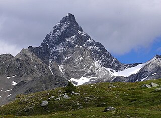
Piz Kesch (German) or Piz d'Es-cha (Rumantsch) is a peak in the Albula Alps of the Rhaetian Alps in Switzerland. At 3,418 metres (11,214 ft), it is the highest peak in the Albula Alps and the municipality of Bergün, Grisons.

The Ober Gabelhorn is a mountain in the Pennine Alps in Switzerland, located between Zermatt and Zinal.
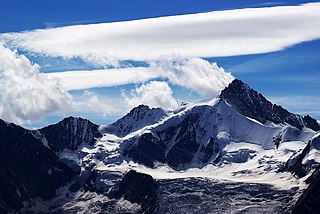
The Zinalrothorn is a mountain in the Pennine Alps in Switzerland. Its name comes from the village of Zinal lying on the north side and from the German word Rothorn which means Red Peak. When it was first climbed in 1864 the mountain was known locally as Moming.
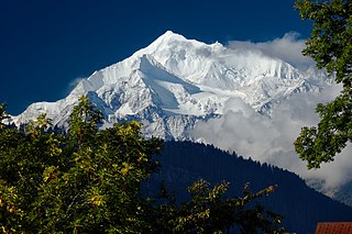
The Weisshorn is a major peak of the Swiss Alps, culminating at 4,506 metres above sea level. It is part of the Pennine Alps and is located between the valleys of Anniviers and Zermatt in the canton of Valais. In the latter valley, the Weisshorn is one of the many 4000ers surrounding Zermatt, with Monte Rosa and the Matterhorn.

The Mettelhorn is a mountain of the Swiss Pennine Alps, located near Zermatt in the canton of Valais.

The Unterrothon is a mountain of the Swiss Pennine Alps, overlooking Zermatt in the canton of Valais. It is located west of the Oberrothorn, on the range north of the Findel Glacier.

The Hahnenmoos Pass is a mountain pass of the Bernese Alps. The pass crosses the col between the peaks of Regenboldshorn and Albristhorn, at an elevation of 1,950 m (6,400 ft). The Hahnenmoos Pass is the lowest pass between the Engstligental, to the east, and the upper Simmental, to the west.


