
Ocean Park is a neighbourhood of South Surrey, a region of Surrey, British Columbia.
Ocean Park is a neighbourhood of South Surrey, a region of Surrey, British Columbia.

Ocean Park was part of the territory of the Semiahmoo people, one of a group of tribes called the Straits Salish, a division of the Coast Salish.
They used this place for spiritual renewal and named the area "Kwomais" which literally means place of vision, because of its high bluffs and unobstructed views to the ocean and islands. Kwomais Point is marked on many early navigation maps and has long been used as a lookout point. [1] For protection against the raids of the Yukulta people, the Semiahmoo built a fort in Ocean Park possibly between 1820 and 1830. The fort fell into disrepair in colonial times. Today, the site is a subdivision called Indian Fort Drive near the west end of 20th Avenue.
In 1886, early pioneer Ben Stevenson acquired 350 acres (140 ha) of land and built a large home overlooking Semiahmoo Bay.
In the early 1900s, 136 acres (55 ha) were acquired in order to provide the members of the Methodist church a place where they could vacation. Promotional materials named the area “Ocean Park”, [2] and in 1910 the church offered its first summer camp. In 1925 the Methodist Church joined with The United Church of Canada, and the camp was administered by British Columbia Conference of the church. Over the years bits of the property were sold for housing. In 2007 the last remaining 13 acres (5.3 ha) of the site were sold to the City of Surrey as parkland. Camp Kwomais was the second oldest camp accredited with BC Camping and the oldest camp using its original campsite.
In 1912, campers built a small shed beside the tracks of the recently completed railroad. The Great Northern Railway reluctantly accepted it as a stop, thereby giving easier access to vacation spots in Ocean Park for residents of Vancouver and New Westminster.
In 1921, Ocean Park opened its first post office, which was featured in Ripley's Believe It or Not! as 'the world's smallest post office'. The 6 feet (1.8 m)-by-6-feet building was later expanded to 6 feet (1.8 m)-by-12-feet. [3]
In 1925, the Ocean Park Community Hall opened after a community fundraising campaign. The Hall continues to be the focus for the community and has been home to hundreds of social gatherings and special events for thousands over generations. The Hall’s 75th anniversary in 2000 resulted in a special edition of the Ocean Parker, a volunteer community newspaper. The Hall is operated by the Ocean Park Community Association.
In the 1950s, Ocean Park’s first residential telephone was installed at the house of firefighter Derek Uren.
In 1958, the volunteer fire hall was built by the community, seven years after a house fire killed a woman and her two sons. [4]
In 1985, Fun Fun Park was created by community volunteers as the first “Volunteers in Parks” in BC. 12-year-old Jessica Tuttle was awarded 10 silver dollars for her winning entry in the naming contest. [5]
In 2002, the community association’s Ocean Park Area Livability Study identified three main community issues: 1) traffic concerns 2) lack of policing and vandalism 3) lack of community recreation opportunities, especially for youth and seniors. [6]
49°01.6′N122°52.275′W / 49.0267°N 122.871250°W Ocean Park is the most western part of the Semiahmoo Peninsula, bounded by the waters of Semiahmoo Bay and Boundary Bay. On land, Ocean Park borders the neighbourhood of Crescent Beach to the north and the city of White Rock to the east.
Ocean Park has a business and shopping centre. [1] In 2006, actors Danny DeVito and Matthew Broderick starred in the movie Deck the Halls on a purpose-built set in Ocean Park. [7]
Ocean Park is served by four elementary schools: Crescent Park Elementary School, Ocean Cliff Elementary School, Ray Shepherd Elementary and Laronde Elementary School. Both Crescent Park and Laronde offer French Immersion programs.
St. Mark's Anglican Church opened in 1966. The Surrey Public Library operates a branch in Ocean Park.
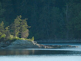
There are two waterfront walks in Ocean Park. 1001 Steps Park, at the foot of 128th Street near Camp Kwomais, has stairs down to waterfront access and nature trails. Ocean Park Shoreline Walk is a tidal-beach walk. The beach is a clothing-optional one just as the Wreck Beach.
Ocean Park has morning and afternoon commuter bus service to Bridgeport Station operated by TransLink (British Columbia) on route 352 Ocean Park/Bridgeport Station via the South Surrey Park & Ride. All day service on a 30-minute frequency is provided by the #350 Crescent Beach / White Rock Centre service.
Places adjacent to Ocean Park, Surrey | |
|---|---|

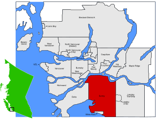
Surrey is a city in British Columbia, Canada. It is located south of the Fraser River on the Canada–United States border. It is a member municipality of the Metro Vancouver regional district and metropolitan area. Mainly a suburban city, Surrey is the province's second-largest by population after Vancouver and the third-largest by area after Abbotsford and Prince George. Seven neighbourhoods in Surrey are designated town centres: Cloverdale, Fleetwood, Guildford, Newton, South Surrey, and City Centre encompassed by Whalley.
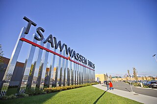
Tsawwassen is a suburban, mostly residential community on a peninsula in the southwestern corner of the City of Delta in British Columbia, Canada. It provides the only road access to the American territory on the southern tip of the peninsula, the community of Point Roberts, Washington, via 56th Street. It is also the location of Tsawwassen Ferry Terminal, part of the BC Ferries, built in 1959 to provide foot-passenger and motor vehicle access from the Lower Mainland to the southern part of Vancouver Island and the southern Gulf Islands. Because Tsawwassen touches a shallow bank, the ferry terminal is built at the southwestern end of a 3 km (1.9 mi) causeway that juts into the Strait of Georgia. Boundary Bay Airport, a major training hub for local and international pilots which also provides local airplane and helicopter service, is ten minutes away. The Roberts Bank Superport is also nearby.

White Rock is a city in British Columbia, Canada, and a member municipality of the Metro Vancouver Regional District. It is bordered by Semiahmoo Bay to the south and is surrounded on three sides by Surrey. To the southeast across a footbridge lies the Semiahmoo First Nation, which is within the borders of Surrey. Semiahmoo Bay and the Southern Gulf Islands in the Strait of Georgia are also to the south.

Boundary Bay is a shallow bay situated on the Pacific coast of North America on the Canada–United States border between the Canadian province of British Columbia and the U.S. state of Washington.

The Juan de Fuca Marine Trail is a rugged 47 kilometres (29 mi) wilderness hiking trail located within Juan de Fuca Provincial Park along the southwestern coast of Vancouver Island, British Columbia, Canada. The trail stretches from China Beach, 35 kilometres (22 mi) west of Sooke, to Botanical Beach, just outside Port Renfrew.

South Surrey is a community within the City of Surrey, British Columbia, located on the Semiahmoo peninsula in the southern portion of the City of Surrey, sharing a border with the City of White Rock. Neighbourhoods of South Surrey include Crescent Beach, Crescent Heights, Elgin, Chantrell Creek, Morgan Creek, Grandview Heights, Hazelmere, Ocean Park, and Sunnyside. Most of South Surrey lies in White Rock's population centre.
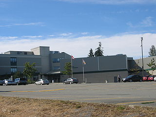
Earl Marriott Secondary (EMS) is a public high school in the Vancouver suburb of Surrey, British Columbia, Canada and is part of School District 36 Surrey. It is referred to as the 'Home of the Mariners'. It is located on the edge of city limits, on 16th Avenue.
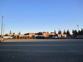
Semiahmoo Secondary School is a public high school in South Surrey, British Columbia, and is part of School District 36 Surrey. It was founded in 1940 as the first senior secondary school in South Surrey. The school serves grades eight through twelve.

Crescent Beach is a beachside community within the South Surrey town centre of Surrey, British Columbia, Canada next to Boundary Bay and Mud Bay, across from Delta, British Columbia. It is home to 1,200 residents, mostly in single-family homes.

Semiahmoo Bay is the southeastern section of Boundary Bay on the Pacific coast of North America in British Columbia, Canada. The bay is named for the Semiahmoo First Nation, who originally occupied the area. The Semiahmoo Peninsula borders the bay and was home to cannery operations. It is now home to the Semiahmoo Golf Resort.
Semiahmoo First Nation is the band government of the Semiahmoo people, a Coast Salish subgroup. The band's main community and offices are located on the 312 acres (1.3 km2) Semiahmoo Indian Reserve which is sandwiched between the boundary of White Rock, British Columbia and the Canada–United States boundary and Peace Arch Provincial Park.

Semiahmoo Spit is a spit that protrudes from the westernmost expanse of shore on Semiahmoo Peninsula between Semiahmoo Bay and Drayton Harbor off the coast of Blaine in Whatcom County, Washington state. The spit is home to Semiahmoo Park.

The Campbell River passes through Surrey and Langley, British Columbia, Canada, entering Semiahmoo Bay at the Semiahmoo Indian Reserve, which lies between the City of White Rock and Peace Arch Park on the international boundary.

The Semiahmoo are a Coast Salish indigenous people whose homeland is in the Lower Mainland region of southwestern British Columbia, Canada. According to Chief James “Jimmy” Charles (1867-1952), chief of the Semiahmoo from 1909 to 1952, the word Semiahmoo means “half-moon,” and describes the shape of Semiahmoo Bay.
Sunnyside is a neighbourhood of South Surrey, which in turn is a region of Surrey, British Columbia, Canada.

Fern Ridge is a neighbourhood of Langley, British Columbia. It is located in the southwestern area of Langley Township, near Campbell Valley Regional Park. 200th Street, or Carvolth Road, runs south through Fern Ridge, and TransLink provides hourly bus service during daylight hours to Langley City. There is one church in the community, a Mennonite church.
The Snokomish were a Halkomelem-speaking Coast Salish people whose territory was primarily located across the Boundary Bay area. The Snokomish were also known as the Derby people, as their territory included a portion of the Fraser River, near Derby, British Columbia.
Chuckanut Bay is a crescent-shaped bay about three miles (4.8 km) long in southwestern Whatcom County, directly south of Bellingham, Washington, United States. The bay was formed along the axis of a plunging syncline during the formation of the Chuckanut Mountains. It is situated on the east shore of the Salish Sea at the southeast end of Bellingham Bay. The bay was named Puerto del Socorro by Lieut. Juan Francisco de Eliza in 1791. The present name was chosen by Capt. Henry Roeder on December 1, 1852. The name 'Chuckanut' is derived from a native word for "Long beach far from a narrow entrance" Prominent natural features include Pleasant Bay located south of Chuckanut Bay, Mud Bay to the north and Chuckanut Island and Chuckanut Rocks to the west. Other natural features include Teddy Bear Cove, Governors Point and Clark Point. The most prominent creeks that drain into the bay are Chuckanut Creek and Fragrance Lake Outlet. The bay is home to interesting tafoni formations found in the area.
Grandview Heights is a neighbourhood in the South Surrey town centre of Surrey, British Columbia, Canada.