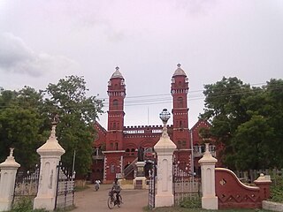
Ramanathapuram, also known as Ramnad, is a town and a municipality in Ramanathapuram district in the Indian state of Tamil Nadu. It is the administrative headquarters of Ramanathapuram district and the second largest town in Ramanathapuram district.
Ramanathapuram District, also known as Ramnad District, is one of the 38 districts an administrative districts of Tamil Nadu state in southern India. The old Ramanathapuram District consists of Present day Virudhunagar and Sivagangai districts, it touches the Western ghats and bordered with the state of Kerala and east by Bay of Bengal. It was the largest district on that time. The town of Ramanathapuram is the district headquarters. Ramanthapuram District has an area of 4,123 km2. It is bounded on the north by Sivaganga District, on the northeast by Pudukkottai District, on the east by the Palk Strait, on the south by the Gulf of Mannar, on the west by Thoothukudi District, and on the northwest by Virudhunagar District. The district contains the Pamban Bridge, an east–west chain of low islands and shallow reefs that extend between India and the island nation of Sri Lanka, and separate the Palk Strait from the Gulf of Mannar. The Palk Strait is navigable only by shallow-draft vessels. As of 2011, Ramanathapuram district had a population of 1,353,445 with a sex-ratio of 983 females for every 1,000 males. The district is home to the pilgrimage center of Rameswaram.
Pudukkottai District is one of the 38 districts of Tamil Nadu state in southern India. The city of Pudukkottai is the district headquarters. It is also known colloquially as Pudhugai.
Virudhunagar District is a district of Tamil Nadu state in south India. Virudhunagar is the district headquarters of Virudhunagar district. Virudhunagar district was formed by the separation of Old Ramanathapuram District in 1987 into Ramanathapuram District, Sivagangai District and the west part as Virudhunagar District. Virudhunagar District was formerly called Karmavirer Kamarajar District. As of 2011, Virudhunagar district had a population of 1,942,288 with a sex-ratio of 1,007 females for every 1,000 males. Sivakasi is the most populous and largest city in the district.
R. S. Mangalam, also known as Raja Singa Mangalam, is a panchayat town in Ramanathapuram district in the Indian state of Tamil Nadu. It is located 35 Kilometres north from the district headquarters Ramanathapuram.

Wandoor is a town in Nilambur Taluk, Malappuram District, Kerala, India. It is located on the southeast of Chaliyar River, about 24 kilometres northeast of the district seat Malappuram, and 8 km south of the taluk seat Nilambur. In the year 2011, the town has a population of 50,973.
Erikuthi is a village in Gudiyatham Taluk, Vellore District, Tamil Nadu, India. It lies near the state boundary with Andhra Pradesh, about 16 kilometres west of the subdistrict capital Gudiyatham, and 45 kilometres west of the district capital Vellore. As of 2011, it had a population of 8,057.
Orur is a small village located in Tiruvadanai taluk, Ramanathapuram district, Tamil Nadu, India. It is situated 35 km from Devakottai, Sivagangai. As of the 2011 Census of India, the village had a population of 5,065 across 1,171 households. There were 2,470 males and 2,595 females.
Erumeli North is a village in Kanjirappally Taluk, Kottayam District, Kerala, India. It is located near the boundary with Idukki District, about 34 kilometres southeast of the district seat Kottayam, and about 6 kilometres southeast of the taluk seat Kanjirappally. In 2011, it has a population of 40,511.
Chinchali is a village in Raybag Taluk, Belagavi District, Karnataka, India. It is located near the state boundary with Maharashtra, approximately 84 kilometres north of the district seat Belgaum, and 10 kilometres northeast of the taluk seat Raibag. In the year 2011, the village has a population of 18,986.
Tiruvadanai taluk is a taluk of Ramanathapuram district of the Indian state of Tamil Nadu. The headquarters of the taluk is the town of Tiruvadanai.[uppor post]]kadaloor]
Ramanathapuram taluk is a taluk in the Ramanathapuram district of Tamil Nadu, India. The headquarters is the district seat of Ramanathapuram.
Mohare is a village in Bailhongal Taluk, Belagavi District of Karnataka, India. It is located near the state border with Maharashtra, about 26 kilometres east of the district seat Belgaum, and 16 kilometres northwest of the taluk seat Bailhongal. As of 2011, it has a total population of 2,365.
Thiruvetriyur is a Village in Tiruvadanai taluk, Ramanathapuram district, Tamil Nadu in southern India.
Appanur, is a village in the Kadaladi Taluk of Ramanathapuram District in Tamil Nadu, India. It is located between Mudukulathur and Sayalgudi, on the State Highway 29 (SH29).
Sellur is a village in Ramanathapuram district and Mudukulathur taluka in the Indian state of Tamil Nadu.
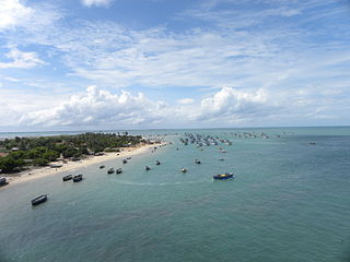
Alagankulam is a village situated on the east coast in the Ramanathapuram taluk and district in India. The village is situated on the banks of the Vaigai River and is about 3 kilometres (1.9 mi) away from the seashore. The village is located 18 kilometres (11 mi) east of Ramanathapuram. The village had a population of 15,473 at the 2011 census.

Kuruva is a village in Perinthalmanna Taluk, Malappuram District, Kerala, India. It is located along the National Highway 966, about 6 kilometres southeast of the district seat Malappuram, and 13 kilometres northwest of the taluk seat Perinthalmanna. As of the 2011 India Census, the population was 38,153.
Jalalpur is a village in Raybag Taluk, Belagavi District, Karnataka, India. It is located near the state border with Maharashtra, approximately 83 kilometres north of the district seat Belgaum, and 6 kilometres north of the taluk seat Raibag. As of 2011, it had a total population of 4,496.
Mathighatta is a village in Chikkanayakahalli Taluk, Tumkur District, Karnataka, India. It is situated along the Karnataka State Highway 73, about 24 kilometres west of the district seat Tumkur, and 33 kilometres southeast of the taluk seat Chikkanayakana Halli. As of 2011, the village had a population of 1,843.

