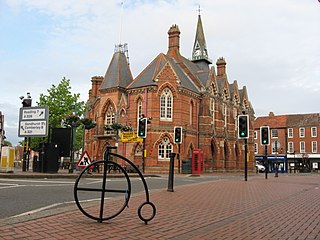
Wokingham is a market town and civil parish in Berkshire, England, 37 miles (60 km) west of London, 7 miles (11 km) southeast of Reading, 8 miles (13 km) north of Camberley and 4 miles (6 km) west of Bracknell. It is the main administrative centre of the wider Borough of Wokingham. At the 2021 census the parish had a population of 38,284 and the wider built-up area had a population of 50,325.

Harwell is a village and civil parish in the Vale of White Horse about 2 miles (3 km) west of Didcot, 6 miles (10 km) east of Wantage and 13 miles (21 km) south of Oxford, England. The parish measures about 3.5 miles (6 km) north – south, and almost 2 miles (3 km) east – west at its widest point. In 1923 its area was 2,521 acres (1,020 ha). Historically in Berkshire, it has been administered as part of Oxfordshire since the 1974 boundary changes. The parish includes part of Harwell Science and Innovation Campus in the southwest. The 2011 census recorded the parish's population as 2,349.
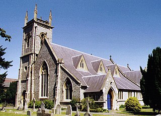
Earley is a town and civil parish in the Borough of Wokingham, Berkshire, England. Along with the neighbouring town of Woodley, the Office for National Statistics places Earley within the Reading/Wokingham Urban Area; for the purposes of local government it falls within the Borough of Wokingham, outside the area of Reading Borough Council. Its name is sometimes spelt Erleigh or Erlegh and consists of a number of smaller areas, including Maiden Erlegh and Lower Earley, and lies some 3 miles (5 km) south and east of the centre of Reading, and some 4 miles (6 km) northwest of Wokingham. It had a population of 32,036 at the 2011 Census.
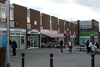
Tilehurst is a suburb of the town of Reading in the county of Berkshire, England. It lies to the west of the centre of Reading; it extends from the River Thames in the north to the A4 road in the south.

Twyford is a large village and civil parish in the Borough of Wokingham in Berkshire, England. It had a population of 6,618 in the 2011 Census. It is in the Thames Valley and on the A4 between Reading and Maidenhead, close to Henley-on-Thames and Wokingham.

Aldermaston Court is a country house and private park built in the Victorian era for Daniel Higford Davall Burr with incorporations from a Stuart house. It is south-east of the village nucleus of Aldermaston in the English county of Berkshire. The predecessor manor house became a mansion from the wealth of its land and from assistance to Charles I during the English Civil War under ownership of the Forster baronets of Aldermaston after which the estate has alternated between the names Aldermaston Park and Aldermaston Manor.

Blewbury is a village and civil parish at the foot of the Berkshire Downs section of the North Wessex Downs about 4 miles (6.4 km) south of Didcot, 14 miles (23 km) south of Oxford and 50 miles (80 km) west of London. It was part of Berkshire until the 1974 boundary changes transferred it to Oxfordshire. The 2011 Census recorded the parish's population as 1,581. A number of springs rise at the foot of the escarpment of the downs. Some springs feed a small lake called the Watercress Beds, where watercress used to be grown. From here and elsewhere tributaries feed the Mill Brook which carries the water to the river Thames at Wallingford. The A417 road runs along below the escarpment above the springs and through the south of the village. The Blewbury citizens are often called Blewbarians.

Cookham is a historic Thames-side village and civil parish on the north-eastern edge of Berkshire, England, 2.9 miles (5 km) north-north-east of Maidenhead and opposite the village of Bourne End. Cookham forms the southernmost and most rural part of the High Wycombe urban area. With adjoining Cookham Rise and Cookham Dean, it had a combined population of 5,779 at the 2011 Census. In 2011, The Daily Telegraph deemed Cookham Britain's second richest village.

Cookham Lock is a lock with weirs situated on the River Thames near Cookham, Berkshire, about a half-mile downstream of Cookham Bridge. The lock is set in a lock cut which is one of four streams here and it is surrounded by woods. On one side is Sashes Island and on the other is Mill Island connected to Formosa Island, the largest on the non-tidal Thames.

Abingdon Abbey was a Benedictine monastery in Abingdon-on-Thames in the modern county of Oxfordshire in the United Kingdom. Situated near to the River Thames, it was founded in c.675 AD and was dedicated to Mary, mother of Jesus. It was disestablished in 1538 during the dissolution of the monasteries. A few physical remnants of the Abbey buildings survive within Abingdon-on-Thames.

Geoffrey Eastop was an English potter.

Conway's Bridge is an ornamental rustic arched stone structure close to the River Thames on the estate of Park Place, Berkshire, England.

Clifton Hampden Bridge is a road bridge crossing the River Thames in Clifton Hampden, Oxfordshire, England, situated on the reach below Clifton Lock. Originally it joined Oxfordshire on the north bank with Berkshire on the south but in 1974 the area on the south bank was transferred from Berkshire to Oxfordshire. It is a Grade II* listed building.

Wytham Abbey is a privately-owned Grade I listed historic manor house situated in the village of Wytham, 3 miles northwest of the centre of Oxford, England, near the River Thames.

Moulsford is a village and civil parish in South Oxfordshire. Before 1974, it was in the county of Berkshire, in Wallingford Rural District, but following the Berkshire boundary changes of that year it became a part of Oxfordshire. Moulsford is on the A329, by the River Thames, just north of Streatley and south of Wallingford. The west of the parish is taken up by the foothills of the Berkshire Downs, including the Moulsford Downs. Moulsford Bottom and Kingstanding Hill are traditionally associated with King Alfred and the Battle of Ashdown.
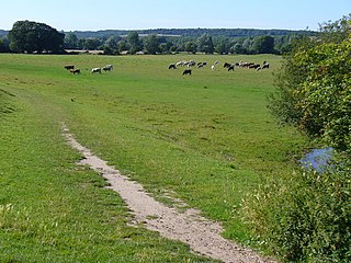
Cock Marsh is an area of marsh land and steep chalk slope covering more than 150-acre (61-hectare) north of Maidenhead in Berkshire. It includes a 45-acre (18-hectare) biological Site of Special Scientific Interest. It is also the location of a Round barrow cemetery and common land where livestock have grazed for hundreds of years. Cock Marsh is owned and managed by the National Trust.
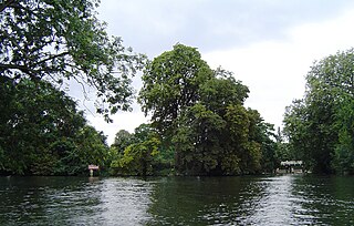
Formosa Island is an island in the River Thames in England at Cookham Lock near Cookham, Berkshire, with two smaller adjacent islands.

Lyford is a small village and civil parish on the River Ock about 4 miles (6 km) north of Wantage. Historically it was part of the ecclesiastical parish of Hanney. Lyford was part of Berkshire until the 1974 boundary changes transferred the Vale of White Horse to Oxfordshire. The 2001 Census recorded the parish's population as 44. Lyford's name refers to a former ford across the river Ock, now replaced with a bridge on the road to Charney Bassett. "Ly" is derived from the Old English lin, meaning "flax". In 1034 it was recorded as Linford.

Aldermaston Pottery was a pottery located in the Berkshire village of Aldermaston, England. It was founded in 1955 by Alan Caiger-Smith and was known for its tin-glaze pottery and particularly its lustre ware. His first assistant, Geoffrey Eastop, joined him in 1956, a year after the pottery started. They were joined in 1961 by David Tipler and Edgar Campden, who remained there until 1975 and 1993 respectively. Over a period of forty years, around sixty assistants worked at the pottery.

Bere Court is an English country house. It is a historic Grade I listed building. The house is located southwest of Pangbourne, Berkshire where it was once the manor house.


