Olaf, Iowa | |
|---|---|
 Olaf, Iowa | |
| Coordinates: 42°53′12″N93°43′29″W / 42.88667°N 93.72472°W | |
| Country | United States |
| State | Iowa |
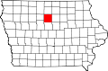
| County | Wright |
| Elevation | 376 m (1,234 ft) |
| Time zone | UTC-6 (Central (CST)) |
| • Summer (DST) | UTC-5 (CDT) |
| Area code | 515 |
| GNIS feature ID | 464680 [1] |
Olaf is an unincorporated community and de facto ghost town in Wright County, Iowa, United States. [1] [2]