
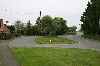
Deerhurst is a village and civil parish in Gloucestershire, England, about 2 miles (3 km) southwest of Tewkesbury. The village is on the east bank of the River Severn. The parish includes the village of Apperley and the hamlet of Deerhurst Walton. The 2011 Census recorded the parish's population as 906, the majority of whom live in Apperley.

Cinderford is a town and civil parish on the eastern fringe of the Forest of Dean in Gloucestershire, England. The population was 8,777 at the 2021 Census.

Coleford is a market town in the west of the Forest of Dean, Gloucestershire, England, two miles (3 km) east of the Welsh border and close to the Wye Valley. It is the administrative centre of the Forest of Dean district. The combined population of the town's two electoral wards at the 2011 census was 8,359. The population of the town's parish was 9,273 in the 2021 Census. The parish includes the village of Baker's Hill.

Billington is a civil parish in Bedfordshire about 3 miles (4.8 km) south of Leighton Buzzard and not far from the Buckinghamshire border. There are two settlements: Little Billington and one that is now called Great Billington. At the 2021 census, the parish had a population of 359.

Lower Catesby is a hamlet in the civil parish of Catesby, Northamptonshire, about 4 miles (6.4 km) southwest of Daventry. Lower Catesby is beside the nascent River Leam, which rises about 1 mile (1.6 km) to the south in the parish of Hellidon. The Jurassic Way long-distance footpath passes through Lower Catesby. The population of the hamlet is included in the civil parish of Hellidon.

Wylye is a village and civil parish on the River Wylye in Wiltshire, England. The village is about 9+1⁄2 miles (15 km) northwest of Salisbury and a similar distance southeast of Warminster.
Little London is a hamlet consisting of approximately 70 houses located immediately east of the village of Oakley in Buckinghamshire and about 5.5 miles (9 km) northwest of the market town of Thame in neighbouring Oxfordshire.

Warborough is a village and civil parish in South Oxfordshire, about 2.5 miles (4 km) north of Wallingford and about 9 miles (14 km) south of Oxford. The parish also includes the hamlet of Shillingford, south of Warborough beside the River Thames.

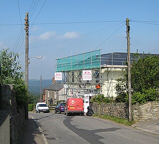
Clearwell is a village and former ancient manor in the Forest of Dean, West Gloucestershire, England. A recent survey indicated that the population of Clearwell is approximately 350.
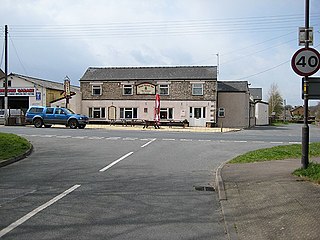
Yorkley is a village in west Gloucestershire, England. The village includes the settlement of Yorkley Slade to the east. Yorkley is situated between the villages of Pillowell and Oldcroft.

East Boldre is a linear village and civil parish situated near Lymington, Hampshire, England. East Boldre is surrounded by the New Forest and forms part of the district of New Forest.

Wootton Rivers is a small village and civil parish in the Vale of Pewsey, Wiltshire, England. The village lies about 3 miles (5 km) northeast of Pewsey and 4 miles (6 km) south of Marlborough. During the 20th century its population halved and most of its facilities closed.

Thrupp is a hamlet in the civil parish of Shipton-on-Cherwell and Thrupp, in the Cherwell district, in the county of Oxfordshire, England. It is beside the Oxford Canal and close to the River Cherwell, just north of Kidlington.

The Pludds is a hamlet in the Forest of Dean, Gloucestershire, England. Lydbrook and Joys Green are to the west, Ruardean is to the north, and Ruardean Woodside is to the east. The Pludds has a village hall.
Sling is a village in Gloucestershire, England. The village is located between Clearwell and Bream. It is just south of the village of Milkwall.

Whitecroft is a village in the Forest of Dean in west Gloucestershire, England. It is located in-between Bream and Yorkley. Whitecroft comes under the postal district of Lydney.

Charlton-All-Saints is a hamlet in the civil parish of Downton, in South Wiltshire, England. It lies immediately west of the River Avon, about 1.5 mi (2.4 km) north of Downton village and 4 mi (6 km) south-east of the city of Salisbury.
Mile End is a small village in the English county of Gloucestershire. It belongs to the civil parish of Coleford, which is also its post town. Mile End is 1 mile (1.6 km) northeast of Coleford. The village lies at the western edge of the Forest of Dean. The village merges with the village of Broadwell to the south.

Storrs is a hamlet within the boundaries of the City of Sheffield in England, 4 miles (6.4 km) west-northwest of the city centre. It is between the suburb of Stannington and the village of Dungworth in the civil parish of Bradfield at a height of 210 metres above sea level between the Loxley and Rivelin valleys. Although historically a farming settlement, water-powered milling on the Storrs Brook and small-scale cutlery making has also taken place in the hamlet.
West Tisbury is a civil parish in southwest Wiltshire, England. The parish takes in the southwestern quarter of the village of Tisbury and extends about 3.8 miles (6.1 km) westward; Tisbury is about 13 miles (21 km) west of Salisbury.

