Iwi are the largest social units in Aotearoa Māori society. The Māori-language word iwi means "people" or "nation", and is often translated as "tribe", or "a confederation of tribes". The word is both singular and plural in the Māori language. Māori use the word rohe to describe the territory or boundaries of iwi.

Tūrangi is a small town on the west bank of the Tongariro River, 50 kilometres south-west of Taupo on the North Island Volcanic Plateau of New Zealand. It was built to accommodate the workers associated with the Tongariro hydro-electric power development project and their families. The town was designed to remain as a small servicing centre for the exotic forest plantations south of Lake Taupo and for tourists. It is well known for its trout fishing and calls itself "The trout fishing capital of the world". The major Māori hapu (tribe) of the Turangi area is Ngāti Tūrangitukua.

Ngāti Kahungunu is a Māori iwi (tribe) located along the eastern coast of the North Island of New Zealand. The iwi is traditionally centred in the Hawke's Bay and Wairārapa regions.

Tolaga Bay is both a bay and small town on the East Coast of New Zealand's North Island located 45 kilometres northeast of Gisborne and 30 kilometres south of Tokomaru Bay.

Orakei is a suburb of Auckland city, in the North Island of New Zealand. It is located on a peninsula five kilometres to the east of the city centre, on the shore of the Waitemata Harbour, which lies to the north, and Hobson Bay and Orakei Basin, two arms of the Waitemata, which lie to the west and south. To the east is the suburb of Mission Bay. The mouth of the Waitemata is to the immediate north of Orakei, lying between Bastion Point, in Orakei, and North Head, in Devonport on the North Shore.

Ōtaki is a town in the Kapiti Coast District of the North Island of New Zealand, situated half way between the capital city Wellington, 70 km (43 mi) to the southwest, and Palmerston North, 70 km (43 mi) to the northeast. In the 2018 census, the town's recorded population was 3,489.

Ngāti Tūwharetoa is an iwi descended from Ngātoro-i-rangi, the priest who navigated the Arawa canoe to New Zealand. The Tūwharetoa region extends from Te Awa o te Atua at Matata across the central plateau of the North Island to the lands around Mount Tongariro and Lake Taupo.

Waharoa is a rural community in the Waikato region of New Zealand's North Island. It is located 7 km north of Matamata, and is part of the Matamata-Piako District. It is located at the railway junction of the Kinleith Branch railway with the East Coast Main Trunk Railway. State Highway 27 runs through the town, serviced by several shops, cafes and a petrol station.
Ngāti Hotu was a Māori tribe that, according to tradition, lived in the central North Island of New Zealand in the area surrounding southern Lake Taupo, where the Ngāti Tūwharetoa tribe now resides.

Te Araroa is a town in the Gisborne Region of the North Island of New Zealand. It is situated 175 km north of Gisborne city, along State Highway 35 between Tokata and Awatere. Te Araroa is the birthplace of noted Māori politician Sir Āpirana Ngata. Māori in the area are generally associated with the Ngāti Porou iwi. It is 100 metres from its local beach.
Ngāti Rangitihi is a Māori iwi of New Zealand, located in the Bay of Plenty.
Maniaiti Marae or Wallace Pā is a marae in Ngapuke, 8km south-east from the outskirts of Taumarunui, in the central North Island of New Zealand.
Herea Te Heuheu Tukino I was a notable New Zealand tribal leader. Of Māori descent, he identified with the Ngāti Tūwharetoa iwi. He was active from about 1790.

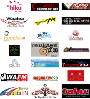
Te Whakaruruhau o Ngā Reo Irirangi Māori is a New Zealand radio network consisting of radio stations that serve the country's indigenous Māori population. Most stations receive contestable government funding from Te Māngai Pāho, the Māori Broadcast Funding Agency, to operate on behalf of affiliated iwi (tribes) or hapū (sub-tribes). Under their funding agreement, the stations must produce programmes in the Māori language, and must actively promote Māori culture.
Waipounamu Māori are a group of Māori iwi at or around the South Island of New Zealand. It includes the iwi (tribe) of Ngāi Tahu and the historical iwi of Kāti Māmoe, who occupy the island except for its most northern districts. It also includes Te Tau Ihu Māori iwi, such as Ngāti Toa, Te Atiawa o Te Waka-a-Māui, Ngāti Apa ki te Rā Tō, Rangitāne, Ngāti Kuia, Ngāti Rārua, Ngāti Kōata and Ngāti Tama.

Okauia is a rural settlement and community located east of Matamata, in the Waikato region of New Zealand's North Island.
Ngapuke or Ngāpuke is a village and rural community, located east of Taumaranui and west of Tongariro and Kuratau on State Highway 41. It is located on the south side of the valley of Pungapunga River, a tributary of the upper Whanganui River.

Te Haroto is a rural community in the Hastings District and Hawke's Bay Region of New Zealand's North Island.
Waihaha or Waihāhā is a village and rural community in the Taupo District and Waikato region of New Zealand's North Island.
Oruanui or Ōruanui is a rural community in the Taupo District and Waikato region of New Zealand's North Island, located northwest of Wairakei on State Highway 1.


