
A ZIP Code is a system of postal codes used by the United States Postal Service (USPS). Introduced on July 1, 1963, the basic format consisted of five digits. In 1983, an extended ZIP+4 code was introduced; it included the five digits of the ZIP Code, followed by a hyphen and four digits that designated a more specific location.

Huron Charter Township is a charter township of Wayne County in the U.S. state of Michigan. The population was 15,879 at the 2010 census. Huron Charter Township is named after the Huron River, which flows southeast through the township. The township is home to three divisions of the Huron–Clinton Metroparks system: Lower Huron, Oakwoods, and Willow.

Imperial is a census-designated place (CDP) in Allegheny County, Pennsylvania, United States and part of the Pittsburgh metropolitan area. The population was 2,722 at the 2020 census. The CDP is located in North Fayette and Findlay Townships, and geographically close to Pittsburgh International Airport.
Skytop is an unincorporated community in Barrett Township, Monroe County, Pennsylvania, United States. Located north of Mountainhome, it is accessible by local roads off Route 390. Its elevation is 1,562 feet (476 m), and it is located at 41°13′40″N75°14′18″W. Although Skytop is unincorporated, it has a post office, with the ZIP code of 18357; the ZCTA for ZIP Code 18357 had a population of 87 at the 2000 census.

Mill City is an unincorporated community in Pershing County, Nevada, United States. The ZIP Code of Mill City is 89418.

Roggen is an unincorporated community and a U.S. Post Office in Weld County, Colorado, United States. The Roggen Post Office has the ZIP Code 80652.
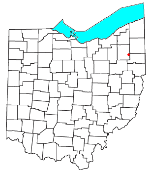
Diamond is an unincorporated community in eastern Palmyra Township, Portage County, Ohio, United States. It has a post office with the ZIP code 44412. The community is part of the Akron Metropolitan Statistical Area. Interstate 76 travels near Diamond. The town used to be a stop on the New York Central Railroad, but the stop was abandoned in the early 1970s.
Willard is a hamlet primarily in the Town of Romulus, Seneca County, New York, United States on the Ovid town line. It is located two miles west of the Village of Ovid, at an elevation of 600 feet. The primary intersection in the hamlet is at N.Y. Route 96A and Main Street.
Norrisville is an unincorporated community in Harford County, Maryland, United States, located just south of the Pennsylvania state line in the extreme northwest section of the county. It is primarily a farming community full of rolling hills and small valleys, and is part of the Deer Creek watershed. The area is served by two state roads, Maryland routes 23 and 136. A demographic profile estimates that the Norrisville area had a population of 2,931 as of 2000. It lies at an elevation of 741 feet (226 m). Norrisville is part of the White Hall zip code 21161, whose post office is located just over the Baltimore County line.
Plowville is an unincorporated area of Robeson Township, Berks County, Pennsylvania, United States. it is located on Pennsylvania Route 10, just east of Interstate 176. Its zip code is 19540 and the community is served by the Twin Valley School District. The most recognizable landmark is Plow Church.
West Lebanon is an unincorporated community, founded in 1839, in northern Young Township, Indiana County, Pennsylvania, United States. Its altitude is 1,309 feet (399 m). It has a post office with the ZIP code 15783.

Walker is an unincorporated community in Herzog Township, Ellis County, Kansas, United States. It is located between Hays and Russell, along old Hwy 40 on the north side of I-70. Walker has a post office with ZIP code 67674.
Eckville is an unincorporated community in far northern Berks County, Pennsylvania, United States. The town is located in an agricultural zone at the base of Blue Mountain, in northwestern Albany Township. Eckville is served by the Kutztown Area School District, and is approximately 17 miles (27 km) from the high school. It is near the head of the Pine Creek, which flows east-southeastward to the Maiden Creek.
Waldeck is an unincorporated community in southeastern Lebanon County, Pennsylvania, United States, located on Route 501, south of Schaefferstown. It is on the northern edge of the Furnace Hills in Heidelberg Township and is drained by Hammer Creek southward into Cocalico Creek. The community is served by the Newmanstown post office, with ZIP code 17073.
Killinger is an unincorporated community in Upper Paxton Township in Dauphin County, Pennsylvania. It is part of the Harrisburg–Carlisle metropolitan statistical area and lies within ZIP Code 17061. but uses the Millersburg post office.
Landis Store is a village in District Township, Berks County, Pennsylvania, United States. It is drained by the West Branch Perkiomen Creek into the Perkiomen Creek in the Green Lane Reservoir. It is split between the Alburtis zip code of 18011, the Barto zip code of 19504, and the Boyertown zip code of 19512.

Sacramento is an unincorporated community in southeastern Hubley Township, Schuylkill County, Pennsylvania, United States, situated on Route 25. It is located on the Pine Creek, which drains it westward into the Mahantango Creek. It has a post office with the zip code of 17968.
Schubert is a census-designated place in northeastern Bethel Township, Berks County, Pennsylvania. It is located off PA Route 419 just north of its interchange with Interstate 78 on the southern flank of Blue Mountain.
Lickdale, previously known as Union Forge, is an unincorporated community in northern Lebanon County, Pennsylvania, United States. It is a village approximately three miles west of Fredericksburg, Pennsylvania, and was named for James Lick. Lickdale was a prominent 19th century canal port along a branch of the Union Canal and contained a large commercial ice house. It is on the Swatara Creek and serves as a southern gateway to Swatara State Park. It is located in Union Township and Route 72 has an interchange with Interstate 81 via Fisher Avenue. It is served by the Jonestown post office with the zip code of 17038.
Sporting Hill is an unincorporated community in Hampden Township, Cumberland County, Pennsylvania, United States. It is bordered on the north and south by the Conodoguinet Creek and the Capital Beltway (11/581) respectively. Carlisle Pike and the Beltway interchange a short distance west of the village, which has multiple retail stores and restaurants, including in the Hampden Town Centre. Sporting Hill is served by the Mechanicsburg post office with the zip code of 17050. On June 30, 1863 the northernmost pitched battle of the American Civil War occurred there at the Skirmish of Sporting Hill during the Gettysburg Campaign.
