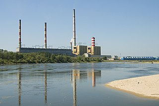
Kozienice County is a unit of territorial administration and local government (powiat) in Masovian Voivodeship, east-central Poland. It came into being on 1 January 1999 as a result of the Polish local government reforms passed in 1998. Its administrative seat and only town is Kozienice, which lies 81 kilometres (50 mi) south-east of Warsaw.
Gmina Kozienice is an urban-rural gmina in Kozienice County, Masovian Voivodeship, in east-central Poland. Its seat is the town of Kozienice, which lies approximately 81 kilometres (50 mi) south-east of Warsaw.
Gmina Głowaczów is a rural gmina in Kozienice County, Masovian Voivodeship, in east-central Poland. Its seat is the village of Głowaczów, which lies approximately 18 kilometres (11 mi) west of Kozienice and 70 km (43 mi) south of Warsaw.
Aleksandrówka is a village in the administrative district of Gmina Kozienice, within Kozienice County, Masovian Voivodeship, in east-central Poland. It lies approximately 3 kilometres (2 mi) south-west of Kozienice and 81 km (50 mi) south-east of Warsaw.
Brzeźnica is a village in the administrative district of Gmina Kozienice, within Kozienice County, Masovian Voivodeship, in east-central Poland. It lies approximately 6 kilometres (4 mi) south-east of Kozienice and 86 km (53 mi) south-east of Warsaw.
Dąbrówki is a village in the administrative district of Gmina Kozienice, within Kozienice County, Masovian Voivodeship, in east-central Poland. It lies approximately 3 kilometres (2 mi) east of Kozienice and 82 km (51 mi) south-east of Warsaw.
Janów is a village in the administrative district of Gmina Kozienice, within Kozienice County, Masovian Voivodeship, in east-central Poland. It lies approximately 3 kilometres (2 mi) south of Kozienice and 83 km (52 mi) south-east of Warsaw.
Kępa Wólczyńska is a village in the administrative district of Gmina Kozienice, within Kozienice County, Masovian Voivodeship, in east-central Poland. It lies approximately 5 kilometres (3 mi) north-east of Kozienice and 81 km (50 mi) south-east of Warsaw.
Kociołki is a village in the administrative district of Gmina Kozienice, within Kozienice County, Masovian Voivodeship, in east-central Poland. It lies approximately 3 kilometres (2 mi) south-east of Kozienice and 83 km (52 mi) south-east of Warsaw.
Łaszówka is a village in the administrative district of Gmina Kozienice, within Kozienice County, Masovian Voivodeship, in east-central Poland. It lies approximately 14 kilometres (9 mi) north-west of Kozienice and 69 km (43 mi) south-east of Warsaw.
Łuczynów is a village in the administrative district of Gmina Kozienice, within Kozienice County, Masovian Voivodeship, in east-central Poland. It lies approximately 6 kilometres (4 mi) north-west of Kozienice and 76 km (47 mi) south-east of Warsaw.
Majdany is a village in the administrative district of Gmina Kozienice, within Kozienice County, Masovian Voivodeship, in east-central Poland. It lies approximately 6 kilometres (4 mi) north-west of Kozienice and 75 km (47 mi) south-east of Warsaw.
Michałówka is a village in the administrative district of Gmina Kozienice, within Kozienice County, Masovian Voivodeship, in east-central Poland. It lies approximately 13 kilometres (8 mi) north-west of Kozienice and 68 km (42 mi) south-east of Warsaw.
Samwodzie is a village in the administrative district of Gmina Kozienice, within Kozienice County, Masovian Voivodeship, in east-central Poland. It lies approximately 7 kilometres (4 mi) east of Kozienice and 82 km (51 mi) south-east of Warsaw.
Śmietanki is a village in the administrative district of Gmina Kozienice, within Kozienice County, Masovian Voivodeship, in east-central Poland. It lies approximately 3 kilometres (2 mi) south-east of Kozienice and 83 km (52 mi) south-east of Warsaw.

Świerże Górne is a village in the administrative district of Gmina Kozienice, within Kozienice County, Masovian Voivodeship, in east-central Poland. It lies approximately 10 kilometres (6 mi) north-west of Kozienice and 72 km (45 mi) south-east of Warsaw.
Wilczkowice Górne is a village in the administrative district of Gmina Kozienice, within Kozienice County, Masovian Voivodeship, in east-central Poland. It lies approximately 14 kilometres (9 mi) north-west of Kozienice and 67 km (42 mi) south-east of Warsaw.
Wójtostwo is a village in the administrative district of Gmina Kozienice, within Kozienice County, Masovian Voivodeship, in east-central Poland. It lies approximately 2 kilometres (1 mi) north of Kozienice and 80 km (50 mi) south-east of Warsaw.
Wólka Tyrzyńska is a village in the administrative district of Gmina Kozienice, within Kozienice County, Masovian Voivodeship, in east-central Poland. It lies approximately 6 kilometres (4 mi) north-east of Kozienice and 80 km (50 mi) south-east of Warsaw.
Wymysłów is a village in the administrative district of Gmina Kozienice, within Kozienice County, Masovian Voivodeship, in east-central Poland. It lies approximately 2 kilometres (1 mi) north of Kozienice and 79 km (49 mi) south-east of Warsaw.


