The Catholic Church in Nigeria is part of the worldwide Catholic Church, under the spiritual leadership of the Pope, the curia in Rome, and the Catholic Bishops' Conference of Nigeria (CBCN).
Onitsha is a city on the eastern bank of the Niger River, in Anambra State, Nigeria. Onitsha along with various cities and towns in southern Anambra State, northern Imo State and neighboring Delta State on the western bank of the Niger River, form a continuous metropolitan area.

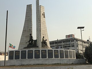
Anambra State is a Nigerian state located in the South-eastern region of the country. The state was created on 27 August 1991. Anambra state is bounded by Delta State to the west, Imo State and Rivers State to the south, Enugu State to the east and Kogi State to the north. The state's capital is Awka, while the state’s largest city is Onitsha which is regarded as one of the largest metropolis in Africa. Nnewi is the second largest commercial and industrial city in Anambra State, and also a known automobile hub within Nigeria and Africa.

Rivers State, also known as Rivers, is a state in the Niger Delta region of southern Nigeria. Formed on 27 May 1967, when it was split from the former Eastern Region, Rivers State borders include Imo and Anambra to the north, Abia and Akwa Ibom to the east, and Bayelsa and Delta to the west.The State capital, Port Harcourt, is a metropolis that is considered to be the commercial center of the Nigerian oil industry.
Oguta is a town on the east bank of Oguta Lake in Imo State of southeastern Nigeria.

Oguta Lake is a lean 'finger lake' formed by the damming of the lower Njaba River with alluvium. it is the largest natural lake in Imo State, Southeastern Nigeria; within the equatorial rainforest region of Niger Delta. Oguta Lake's catchment area comprises the drainage area of the Njaba River and a part of the River Niger floodplain in the region south of Onitsha.

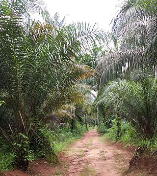
The Cross–Niger transition forests is a tropical moist broadleaf forest ecoregion of southeastern Nigeria, located between the Niger River on the west and the Cross River on the east. Once a rich mixture of tropical forest and savanna woodland covered these low, rolling hills but today, this is one of the most densely populated areas of Africa and today most of the forest has been removed and the area is now grassland.
Imo State is a state in the South-East geopolitical zone of Nigeria, bordered to the north by Anambra State, Rivers State to the west and south, and Abia State to the east. It takes its name from the Imo River which flows along the state's eastern border. The state capital is Owerri and the State's slogan is the "Eastern Heartland."
Ogbaru is a local government area in Anambra State, south-central Nigeria. The area's local government headquarters is in the port city of Atani.It is part of the Greater Onitsha Metropolis.
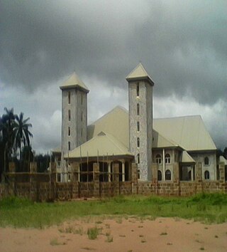
Okija is the largest town in Ihiala LGA of Anambra State in Southeast Nigeria. The town is the oldest of all the towns in Ihiala local government area, and one of the biggest towns in Igboland. The people of Okija are predominantly Christians. Okija is the home to Madonna University and Legacy University. Bordered in the east by Ihembosi and Ukpor cities, within the west by olu or Ogbakubara, within the north by Ozubulu and within the south by Ihiala. In Okija, the Ulasi River on its flow to the Atlantic, joins Okposi river one of its tributaries.

Ideato South is a Local Government Area in Imo State, South-eastern Nigeria. Ideato South, with a total of 23 autonomous communities has its headquarters in the town of Dikenafai, the source of Orashi River. Ideato South has an area of 88 km² and a population of 159,879 at the 2006 census. The postal code of the area is 475.
Umueshi is a community in Ideato South Local Government Area in Imo State, Nigeria. The community comprises 15 villages, including: Okorobi, Umuezeanuwai, Umunwangwu, Umuanajughi, Ukabi, Umuokwara, Umudieshi, Okoroikpa, Umuduruaku, Umudire, and Obinugwu.

Awo-Omamma, in the bortheast of the Niger Delta basin, is an oil-rich indigenous Igbo town on the banks of Njaba River. It is a potential tourism hub in the region due to its species of wildlife in Umuezukwe and green vegetation.

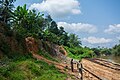
Njaba River, in the Niger Delta Basin is a major tributary of Oguta Lake in Nigeria's South East Imo State. With 4.5m mean depth, the river has a total stream length of 78.2 km, basin area of 145.63 square kilometers and an average specific discharge of about 1700 m3/hour.
Izombe in the northeast of Niger Delta is an oil town in Njaba River basin, Imo State Southeastern Nigeria.
Osina is a town in Ideato North Local Government of Imo State, Nigeria and is under Orlu senatorial zone. Osina has four villages: Eluama, Uhualla, Ofeke, Umuduru/Umuogbu (Durunogbu). The Nnewi – Okigwe road passes through Osina. The Awka – Umuahia road also passes through Osina.
Dikenafai is a town in Ideato South Local Government Area of Imo State, Nigeria, famous for its natural waterfall, Ezeama, which turns into the great Orashi River. Dikenafai currently serves as the headquarters of Ideato South.
Isiekenesi, is a community in Ideato South Local Government Area of Imo State, Nigeria.
The South East is the one of the six geopolitical zones of Nigeria representing both a geographic and political region of the country's inland southeast. It comprises five states – Abia, Anambra, Ebonyi, Enugu, and Imo.
Umuezukwe is an ancient trade route, a river port, and a farming community in Awo-Omamma, northeast of the Niger Delta region, Nigeria's South East, Imo State. It is one of the densely populated Awo-Omamma rural settlements in the Njaba River basin.