Oguta Ugwuta | |
|---|---|
City | |
 Entrance to the building of Oguta Local Government Area | |
 Interactive map of Oguta | |
 Oguta | |
| Coordinates: 5°42′42″N6°48′34″E / 5.71167°N 6.80944°E | |
| Country | |
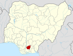
| State | Imo State |
| LGA | Oguta LGA |
| Government | |
| • Local Government Chairman | Ifeanyi Nani [1] |
| Population (2012) | |
• Total | 20,096 |
| Time zone | UTC+1 (WAT) |
| • Summer (DST) | not observed |
| Postcode | 464... |
| National language | Igbo |
Oguta is a town on the east bank of Oguta Lake in Imo State of southeastern Nigeria. [2]
Contents
Oguta is called "Oguta-Ameshi" or "Ameshi"- by its aborigines. Indigenes - consists of two parts, the old part which holds the 27 villages of Oguta, and the new part, called the "Oguta New Layout". [3]
Oguta New Layout, as a rule, is strict compliance with its original master plan. Oguta Town by location is embedded between Oguta Lake on the eastern side, and Obana River that joined Okposha River, on the western side, leaving only the Egwe Gateway as the only dry land route into Oguta without passing through water or a bridge.[ citation needed ][ citation needed ]
Oguta as a tourist destination, makes most people including natives to have the preponderance to describe Oguta Town more often - as being located on the east bank of Oguta Lake. Oguta's high-yield oil and gas fields make Oguta an important territory and geographic area, hosting many multinational oil companies like AGIP, Shell, Chevron.[ citation needed ] [4] Some times Oguta is used as a synonym for Oguta Local Government Area, which has Oguta as its headquarters. Oguta LGA is one of the twenty seven local government areas that make up the Imo State.[ citation needed ]

In turn, Imo State is one of the five states that make up the South-East geopolitical region, which is one of the six geopolitical regions that make up The Federal Republic of Nigeria.[ citation needed ] With its Oguide Lake and Urashi River bestowing her peculiar advantages, Oguta was one of the chosen endowed territories that the British through the instrumentality of the Royal Niger Company, UAC, and then the British Colonial Government used and exploited diversely.[ citation needed ]
Due to its strategic waterways, oil and gas, palm produce, agricultural products, natural resources, Oguta was one of the oldest trade and administrative Centres in Nigeria.[ citation needed ] Connected to River Niger, Oguta waterways were used by the British and later Nigerian government forces during the Nigeria - Biafra civil war as routes through which to access and connect to the adjoining towns, villages and other settlement types nearer and further from Oguta, that were and remain principally peopled by other ethnic Igbo people the Mgbidi, Orlu, Awo-Omamma, Nkwerre, Owerri, Okigwe, Umuahia, Aba/Ngwa people, among others, who are substantial parts of the Eastern Nigerian population in the hinterland, collectively called "The Igbos".[ citation needed ]

As of 2012, Oguta's population was estimated at 20,096. [5]
FESTIVALS
Omerife(Ogene): Is the annual New Yam Festival celebrated during harvest time in Oguta. It holds from the last week of August to the third week of September.[ citation needed ]