Okigwe

Last updated

Okigwe
LGA and town
Okigwe Local Government Area, Imo State , Nigeria.jpg
Senator Hope Uzodimma's Hall, Okigwe Local Government Headquarters
Nigeria location map.svg
Red pog.svg
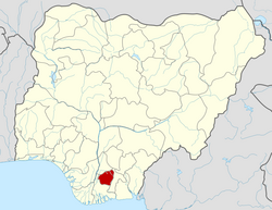
Okigwe
Location in Nigeria
Coordinates: 5°28′59″N7°33′00″E / 5.483°N 7.55°E / 5.483; 7.55
CountryNigeria
State Imo State
Time zone UTC+1 (WAT)
National language Igbo
Okigwe

Okigwe is the third largest city in Imo state in Nigeria after Owerri and Orlu. Okigwe is located in the Okigwe Local Government Area of Nigeria.[ citation needed ] The city lies between the Port Harcourt-Enugu-Maiduguri rail line, being the nearest city to the biggest cattle market in Nigeria located in the Umu Nneochi Area of Abia state. Thus, the city has grown into a major cattle transit town for the southeast and south subregions of Nigeria.[ citation needed ] Okigwe has a population of 132,237 (2005 census). Most of the population is made up of immigrant workers from other states. Okigwe city was the primary host site of the old Imo State University (now Abia State University). Okigwe has various tourist and historical sites.[ citation needed ] The Federal Government College in the city has remained one of the best unity schools in Nigeria. Okigwe remains one of the breadbaskets of Nigeria with terrace cultivation practised on its hilly farmlands.[ citation needed ] Okigwe also boasts many relaxation spots such as Alexandra Suites & Hotels Limited Okigwe Imo state which is situated at No 1 Alexandra Ave, Umuchima Road, Ubahu. St. Mary's Cathedral in Okigwe is the seat of the Roman Catholic Diocese of Okigwe.[ citation needed ] In 2016, the Imo state government recommissioned a new cattle market in the city in respect to the previous one that has been relocated to Abia. [1]

Contents

Autonomous communities and villages

Okigwe has six autonomous communities with different villages (in bracket) namely; [2]

Agriculture and soil

The soil is predominantly partly red clay and black or dark brown. The major crops grown in the district on its hilly farmlands are palm trees (palm oil and palm wine), cassava, and vegetables. [3]

Climate

Rarely falling below 58°F or rising beyond 90°F, the weather is consistently warm throughout the year. The wet season is partially gloomy and humid. [4]

See also

Related Research Articles

<span class="mw-page-title-main">Abia State</span> State of Nigeria

Abia State is a state in the South-East geopolitical zone of Nigeria, it is bordered to the northwest by Anambra State and northeast by the states of Enugu, and Ebonyi, Imo State to the west, Cross River State to the east, Akwa Ibom State to the southeast, and Rivers State to the south. Abia is the only Southeastern state that has boundaries with the other four Southeastern states in Nigeria. It takes its name from the acronym for four of the state's most populated regions: Aba, Bende, Isuikwuato, and Afikpo. The state capital is Umuahia while the largest city and commercial centre is Aba.

<span class="mw-page-title-main">Owerri</span> Capital city of Imo state, Nigeria

Owerri is the capital city of Imo State in Nigeria, set in the heart of Igboland. It is also the state's largest city, followed by Orlu, Okigwe and Ohaji/Egbema. Owerri consists of three Local Government Areas including Owerri Municipal, Owerri North and Owerri West, it has an estimated population of about 1,401,873 as of 2016 and is approximately 100 square kilometres (40 sq mi) in area. Owerri is bordered by the Otamiri River to the east and the Nworie River to the south. The Owerri Slogan is Heartland. It's also called the las Vegas of Africa, due to the night life of the city and the numerous number of hotels, casino and leisure parks all over of the city

<span class="mw-page-title-main">Aba, Nigeria</span> City in Abia, Nigeria

Aba is a city in southeastern Nigeria and the commercial centre of Abia State. Upon the creation of Abia State in 1991, the old Aba township was divided into two local government areas: Aba South and Aba North. Aba South is the main city centre of Abia State, being located on the Aba River. Aba is made up of many villages such as Aba-Ukwu, Eziukwu-Aba, Obuda-Aba, Umuokpoji-Aba and other villages that have been merged for administrative convenience. Aba was established by the Ngwa clan of the Igbo people in Nigeria as a market town. Later, a military post was placed there by the British colonial administration in 1901. It lies along the west bank of the Aba River and is at the intersection of roads leading to Port Harcourt, Owerri, Umuahia, Ikot Ekpene, and Ikot-Abasi. The city became a collection point for agricultural products following construction of a British-made railway running through it to Port Harcourt. Aba is a major urban settlement and commercial centre in its region, which is surrounded by small villages and towns. The indigenous people of Aba are the Ngwa. Aba is well known for its craftsmen and is the most populous city in southeastern Nigeria. As of 2016, Aba had an estimated population of 2,534,265.

<span class="mw-page-title-main">Nnewi</span> City in Anambra State, Nigeria

Nnewi is a commercial and industrial city in Anambra State, southeastern Nigeria. It is the second largest city in Anambra state after Onitsha. Nnewi as a metropolitan area has two local government area, which are Nnewi North and Nnewi South, all centred around the Nnewi town. Even Ekwusigo local government area is now part of Nnewi urban area, as urbanization continues to spread from Nnewi to neighbouring communities. The Nnewi town which is the only town in Nnewi North comprises four villages: Otolo, Uruagu, Umudim, and Nnewichi. Nnewi had been the centre of economics and commerce, being at a time the fastest growing industrial city east of the Niger, being the home of many industries such as The Ibeto Group, the Chicason Group, Cutix Cables, amongst others. The first indigenous car manufacturing plant in Nigeria is located in the city while the first wholly Made-in-Nigeria motorcycle, the 'NASENI M1' was manufactured in Nnewi.

Arondizuogu (Aro-ndizuogu) is a town inhabited by the Igbo subgroup of the Aro people in Imo State of Nigeria. The Arondizuogu community is believed to have migrated from Arochukwu in the present Abia State to their current settlements in Imo state, which include the Okigwe, Ideato North and Onuimo local governments. However, others of Aro descent are in other local governments in Imo State.

<span class="mw-page-title-main">Orlu, Imo</span> LGA and city in Imo, Nigeria

Orlu is the second-largest city in South East, Imo State, Nigeria, with a population of 420,600. It has a long history as the headquarters for the Organisation of African Unity (OAU) and humanitarian relief agencies during the Nigeria-Biafra Civil War. The city houses the Nigerian headquarters of the British Cheshire Home. It is the second most developed city after Owerri in Imo state.

<span class="mw-page-title-main">Oguta</span> Local Government Area in Imo State, Nigeria

Oguta is a town on the east bank of Oguta Lake in Imo State of southeastern Nigeria.

<span class="mw-page-title-main">Abia State University</span> Nigerian public university

Abia State University Uturu (ABSU) is a Nigerian public university. It is one of the state-owned universities in Nigeria. These state academic institutions were created to expand admissions and bring professional skills, expertise and modern research facilities close to the city and rural dwellers, and have helped talented students to obtain higher education.

<span class="mw-page-title-main">Aro people</span> Ethnic subgroup in Nigeria

The Aro people or Aros are an Igbo subgroup that originated from the Arochukwu kingdom in present-day Abia state, Nigeria. The Aros can also be found in about 250 other settlements mostly in the Southeastern Nigeria and adjacent areas. The Aros today are classified as Eastern or Cross River Igbos because of their location, mixed origins, culture, and dialect. Their god, Chukwu Abiama, was a key factor in establishing the Aro Confederacy as a regional power in the Niger Delta and Southeastern Nigeria during the 18th and 19th centuries.

Ihite is a town in Orumba South Local Government Area in Anambra State, Nigeria. It is located south-east of the local government area on the Nnobi-Ekwulobia-Ufuma-Umunze-Ibinta-Okigwe federal trunk road. Ihite shares boundaries with Umunze in Anambra State, Aondizuogu, Ndiochi and Okannachi in Imo state, and Nneato in Abia State.

<span class="mw-page-title-main">Imo State</span> State of Nigeria

Imo State is a state in the South-East geopolitical zone of Nigeria, bordered to the north by Anambra State, Rivers State to the west and south, and Abia State to the east. It takes its name from the Imo River which flows along the state's eastern border. The state capital is Owerri and the state nickname is the "Eastern Heartland."

Umunze is the headquarters of Orumba south local government area in Anambra state of Nigeria.

Isuikwuato is a local government area in Abia State in southeastern Nigeria. The name Isu-Ikwu-Ato translates from Igbo as 'three Isu families or lineage' and refers to the three lineages descended from the Isu people, in what is now a local government area. The three brothers are Imenyi who is the eldest, Oguduasaa, his younger brother from the same mother and Isuamawo the second oldest and first from the second wife. These three major clans which also harbour various communities in each of them make up the present day Isuikwuato. It has an estimated population of over 50,000 people. Isuikwuato has natural resources such as iron ore and kaolin. Oil lines flow through Isuikwuato and there have been cases of burst pipe which have had severe effects on the local economy and environment. The major cash crops are palm oil and cassava. The soil at Isuikwuato is loose and suffers from Erosion and this left some dangerous erosion sites in the area. They lack the needed government backing to build drainages around the area to guide the flow of water without further harming the already crying soil. Blessed with hills and highlands, the town will appreciate water infrastructures because water is an important but hard resource to get in Isuikwuato. Isuikwuato is also home to Abia State University Uturu.

Ohafia is an Igbo town in the Ohafia local government area (LGA) in Abia State, Nigeria. It is an Igbo speaking region. The ancestral capital of Ohafia town is the centrally located village of Elu. Ohafia Local Government Area, is an administrative jurisdiction assigned by the Nigeria Government, which covers the entire Ohafia villages and other towns such as Abiriba and Nkporo, with its Administrative Headquarters at Ebem Ohafia.

Osisioma Ngwa is a Local Government Area of Abia state of Nigeria. Its headquarters are located in Osisioma town.

The Presbyterian Church of Nigeria is a church in Nigeria and subscribes to the Westminster Confession of Faith.

<span class="mw-page-title-main">Ogbunike</span>

Ogbunike is a town in the Oyi local government area of Anambra State, Nigeria. There are markets in Ogbunike. These include Plastic Products Dealers Society International Market Ogbunike.

<span class="mw-page-title-main">Osina, Ideato North</span> Town in Nigeria

Osina is a town in Ideato North Local Government of Imo State, Nigeria and is under Orlu senatorial zone. Osina has four villages: Eluama, Uhualla, Ofeke, Umuduru/Umuogbu (Durunogbu). The Nnewi – Okigwe road passes through Osina. The Awka – Umuahia road also passes through Osina.

<span class="mw-page-title-main">Umuezukwe</span> Place in Imo, Nigeria

Umuezukwe is an ancient trade route, a river port, and a farming community in Awo-Omamma, northeast of the Niger Delta region, Nigeria's South East, Imo State. It is one of the densely populated Awo-Omamma rural settlements in the Njaba River basin.

Nkporo is a town in Abia State, in southeastern Nigeria, traditionally an Igbo speaking region. It is in the Ohafia Local Government Area.

References

  1. "Cattle market re-opens 11-years after". The Guardian Nigeria News - Nigeria and World News. 2016-12-18. Retrieved 2021-09-11.
  2. "List of Towns and Villages in Okigwe L.G.A". 10 March 2014.
  3. "(PDF) Physicochemical Parameter of Palm Oil and Soil from Ihube Community, Okigwe, Imo State Nigeria". ResearchGate. Retrieved 2021-09-11.
  4. "Okigwe Climate, Weather By Month, Average Temperature (Nigeria) - Weather Spark". weatherspark.com. Retrieved 2023-09-15.