
Akabo is a village complex in the Ikeduru Local Government Area of Imo State, Nigeria, West Africa. A village with this same name is also found in Nnewi and Oguta, all in Igboland.

Ogbaku is a town made up of eighteen (18) villages in Mbaitoli Local Government Area of Imo state, South Eastern Nigeria. It is situated along Onitsha-Owerri road. It is about 12 km to the capital city of Owerri.
Ubomiri is a town in Mbaitoli of Imo State located near Owerri, capital city of Imo State, in southeastern Nigeria.
Orodo is an Igbo community in Mbaitoli local government area of Imo State, Nigeria. It is situated between Owerri city and Orlu town. Orodo has borders with Ogwa, Mbieri, Afara, Ifakala, Umuaka, Amurie Omanze and Amandugba. Also, the current Mbaitoli Local Government Headquarters is significantly located at a part of Orodo called Ofekata. The community said to have seven road junction, in the center of the community called nkwo-orodo. The roads are: Ubaha-Eze road, Ahaba road, Amaukwu road, Umuonyahu road, Amaku road, Ofekata road and Eziama road.
Umunoha is a town in southeastern Nigeria near the city of Owerri. It is a typical Igbo town. It is bounded on the north by Eziama Obiato and Afara communities; on the south and southwest by Ogbaku, Azara Obiato and Ejemekwuru communities; and on the south and southeast by Ifakala and Afara communities. It is served by the great east-west road, the Port-Harcourt-Lagos Highway. Umunoha is about thirteen kilometers from Owerri, the Imo State capital. It is a small, compact but thickly populated community with a projected 1997 population of twenty-five thousand people.
Eziama Obiato is a town in Mbaitoli Local Government Area of Imo State, southeastern Nigeria. It is about 18 kilometers to the city of Owerri. The town is strategically located as it shares common boundaries with four other Local Government Areas in Imo State. It is bordered by Awo-Omamma, Umu-ofor/Akabo, Amazano/Umuaka, Afara and Umunoha. Eziama Obiato is home to the popular "Ukwuorji" Bus Stop on the Owerri/Onitsha Road.
Iho is an autonomous community in southeastern Nigeria, in Ikeduru, Imo state. It is located near Owerri. The name may be written and pronounced as Iho. The majority of inhabitants of this community refer to it as Iho-Dimeze and are sometimes referred to as "Dimeze".
Uratta is a village in southeastern Nigeria. It is located on the outskirts of the city of Owerri and falls within the Owerri North local government jurisdiction. Uratta is further subdivided into seven clans or autonomous communities. The communities which made up the seven clans are the present day: 1. Umualum 2. Umuorii 3. Umuobaa 4. Okwu 5. Owalla 6. Owaelu 7. Amakohia 8. Umunahu 9. Akwakuma 10. Orji.
Owelu, Imo is a village under Obibi-ward-2 in Uratta which is in Owerri-north L.G.A of Imo-east in Imo region under East-central and Southeast of Southern Nigeria.
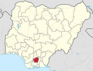
Imo State is a state in the South-East geopolitical zone of Nigeria, bordered to the north by Anambra State, Rivers State to the west and south, and Abia State to the east. It takes its name from the Imo River which flows along the state's eastern border. The state capital is Owerri and the state nickname is the "Eastern Heartland."
Ejemekwuru is an Igbo-speaking community that sits in the North-Western part of Imo State in the southeastern region of Nigeria.

Njaba is a Local Government Area of Imo State, Nigeria. Its headquarters is located in the town of Nnenasa. It has an area of 84 km2 and a population of 143,485 at the 2006 census. The 2011 density projection is 2,004.5 inhabitants/km2. The postal code of the area is 474.

Oru-East is a Local Government Area of Imo State, Nigeria. Its headquarters is at Omuma. The following are towns that make up Oru East: Akatta, Akuma, Amagu, Amiri, Awo-Omamma, and Omuma.
Owerri North is a Local Government Area of Imo State, Nigeria. Its headquarters are in the town of Orie Uratta. It has an area of 198 square km and a population of 175,395 at the 2006 census. The postal code of the area is 460. Owerri North is semi-urban government area. It encircles Owerri Municipal like a peninsula. Six major roads that lead out of the municipal cuts across Owerri North Communities. In the North, Orlu road leads to Amakaohia and Akwakuma communities. In the East, Okigwe road leads to Orji Community. In the West, MCC road off Wetheral to Obibi Uratta and Ihitaoha communities. In the South, Mbaise road leads to Egbu and Emekuku communities, while Aba road leads to Naze, Agbala and Ulakwo communities.
Obazu in Imo State is one of the autonomous communities in Mbieri ancient kingdom of Imo state. It is made up of six villages, namely: Umueze, Umuchoke, Umuchimanwiri, Amaogwugwu, Obilubi and Umunkwo in order of seniority. It is located at the eastern part of Mbieri and share boundaries with Umuoba, Orji and Owuala of Uratta people, Amatta and Akabo (Ikeduru) and Ụmụneke, Umunjam, Amaulu, Eziome, Achi, Umuagwu, Ubakuru and Amankuta. The people are mostly Anglican though there are other Christian denomination followers among her people.
Ibele is an autonomous community in the Njaba Local Government Area in Orlu Senatorial zone of Imo State, Nigeria. The town is located at the old Douglas road, running from Afor-Umuaka westward in Njaba Local Government Area to Ukworji in Eziama-Obiator of Mbaitoli local government area, then to Oguta.

Otulu is a town in Oru West local government area of Imo State, Nigeria. It is located along the Owerri-Onitsha Federal Highway in Imo State. Approaching from Owerri to Onitsha one will get to Awo-Omanma, Amiri and then Otulu after which one has Mgbidi; while from Onitsha to Owerri one has Otulu after Mgbidi.

Awo-Omamma, in the Northeast of Niger Delta basin is an oil-rich indigenous Igbo town on the banks of Njaba River. It is a potential tourism hub in the region due to its species of wildlife in Umuezukwe and green vegetation.
Umuezukwe is an ancient trade route, a river port, and a farming community in Awo-Omamma, northeast of the Niger Delta region, Nigeria's South East, Imo State. It is one of the densely populated Awo-Omamma rural settlements in the Njaba River basin.
Chukwuma Chinekezi Oparah is an Anglican bishop in Nigeria.